File:Un-nepal.png

Faylın orijinalı (3.038 × 2.257 piksel, fayl həcmi: 1,56 MB, MIME növü: image/png)
Captions
Captions
Xülasə[redaktə]
| İzah |
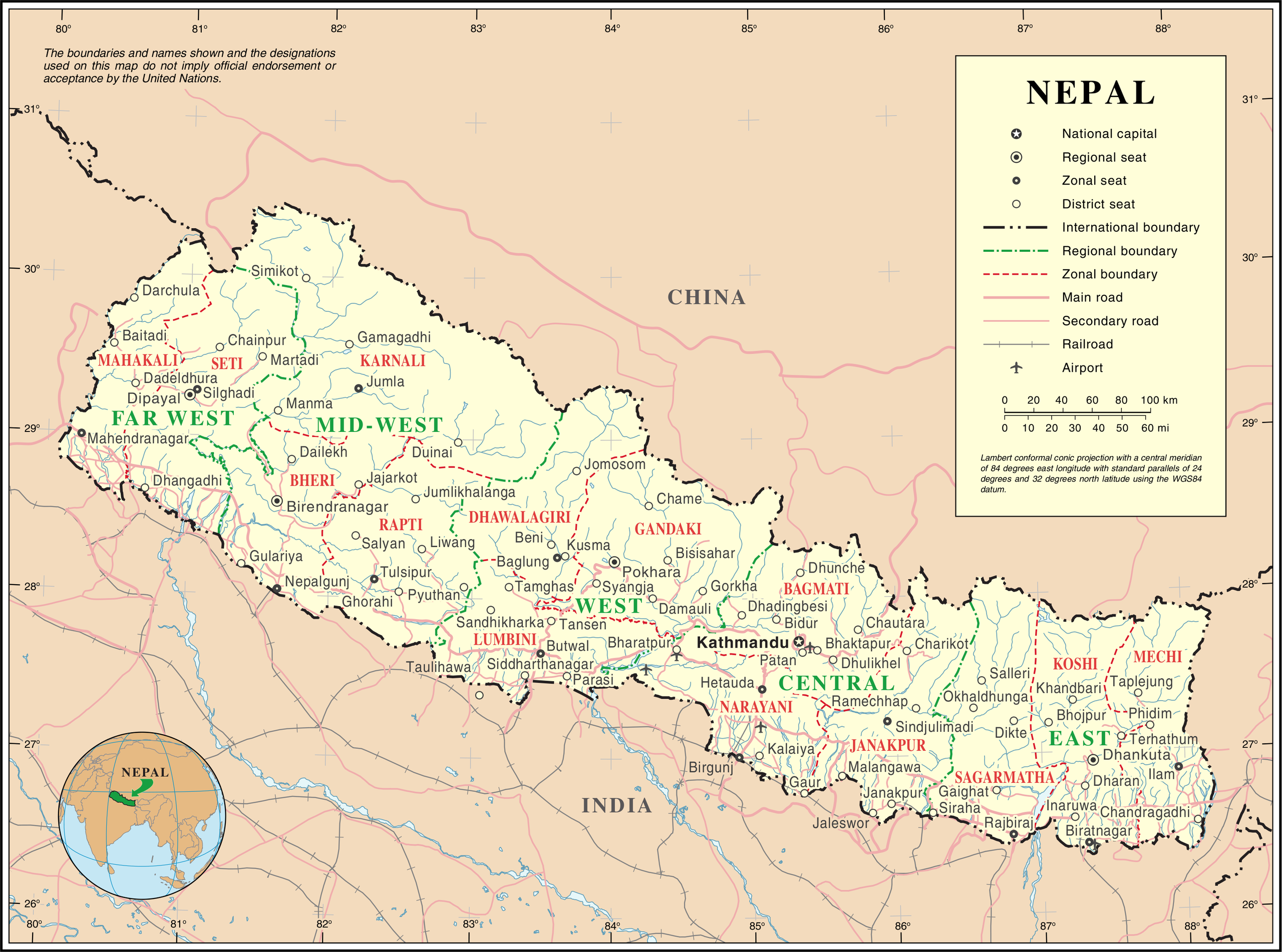
English: Map of Nepal highlighting development regions (green) and administrative zones (red), both disestablished in 2015 |
|||
| Tarix | before 25 oktyabr 2007 | |||
| Mənbə | United Nations | |||
| Müəllif | Naməlum | |||
| İcazə (Faylın təkrar istifadəsi) |
|

Faylın tarixçəsi
Faylın əvvəlki versiyasını görmək üçün gün/tarix bölməsindəki tarixlərə klikləyin.
| Tarix/Vaxt | Kiçik şəkil | Ölçülər | İstifadəçi | Şərh | |
|---|---|---|---|---|---|
| indiki | 01:36, 24 oktyabr 2007 | | 3.038 × 2.257 (1,56 MB) | Jeroen (müzakirə | töhfələr) | {{UN map}} Category:Maps of Nepal |
Siz bu faylı yenidən yükləyə bilməzsiniz.
Fayl keçidləri
Aşağıdakı səhifə bu faylı istifadə edir:
Faylın qlobal istifadəsi
Bu fayl aşağıdakı vikilərdə istifadə olunur:
- af.wikipedia.org layihəsində istifadəsi
- az.wikipedia.org layihəsində istifadəsi
- ba.wikipedia.org layihəsində istifadəsi
- bh.wikipedia.org layihəsində istifadəsi
- ca.wikipedia.org layihəsində istifadəsi
- de.wikipedia.org layihəsində istifadəsi
- en.wikipedia.org layihəsində istifadəsi
- fi.wikipedia.org layihəsində istifadəsi
- fr.wikipedia.org layihəsində istifadəsi
- hyw.wikipedia.org layihəsində istifadəsi
- ja.wikipedia.org layihəsində istifadəsi
- krc.wikipedia.org layihəsində istifadəsi
- nl.wikipedia.org layihəsində istifadəsi
- pap.wikipedia.org layihəsində istifadəsi
- pcd.wikipedia.org layihəsində istifadəsi
- pl.wiktionary.org layihəsində istifadəsi
- roa-rup.wikipedia.org layihəsində istifadəsi
- ru.wikipedia.org layihəsində istifadəsi
- sco.wikipedia.org layihəsində istifadəsi
- sl.wikipedia.org layihəsində istifadəsi
- ta.wikipedia.org layihəsində istifadəsi
- th.wikipedia.org layihəsində istifadəsi
- tr.wikipedia.org layihəsində istifadəsi
- uk.wikipedia.org layihəsində istifadəsi
- ur.wikipedia.org layihəsində istifadəsi
- www.wikidata.org layihəsində istifadəsi
- xmf.wikipedia.org layihəsində istifadəsi