File:Uncompahgre National Forest location in Colorado.png
跳转到导航
跳转到搜索
本预览的尺寸:800 × 579像素。 其他分辨率:320 × 232像素 | 640 × 463像素 | 1,024 × 741像素 | 1,280 × 926像素 | 2,000 × 1,447像素。
原始文件 (2,000 × 1,447像素,文件大小:1.74 MB,MIME类型:image/png)
说明
说明
添加一行文字以描述该文件所表现的内容
摘要
[编辑]
| 描述 |
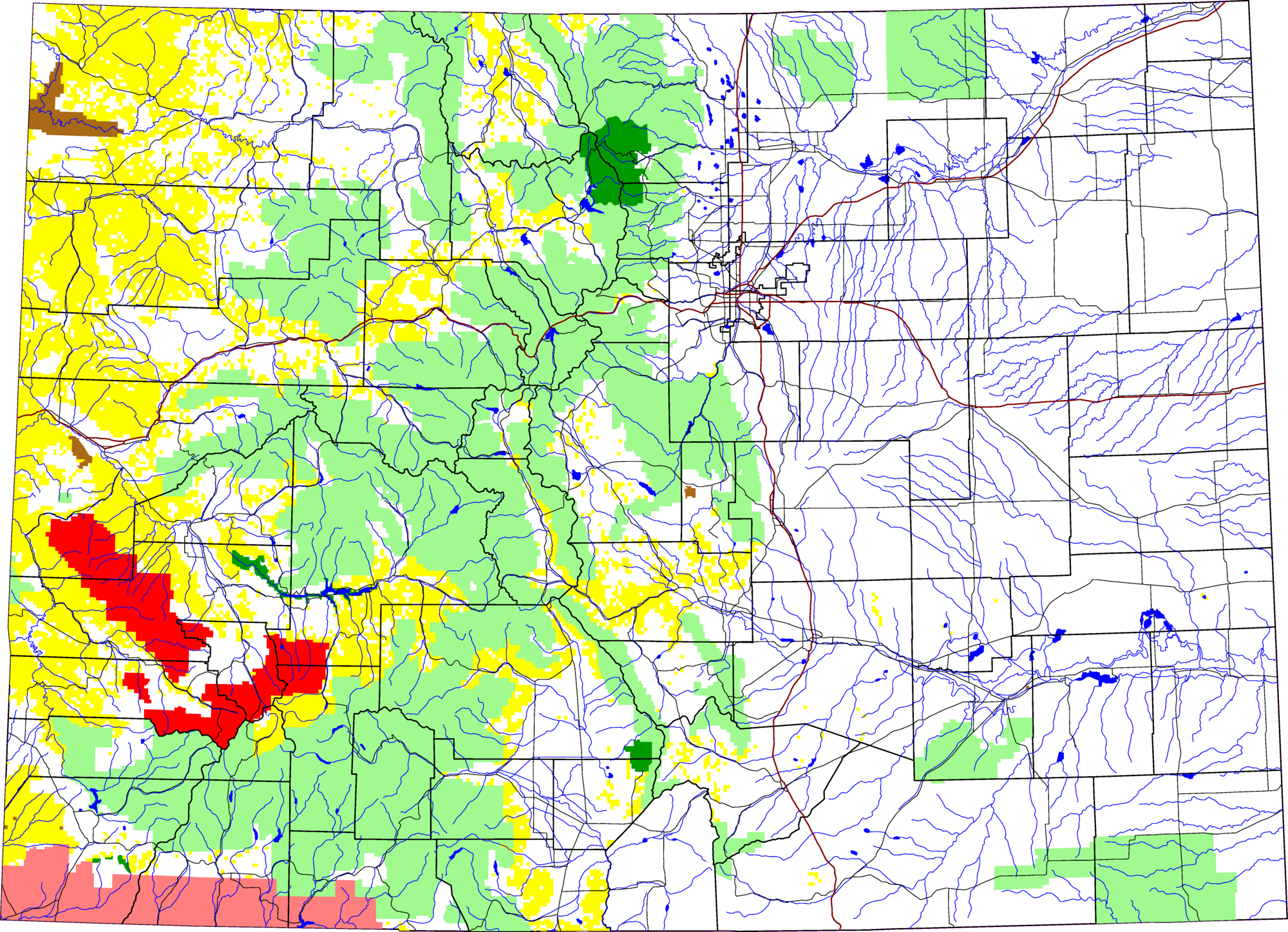
English: A map of Colorado, with Uncompahgre National Forest highlighted in red. The light green is other Forest Service land, yellow is BLM land, dark green is National Park, brown is National Monument or National Historic Site, pink is Indian reservation. The reddish lines are Interstate Highways.
David Benbennick made this map with data from nationalatlas.gov. The map uses the azimuthal equidistant projection, centered on (-105.7167, 39.1333) (degrees latitude, longitude). The area outside Colorado is transparent, so it should look nice on non-white backgrounds. Eventually, I will upload the 4 megabyte Metapost script I used to make this map. In the mean time, see map.mp. |
| 来源 | 自己的作品 |
| 作者 | David Benbennick |
许可协议
[编辑]
| 我,本作品著作权人,释出本作品至公有领域。这适用于全世界。 在一些国家这可能不合法;如果是这样的话,那么: 我无条件地授予任何人以任何目的使用本作品的权利,除非这些条件是法律规定所必需的。 |
文件历史
点击某个日期/时间查看对应时刻的文件。
| 日期/时间 | 缩略图 | 大小 | 用户 | 备注 | |
|---|---|---|---|---|---|
| 当前 | 2006年3月8日 (三) 19:51 | | 2,000 × 1,447(1.74 MB) | Dbenbenn(留言 | 贡献) | thumbnail, since MediaWiki can't scale PNG images that are larger than 12.5 megapixels |
| 2005年8月8日 (一) 02:45 |  | 6,235 × 4,511(651 KB) | Dbenbenn(留言 | 贡献) | by me, PD |
您不可以覆盖此文件。
文件用途
没有页面使用本文件。
全域文件用途
以下其他wiki使用此文件:
- de.wikipedia.org上的用途
- en.wikipedia.org上的用途
- es.wikipedia.org上的用途
- zh.wikipedia.org上的用途