File:United Kingdom Portugal Locator.png
Aller à la navigation
Aller à la recherche

Taille de cet aperçu : 800 × 583 pixels. Autres résolutions : 320 × 233 pixels | 640 × 467 pixels | 1 024 × 747 pixels | 1 280 × 934 pixels | 1 788 × 1 304 pixels.
Fichier d’origine (1 788 × 1 304 pixels, taille du fichier : 123 kio, type MIME : image/png)
Légendes
Légendes
Ajoutez en une ligne la description de ce que représente ce fichier
Description[modifier]
| Description |
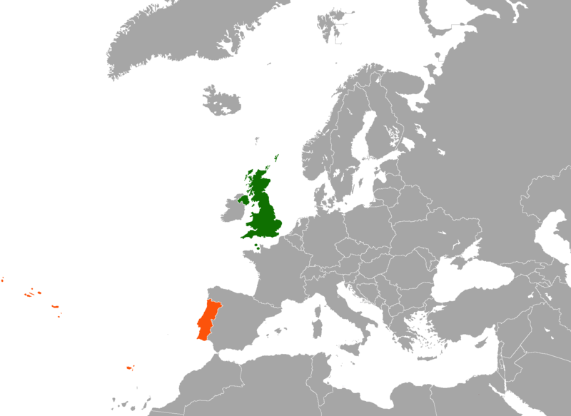
English: Map of Europe indicating the United Kingdom and Portugal. For use in British-Portuguese relations and similar articles. |
| Date | |
| Source |
|
| Auteur | en:User:Dancingwombatsrule |
Conditions d’utilisation[modifier]
| Cette œuvre a été placée dans le domaine public par son auteur, Dancingwombatsrule sur Wikipédia anglais. Ceci s’applique dans le monde entier. Dans certains pays, ceci peut ne pas être possible ; dans ce cas : Dancingwombatsrule accorde à toute personne le droit d’utiliser cette œuvre dans n’importe quel but, sans aucune condition, sauf celles requises par la loi. |
Journal des téléversements d’origine[modifier]
La page de description originale était ici. Tous les noms d'utilisateur qui suivent se rapportent à en.wikipedia.
| Upload date | User | Bytes | Dimensions | Comment |
|---|---|---|---|---|
| 2007-12-17 12:49:42 | Dancingwombatsrule | 64791 | 1217×974 | == Summary == '''Description:''' Map of [[Europe]] indicating the [[United Kingdom]] and [[Portugal]]. For use in [[British-Portuguese relations]] and similar articles. '''Source:''' Own work based on [[:Image:United Kingdom Greece Locator.png]] '''Cr |
| 2007-07-19 10:59:30 | Dancingwombatsrule | 47438 | 1357×628 | Description: Map of the world indicating the United Kingdom and Portugal. For use in [[British-Portuguese relations]] and similar articles. Source: Own work based on Image:BlankMap-World-v5.png Date: 19th July 2007 Author: [[User:Dancingwombatsrule]] |
Historique du fichier
Cliquer sur une date et heure pour voir le fichier tel qu'il était à ce moment-là.
| Date et heure | Vignette | Dimensions | Utilisateur | Commentaire | |
|---|---|---|---|---|---|
| actuel | 16 février 2021 à 02:11 | | 1 788 × 1 304 (123 kio) | Aquintero82 (d | contributions) | Updated map |
| 14 juin 2015 à 09:39 |  | 1 217 × 974 (49 kio) | The Rim of the Sky (d | contributions) | Fixing Malta from orange to grey; fixed colouration error on Morocco. | |
| 19 septembre 2012 à 04:13 |  | 1 217 × 974 (63 kio) | OgreBot (d | contributions) | (BOT): Uploading old version of file from en.wikipedia; originally uploaded on 2007-12-17 12:49:42 by Dancingwombatsrule | |
| 19 septembre 2012 à 04:13 |  | 1 357 × 628 (46 kio) | OgreBot (d | contributions) | (BOT): Uploading old version of file from en.wikipedia; originally uploaded on 2007-07-19 10:59:30 by Dancingwombatsrule | |
| 15 septembre 2009 à 23:01 |  | 749 × 599 (137 kio) | Alexg~commonswiki (d | contributions) | {{BotMoveToCommons|en.wikipedia|year={{subst:CURRENTYEAR}}|month={{subst:CURRENTMONTHNAME}}|day={{subst:CURRENTDAY}}}} == Summary == '''Description:''' Map of en:Europe indicating the en:United Kingdom and en:Portugal. For use in [[:en:Brit |
Vous ne pouvez pas remplacer ce fichier.
Utilisations locales du fichier
La page suivante utilise ce fichier :
Utilisations du fichier sur d’autres wikis
Les autres wikis suivants utilisent ce fichier :
- Utilisation sur ar.wikipedia.org
- Utilisation sur de.wikipedia.org
- Utilisation sur en.wikipedia.org
- Utilisation sur fa.wikipedia.org
- Utilisation sur fr.wikipedia.org
- Utilisation sur he.wikipedia.org
- Utilisation sur pl.wikipedia.org
- Utilisation sur pt.wikipedia.org
- Utilisation sur www.wikidata.org
- Utilisation sur zh.wikipedia.org