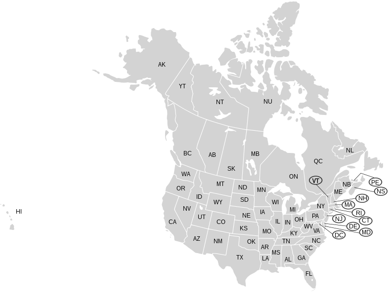
File:Usa and Canada with names natural.svg

Wikimedia Commonsista
Siirry navigaatioon Siirry hakuun

Alkuperäinen tiedosto(SVG-tiedosto; oletustarkkuus 2 289 × 1 744 kuvapistettä; tiedostokoko 260 KiB)

Kuvatekstit

Kuvatekstit

Lisää yhden rivin pituinen kuvaus tästä tiedostosta

Yhteenveto

[muokkaa]
Kuvaus
English: Blank SVG map of USA and Canada with state and province borders. Each state, province or territory is labeled with the two-letter code for that area. Non-contiguous parts of a states/provinces are "grouped" together with the main area of the state/provinces, so any state/provinces can be coloured in completion with one click anywhere on the state/provinces's area. Also, all states/provinces have a "id" attached to them, making them easy to find. Select "find" and then enter in the state/provinces's ISO 3166-2 code in the "id" field to find it. The codes can be found here (Canada) and here (USA).
Päiväys 03-07-2007 (upload with labels 9-Aug-2007)
Lähde Map has been corrected as New Brunswick was marked Nova Scotia and NS wasn't even marked at all.
Tekijä Lokal_Profil labels added by Paul Robinson
Muut versiot

Version with Hawaii moved closer to mainland

The same as that map with labels

Lisenssi

[muokkaa]
w:fi:Creative Commons
nimeäminen jaa samoin
Tämä tiedosto on lisensoitu Creative Commons Nimeä-JaaSamoin 2.5 Yleinen -lisenssillä.
Voit:
  • jakaa – kopioida, levittää ja esittää teosta
  • remiksata – valmistaa muutettuja teoksia
Seuraavilla ehdoilla:
  • nimeäminen – Sinun on mainittava lähde asianmukaisesti, tarjottava linkki lisenssiin sekä merkittävä, mikäli olet tehnyt muutoksia. Voit tehdä yllä olevan millä tahansa kohtuullisella tavalla, mutta et siten, että annat ymmärtää lisenssinantajan suosittelevan sinua tai teoksen käyttöäsi.
  • jaa samoin – Jos muutat tai perustat tähän työhön, voit jakaa tuloksena syntyvää työtä vain tällä tai tämän kaltaisella lisenssillä.

Tiedoston historia

Päiväystä napsauttamalla näet, millainen tiedosto oli kyseisellä hetkellä.

PäiväysPienoiskuvaKokoKäyttäjäKommentti
nykyinen26. kesäkuuta 2008 kello 23.09Pienoiskuva 26. kesäkuuta 2008 kello 23.09 tallennetusta versiosta2 289 × 1 744 (260 KiB)Rfc1394 (keskustelu | muokkaukset)Mark NS and NB labels and circle and line in accordance with the previous markings so they show up in the XML editor.
26. kesäkuuta 2008 kello 22.30Pienoiskuva 26. kesäkuuta 2008 kello 22.30 tallennetusta versiosta2 289 × 1 744 (260 KiB)Rfc1394 (keskustelu | muokkaukset)
9. elokuuta 2007 kello 15.52Pienoiskuva 9. elokuuta 2007 kello 15.52 tallennetusta versiosta2 289 × 1 744 (258 KiB)Rfc1394 (keskustelu | muokkaukset){{Information |Description={{en|Blank SVG map of USA and Canada with state and province borders. Each state, province or territory is labeled with the two-letter code for that area.}} Non-contiguous parts of a states/provinces are "grouped" together with