File:View of Miribel from the top of Vierge du Mas Rillier.JPG
跳转到导航
跳转到搜索
本预览的尺寸:800 × 600像素。 其他分辨率:320 × 240像素 | 640 × 480像素 | 1,024 × 768像素 | 1,280 × 960像素 | 2,560 × 1,920像素 | 4,320 × 3,240像素。
原始文件 (4,320 × 3,240像素,文件大小:4.89 MB,MIME类型:image/jpeg)
说明
说明
添加一行文字以描述该文件所表现的内容
摘要
[编辑]| 相机位置 | | 在以下服务上查看本图像和附近其他图像: OpenStreetMap |
|---|
| 描述 |
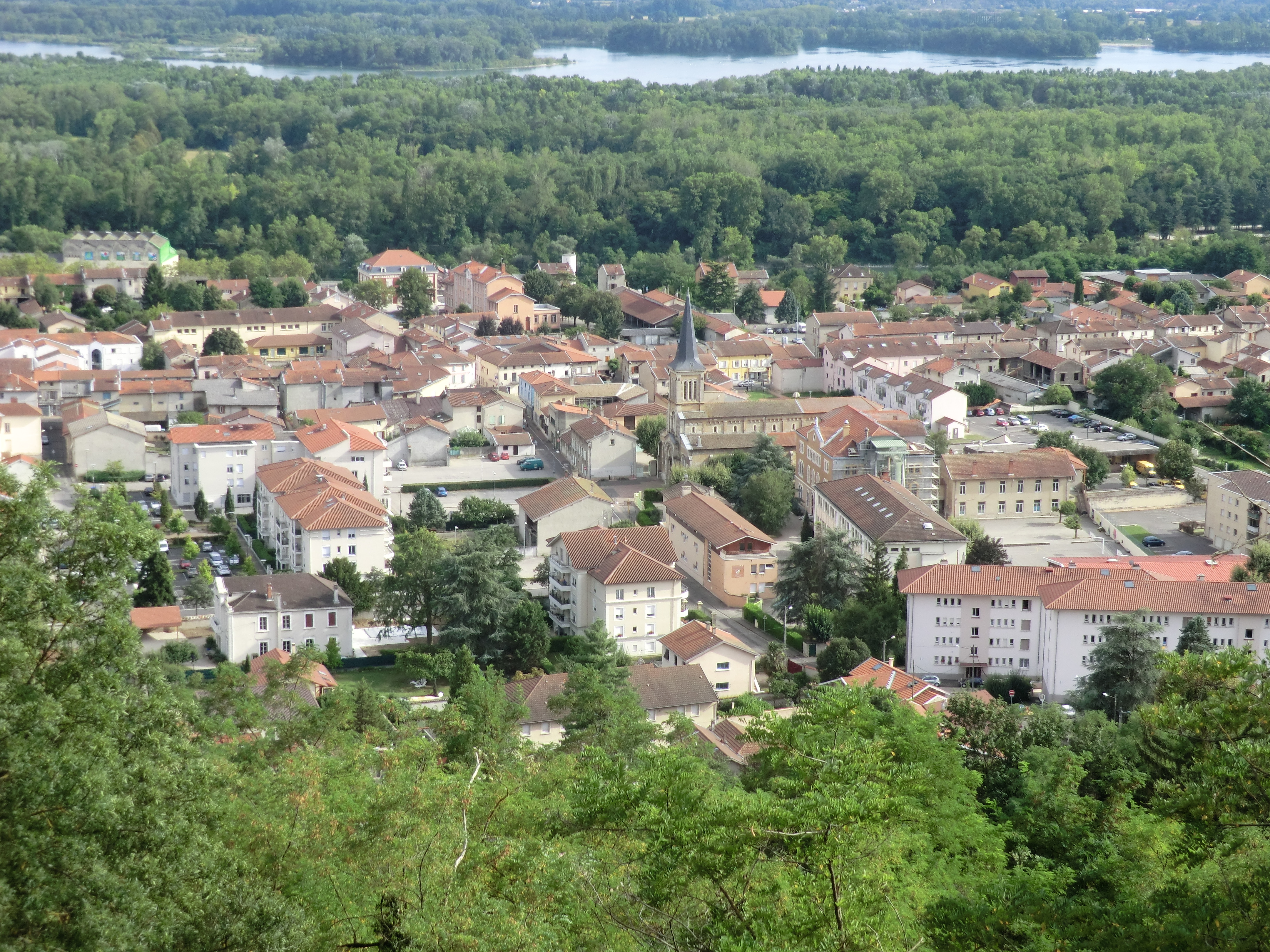
English: View of Miribel from the top of Vierge du Mas Rillier.
Français : Vue de Miribel depuis la Vierge du Mas Rillier. |
| 日期 | |
| 来源 | 自己的作品 |
| 作者 |
_en_juillet_2021.jpg)
许可协议
[编辑]
我,本作品著作权人,特此采用以下许可协议发表本作品:
| 本作品采用知识共享CC0 1.0 通用公有领域贡献许可协议授权。 | |
| 采用本宣告发表本作品的人,已在法律允许的范围内,通过在全世界放弃其对本作品拥有的著作权法规定的所有权利(包括所有相关权利),将本作品贡献至公有领域。您可以复制、修改、传播和表演本作品,将其用于商业目的,无需要求授权。
|
| 注解 | 该图片含有注解:在维基媒体共享资源上查看注解 |
文件历史
点击某个日期/时间查看对应时刻的文件。
| 日期/时间 | 缩略图 | 大小 | 用户 | 备注 | |
|---|---|---|---|---|---|
| 当前 | 2012年8月15日 (三) 11:45 | | 4,320 × 3,240(4.89 MB) | Benoît Prieur(留言 | 贡献) |
您不可以覆盖此文件。
文件用途
以下12个页面使用本文件:
- Category:Buildings in Miribel (Ain)
- Category:Deaths in Miribel (Ain)
- Category:Food shops in Miribel (Ain)
- Category:Maps of Miribel (Ain)
- Category:Miribel (Ain)
- Category:Monuments historiques in Miribel (Ain)
- Category:People of Miribel (Ain)
- Category:Restaurants in Miribel (Ain)
- Category:Shops in Miribel (Ain)
- Category:Signs in Miribel (Ain)
- Category:Squares in Miribel (Ain)
- Category:Streets in Miribel (Ain)
全域文件用途
以下其他wiki使用此文件:
- ar.wikipedia.org上的用途
- arz.wikipedia.org上的用途
- ast.wikipedia.org上的用途
- az.wikipedia.org上的用途
- ca.wikipedia.org上的用途
- ceb.wikipedia.org上的用途
- ce.wikipedia.org上的用途
- cs.wikipedia.org上的用途
- de.wikipedia.org上的用途
- de.wikivoyage.org上的用途
- diq.wikipedia.org上的用途
- eo.wikipedia.org上的用途
- es.wikipedia.org上的用途
- eu.wikipedia.org上的用途
- frp.wikipedia.org上的用途
- fr.wikipedia.org上的用途
- Miribel (Ain)
- Canton de Miribel
- Beynost
- Neyron
- Saint-Maurice-de-Beynost
- Thil (Ain)
- Tramoyes
- Communauté de communes de Miribel et du Plateau
- Émetteur de Tramoyes
- Modèle:Palette Communauté de communes de Miribel et du Plateau
- Canal de Miribel
- Vierge du Mas Rillier
- Carillon du Mas Rillier
- Calvaire-fontaine de Miribel
- Église Saint-Martin de Miribel
- Mémorial Hélène-et-Victor-Basch
- Viaduc Hélène-et-Victor-Basch
- Viaduc de la Côtière
- Viaduc de la Côtière (ferroviaire)
- Pont de Miribel
- Batterie de Sermenaz
- Les Échets
- Côtière liberté réseau intercommunal
- Mas Rillier
- Arboretum de Beynost
- Redoutes de Neyron
- Sermenaz
- Marais des Échets
- Sarrasinières
- Boisement humide de La Boisse
- Église Saint-Maurice de Saint-Maurice-de-Beynost
- La Sathonette
查看此文件的更多全域用途。