File:Voielatine planlatium.jpg
跳转到导航
跳转到搜索

本预览的尺寸:781 × 600像素。 其他分辨率:313 × 240像素 | 625 × 480像素 | 1,000 × 768像素 | 1,280 × 983像素 | 2,560 × 1,965像素 | 2,734 × 2,099像素。
原始文件 (2,734 × 2,099像素,文件大小:1.83 MB,MIME类型:image/jpeg)
说明
说明
添加一行文字以描述该文件所表现的内容
摘要
[编辑]
| 描述 |
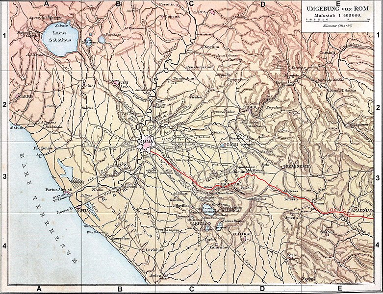
Français : Fond de carte de 1886 (G. Droysens Allgemeiner Historischer Handatlas), libre de droit (Image:Rom_Umgebung.jpg), avec la voie Latine en rouge. |
| 日期 | / 2008 |
| 来源 | Fond de carte 1886 / travail personnel (own work) |
| 作者 | ? / Coldeel |
| 其他版本 | Image:Rom_Umgebung.jpg |
许可协议
[编辑]
| 我,本作品著作权人,释出本作品至公有领域。这适用于全世界。 在一些国家这可能不合法;如果是这样的话,那么: 我无条件地授予任何人以任何目的使用本作品的权利,除非这些条件是法律规定所必需的。 |
文件历史
点击某个日期/时间查看对应时刻的文件。
| 日期/时间 | 缩略图 | 大小 | 用户 | 备注 | |
|---|---|---|---|---|---|
| 当前 | 2008年6月12日 (四) 19:54 | | 2,734 × 2,099(1.83 MB) | Coldeel(留言 | 贡献) | {{Information |Description= |Source= |Date= |Author= |Permission= |other_versions= }} |
| 2008年6月12日 (四) 09:34 |  | 2,734 × 2,099(1.83 MB) | Coldeel(留言 | 贡献) | {{Information |Description={{fr|1=Fond de carte de 1886 (G. Droysens Allgemeiner Historischer Handatlas), libre de droit (Image:Rom_Umgebung.jpg), avec la voie Prénestine en rouge.}} |Source=Fond de carte 1886 / travail personnel (own work) |Author= |
您不可以覆盖此文件。
文件用途
没有页面使用本文件。
全域文件用途
以下其他wiki使用此文件:
- de.wikipedia.org上的用途
- en.wikipedia.org上的用途
- fa.wikipedia.org上的用途
- fr.wikipedia.org上的用途
- it.wikipedia.org上的用途
- mk.wikipedia.org上的用途
- no.wikipedia.org上的用途
- pt.wikipedia.org上的用途
- ru.wikipedia.org上的用途
- zh.wikipedia.org上的用途