File:Wallis-et-Futuna collectivity location map.svg
Zur Navigation springen
Zur Suche springen

Gröössi vor PNG-Vorschou vor SVG-Datei: 800 × 508 Pixel. Wyteri Ufflösige: 320 × 203 Pixel | 640 × 406 Pixel | 1.024 × 650 Pixel | 1.280 × 813 Pixel | 2.560 × 1.626 Pixel | 1.691 × 1.074 Pixel.
Originaldatei (SVG-Datei, Basisgrößi: 1.691 × 1.074 Pixel, Dateigrößi: 89 KB)
Bildtexte
Kurzbeschreibungen
Ergänze eine einzeilige Erklärung, was diese Datei darstellt.
Bschryybig[ändere]
| Kameraposition | | Dieses und weitere Bilder auf OpenStreetMap |
|---|
| Bschryybig |
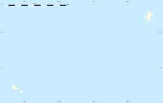
English: Blank administrative map of the French overseas collectivity of Wallis and Futuna, for geo-location purpose.
Français : Carte administrative vierge de la Collectivité d'outre-mer de Wallis-et-Futuna, destinée à la géolocalisation. Estimated scale: 1:400,000 (precision: 100 m)
Geographic limits of the map:
|
||
| Datum | |||
| Quälle |
Eigeni Arbet
|
||
| Urheber | Eric Gaba (Sting - fr:Sting) | ||
| Gnähmigung (Wyternutzig vu däre Datei) |
|
||
| Anderi Versione |
See also:
|


Lizänzierig[ändere]
Eric Gaba, Wikimedia Commons user Sting, dr Urheber vu däm Wärch, vereffetligt s dodermit unter däre Lizänz:
Die Datei isch lizänziert unter dr Creative-Commons-Lizenz Namensnännig – Wytergab unter glyche Bedingige 3.0 nit portiert.
Namenännig: Eric Gaba, Wikimedia Commons user Sting
- Du derfsch:
- des Wärch an anderi wytergee – des Wärch kopiere, verbreite un ibertrage
- des Wärch verändere – des Wärch aapasse
- Unter däne Bedingige:
- Namenännig – Du muesch aagmässeni Aagabe zum Urheber un dr Rächt mache, e Link zue dr Lizänz zuefiege un aagee, eb Änderige gmacht wore sin. Die Aagabe chenne in ere aagmässene Art gmacht wäre, aber nit eso, ass dr Yydruck entstoht, ass dr Lizänzgeber Dii oder Dyy Gebruch vum Wärch unterstitze un guetheiße.
- Wytergab unter glyche Bedingige – Wänn du des Wärch veränderesch, umwandlesch oder druf ufböusch, no derfsch s Ergebnis nume unter dr glyche oder ere kumpatible Lizänz wie s Orginal vereffetlige.
Dateiversione
Klick uf e Zytpunkt zu aazeige, wie s dert usgsäh het.
| Version vom | Vorschaubild | Mäß | Benutzer | Kommentar | |
|---|---|---|---|---|---|
| aktuell | 21:03, 12. Jul. 2010 | | 1.691 × 1.074 (89 KB) | Sting (Diskussion | Byträg) | == {{int:filedesc}} == {{Location|13|46|30|S|177|10|30|W|scale:1000000}} <br/> {{Information |Description={{en|Blank administrative map of the French overseas collectivity of Wallis and Futuna |
Du chasch die Datei nit iberschryybe.
Verwändig vu dr Datei
Die 8 Syte bruuche die Datei:
- User:SpinnerLaserz/Flags/Flags of France/France/Wallis and Futuna
- User:Sting/Gallery: Location and locator maps
- File:COVID-19 Outbreak in Wallis and Futuna by islands.svg
- File:France (+overseas), administrative divisions - Nmbrs (zoom).svg
- File:Futuna location map.svg
- File:Futuna relief location map.png
- File:Wallis location map.svg
- File:Wallis relief location map.png
,_administrative_divisions_-_Nmbrs_(zoom).svg)
Wältwyti Dateinutzig
Die andere Wikis bruche die Datei:
- Gebruch uf af.wikipedia.org
- Gebruch uf als.wikipedia.org
- Gebruch uf an.wikipedia.org
- Gebruch uf ar.wikipedia.org
- Gebruch uf ast.wikipedia.org
- Gebruch uf az.wikipedia.org
- Gebruch uf bg.wikipedia.org
- Gebruch uf bs.wikipedia.org
- Gebruch uf ceb.wikipedia.org
- Plantilya:Location map Wallis and Futuna
- North Point
- Rocky Point
- Sail Rock
- Green Point
- Red Point
- Entrance Island
- Tepa (pagklaro)
- Wallis Island
- Pasco Reef
- Little Peak
- Pointe Rouge
- Liku
- Vele
- Alo
- Pointe Verte
- Kolia
- Lac Lano
- Pointe Nord
- Southwest Rock
- The Lions
- Combe Bank
- Petit Piton
- Pointe Falaise
- Mamelon Vert
- Ouvéa
- Halalo
- Gahi
- Akaka
- Alele
- Vaitupu
- Nukufetau
- Lulu Hill
- Les Lions
- Île Futuna
- Waterwitch Seamount
- Taviuni Reef
- Rotumah Reef
Wältwyti Verwändig vu däre Datei aaluege.