File:Walloon Region in Belgium and Europe.svg
Sautar la navigacion
Sautar la recèrca

Talha d'aquesta previsualizacion PNG per aquest fichièr SVG: 680 × 520 pixèls. Autras resolucions : 314 × 240 pixèls | 628 × 480 pixèls | 1 004 × 768 pixèls | 1 280 × 979 pixèls | 2 560 × 1 958 pixèls.
Fichièr d'origina (Fichièr SVG, resolucion de 680 × 520 pixèls, talha : 2,36 Mo)
Llegendes
Llegendes
Afegeix una explicació d'una línia del que representa aquest fitxer
Descripcion[modificar]
| Descripcion |
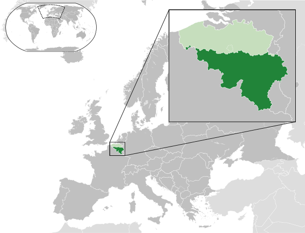
English: A map of the Walloon Region within Belgium and within Europe. |
| Data | (UTC) |
| Font |
Ce fichier est dérivé de : Blank map of Europe (with disputed regions).svg: |
| Autor |
|
| Autras versions |
|


.svg)
Publicat jos licéncia(s)[modificar]
Aqueste fichièr es jos licéncia Creative Commons licéncia generica atribucion-partiment a l'identic 3.0
- Sètz liure :
- de partejar – de copiar, distribuir e transmetre aquesta òbra
- d'adaptar – d'adaptar aquesta òbra
- Jos las condicions seguentas :
- atribucion – Vos cal atribuir aquesta òbra amb lo biais especificat per l'autor o lo concedent (mas pas dins un sens que suggerís que vos apròvan o qu'apròvan l'utilizacion d'aquesta òbra).
- partiment a l'identic – Se modificatz, transformatz, o vos basatz sus aquesta òbra, vos cal distribuir l'òbra resultanta jos la meteissa licéncia o una licéncia similara a aquesta.
Registre original de càrregues[modificar]
This image is a derivative work of the following images:
- File:Blank_map_of_Europe.svg licensed with Cc-by-sa-2.5
- 2012-02-21T16:27:27Z Alphathon 680x520 (614699 Bytes) Updated Metadata and the boarders/coastlines along the western coast of the Black Sea
- 2011-09-19T22:57:58Z Alphathon 680x520 (603759 Bytes) Added North/Northern Cyprus
- 2011-08-23T10:26:48Z Heb 680x520 (604212 Bytes) Added [[:en:Bornholm]] (taken from [[:File:Denmark blank map.svg]])
- 2011-04-12T00:40:40Z Alphathon 680x520 (602549 Bytes) Upgraded Sicily based on "File:Freeworldmaps-sicily.jpg". Upgraded Malta based on "File:Map of Malta 2.png". Simplified Croatian borders.
- 2011-04-10T21:43:04Z Alphathon 680x520 (607359 Bytes) Upgraded Croatia, Bosnia & Herzegovina, Slovenia and surrounding countries based on data from "File:Kroatien - Politische Gliederung (Karte).png"
- 2011-04-10T20:05:09Z Alphathon 680x520 (568373 Bytes) Improved Serbia, Montenegro and surrounding countries using data from "File:Serbia Map.png". Fixed Serbia-Montenegro border. Added Kosovo (using dashed border, since it is not a universally recognised nation, and left the lan
- 2011-04-10T15:55:02Z Alphathon 680x520 (524980 Bytes) Tweaked Ukraine and surrounding countries based on data from "File:Up-map.png"
- 2011-04-10T04:02:09Z Alphathon 680x520 (511168 Bytes) Improved Greece, Albania, F.Y.R. Macedonia and Bulgaria based on "File:Greece topo.jpg"
- 2011-04-10T02:48:52Z Alphathon 680x520 (505569 Bytes) Tweaked Germany and surrounding countries based on info from "File:Germany_general_map.png"
- 2011-04-10T01:54:05Z Alphathon 680x520 (493733 Bytes) Converted all lakes back to separate layer. Added Finish lakes and tweaked Finland shape based on "File:Finland 1996 CIA map.jpg". Added Swiss lakes based on "File:Suisse cantons.svg". Tweaked Scotland and added Lochs.
- 2011-04-10T00:07:54Z Alphathon 680x520 (450120 Bytes) Improved England outline and added Isle of Wight based on "File:England Regions - Blank.svg". Improved Denmark based on "File:2 digit postcode danmark.png". Improved Sweden based on "File:Map of Sweden, CIA, 1996.jpg"
- 2011-04-08T15:53:07Z Alphathon 680x520 (438878 Bytes) Upgraded/fixed various parts of the map. Details: *Some minor fixes to Ireland and added some of the larger lakes based on [[:File:Ireland_trad_counties_named.svg]] *Pretty major fixes to Scotland (mainly the west coast and i
- 2008-09-17T09:50:25Z F7 680x520 (531491 Bytes)
- 2008-09-17T09:42:57Z F7 680x520 (2353 Bytes)
- 2008-05-26T19:04:07Z Collard 680x520 (531491 Bytes) uploading on behalf of [[User:Checkit]], direct complaints to him plox: 'Moved countries out of the "outlines" group, removed "outlines" style class, remove separate style information for Russia'
- 2008-04-30T01:38:52Z TimothyBourke 680x520 (531767 Bytes) Changed the country code of Serbia to RS per [http://en.wikipedia.org/wiki/Serbian_country_codes] and the file [http://www.iso.org/iso/iso3166_en_code_lists.txt].
- 2008-02-08T22:44:37Z CarolSpears 680x520 (531767 Bytes) validated
- 2007-07-10T11:47:59Z MrWeeble 680x520 (533112 Bytes) Updated to include British Crown Dependencies as seperate entities and regroup them as "British Islands", with some simplifications to the XML and CSS
- 2007-05-14T17:17:34Z Zirland 680x520 (540659 Bytes) serbia and montenegro
- 2007-03-30T20:40:49Z W!B: 680x520 (538830 Bytes) minor corr: update nl:Ijsselmeer, del fi:lakes (all small), add ru:lake Oneka (all ref maps.google), glued northern irland back to ie ;)
- 2007-02-05T18:44:32Z Maix 680x520 (538295 Bytes) cropped
- 2007-02-04T15:07:29Z Maix 680x520 (538310 Bytes) {{Information |Description=A blank Map of Europe in SVG format. Every country has an id which is its ISO-3116-1-ALPHA2 code in lower case for easy coloring. |Source=Image based on [[Image:Europe_countries.svg|]] by [[User:Ti
Téléversé avec derivativeFX
Istoric del fichièr
Clicar sus una data e una ora per veire lo fichièr tal coma èra a aqueste moment
| Data e ora | Miniatura | Dimensions | Utilizaire | Comentari | |
|---|---|---|---|---|---|
| actual | 22 decembre de 2023 a 11.23 | | 680 × 520 (2,36 Mo) | Iktsokh (discussion | contribucions) | Cyprus geographically in Asia |
| 21 març de 2021 a 09.29 |  | 680 × 520 (2,36 Mo) | MrLune (discussion | contribucions) | Reverted to version as of 20:09, 17 August 2013 (UTC) it is in europe | |
| 19 febrièr de 2015 a 20.23 |  | 680 × 520 (2,37 Mo) | Leftcry (discussion | contribucions) | Cyprus isn't Europe | |
| 17 agost de 2013 a 20.09 |  | 680 × 520 (2,36 Mo) | Alphathon (discussion | contribucions) | Enlarged zoomed-in map | |
| 28 julhet de 2013 a 15.33 |  | 680 × 520 (2,36 Mo) | Alphathon (discussion | contribucions) | == {{int:filedesc}} == {{Information |Description={{en|A map of the Walloon Region within Belgium and within Europe.}} |Source={{Derived from|Blank_map_of_Europe.svg|display=50}} |Date=2013-07-28 14:55 (UTC) |Author=*File:Blank_map_of_Europe.svg:... |
Podètz pas remplaçar aqueste fichièr.
Paginas que contenon lo fichièr
Las paginas çaijós compòrtan aqueste imatge :
- User talk:Alphathon
- File:Brussels-Capital Region in Belgium and Europe.svg
- File:Flanders in Europe.svg
- File:Flemish Community in Belgium and Europe.svg
- File:Flemish Region in Belgium and Europe.svg
- File:French Community in Belgium and Europe.svg
- File:German-Speaking Community in Belgium and Europe.svg
Usatge global del fichièr
Los autres wikis seguents utilizan aqueste imatge :
- Utilizacion sus af.wikipedia.org
- Utilizacion sus an.wikipedia.org
- Utilizacion sus be.wikipedia.org
- Utilizacion sus bs.wikipedia.org
- Utilizacion sus cy.wikipedia.org
- Utilizacion sus en.wikipedia.org
- Utilizacion sus es.wikipedia.org
- Utilizacion sus eu.wikipedia.org
- Utilizacion sus fa.wikipedia.org
- Utilizacion sus fi.wikipedia.org
- Utilizacion sus fr.wikipedia.org
- Utilizacion sus fr.wikinews.org
- Utilizacion sus fy.wikipedia.org
- Utilizacion sus gd.wiktionary.org
- Utilizacion sus hr.wikipedia.org
- Utilizacion sus hu.wikipedia.org
- Utilizacion sus id.wikipedia.org
- Utilizacion sus incubator.wikimedia.org
- Utilizacion sus is.wikipedia.org
- Utilizacion sus ja.wikipedia.org
- Utilizacion sus ka.wikipedia.org
- Utilizacion sus ko.wikipedia.org
- Utilizacion sus li.wiktionary.org
- Utilizacion sus lv.wikipedia.org
- Utilizacion sus mk.wikipedia.org
- Utilizacion sus nl.wikipedia.org
- Utilizacion sus nl.wikinews.org
- Utilizacion sus nrm.wikipedia.org
- Utilizacion sus pcd.wikipedia.org
- Utilizacion sus pl.wikipedia.org
- Utilizacion sus pl.wikivoyage.org
- Utilizacion sus pnb.wikipedia.org
- Utilizacion sus ro.wikivoyage.org
- Utilizacion sus sco.wikipedia.org
- Utilizacion sus simple.wikipedia.org
- Utilizacion sus sl.wikipedia.org
- Utilizacion sus ta.wikipedia.org
- Utilizacion sus th.wikipedia.org
- Utilizacion sus tl.wikipedia.org
- Utilizacion sus tr.wikipedia.org
- Utilizacion sus ur.wikipedia.org
- Utilizacion sus vi.wikipedia.org
- Utilizacion sus zh-yue.wikipedia.org
- Utilizacion sus zh.wikipedia.org
Veire l'utilizacion globala d'aqueste fichièr.