File:Wappen Landkreis Bayreuth.svg
Skočit na navigaci
Skočit na vyhledávání

Velikost tohoto PNG náhledu tohoto SVG souboru: 200 × 218 pixelů. Jiná rozlišení: 220 × 240 pixelů | 440 × 480 pixelů | 705 × 768 pixelů | 939 × 1 024 pixelů | 1 879 × 2 048 pixelů.
Původní soubor (soubor SVG, nominální rozměr: 200 × 218 pixelů, velikost souboru: 45 KB)
Popisky
Popisky
Přidejte jednořádkové vysvětlení, co tento soubor představuje
Popis[editovat]
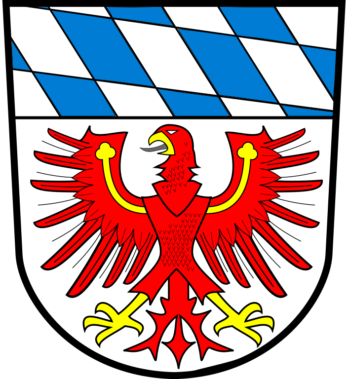
| Znak | des Landkreises Bayreuth. Vektorisiert mit Inkscape. |
| Blason | Unter einem Schildhaupt mit den bayerischen Rauten in Silber ein golden bewehrter roter Adler mit goldenen Kleestängeln auf den Flügeln. |
| Reference | |
| References | |
| Tinktura (BY) | argentorazuregules |
| Datum | 1. června 2008 |
| Tvůrce | Neznámý Vektory: |
| Zdroj | Vlastní tvorba založená na: Wappen Landkreis Bayreuth.png |
| SVG vývoj | Tento vektorový obrázek byl vytvořen programem Inkscape od Peppeg. |
Licence[editovat]
This file depicts the coat of arms of a German Körperschaft des öffentlichen Rechts (corporation governed by public law). According to § 5 Abs. 1 of the German Copyright law, official works like coats of arms are in the public domain.
Note: The usage of coats of arms is governed by legal restrictions, independent of the copyright status of the depiction shown here.
|
 |
Původní historie souboru[editovat]
This image is a derivative work of the following images:
- Wappen Landkreis Bayreuth.svg licensed with PD-Coa-Germany
- 2008-06-01T18:54:23Z Peppeg 200x218 (165554 Bytes) {{Information |Description=== Summary == Vektorisiert mit Inkscape |Source=*[[:Image:_Wappen_Landkreis_Bayreuth.png|]] |Date=2008-06-01 18:53 (UTC) |Author=*derivative work: ~~~ |versions = }} {{Re
- Wappen Landkreis Bayreuth.png licensed with PD-Coa-Germany
- 2005-11-12T12:35:10Z Rosenzweig 200x218 (92646 Bytes) Coat of arms of the district [[:de:Landkreis Bayreuth]] Source: http://www.landkreis-bayreuth.de/media/custom/408_651_1_m.JPG (official district website) Converted into PNG format and transparency added by [[User:Rosenzweig]
Uploaded with derivativeFX
Historie souboru
Kliknutím na datum a čas se zobrazí tehdejší verze souboru.
| Datum a čas | Náhled | Rozměry | Uživatel | Komentář | |
|---|---|---|---|---|---|
| současná | 26. 12. 2009, 16:51 | | 200 × 218 (45 KB) | Peppeg (diskuse | příspěvky) | Vektorisierung verfeinert |
| 1. 6. 2008, 19:14 |  | 200 × 218 (162 KB) | Peppeg (diskuse | příspěvky) | {{Information |Description=== Summary == Vektorisiert mit Inkscape == Summary == |Source=*Image:Wappen_Landkreis_Bayreuth.svg *Image:Wappen_Landkreis_Bayreuth.png |Date=2008-06-01 19:12 (UTC) |Author=*derivative work: ~~~ *[[:Image:Wappen_Land |
Tento soubor nemůžete přepsat.
Využití souboru
Tento soubor používá více než 100 stránek. Následující seznam zobrazuje pouze prvních 100. Můžete si prohlédnout úplný seznam.
- Ascanian Eagle
- File:Abfluss des Weihergrabens.JPG
- File:Am Wiederaustritt der Fichtenohe.JPG
- File:Arm der Fichtenohe1.JPG
- File:Austrittsstelle.JPG
- File:Craimoosweiher.JPG
- File:Düker.JPG
- File:Düker1.JPG
- File:Einmündung der Pegnitz.JPG
- File:Eintrittsstelle.JPG
- File:Junge Pegnitz.JPG
- File:Pegnitzbach.JPG
- File:Pegnitzquelle2.JPG
- File:Pegnitzquellweiher.JPG
- File:Wappen Landkreis Bayreuth.png
- File:Wappen Landkreis Bayreuth.svg
- File:Wappen Landkreis Bayreuth2.svg (přesměrování)
- File:Wiederaustritt.JPG
- Category:Ahorntal
- Category:Aufseß
- Category:Bad Berneck im Fichtelgebirge
- Category:Betzenstein
- Category:Bindlach
- Category:Bischofsgrün
- Category:Buildings in Ahorntal
- Category:Buildings in Aufseß
- Category:Buildings in Bad Berneck im Fichtelgebirge
- Category:Buildings in Betzenstein
- Category:Buildings in Bindlach
- Category:Buildings in Creußen
- Category:Buildings in Eckersdorf
- Category:Buildings in Emtmannsberg
- Category:Buildings in Gefrees
- Category:Buildings in Gesees
- Category:Buildings in Glashütten (Upper Franconia)
- Category:Buildings in Goldkronach
- Category:Buildings in Haag (Upper Franconia)
- Category:Buildings in Heinersreuth
- Category:Buildings in Hollfeld
- Category:Buildings in Hummeltal
- Category:Buildings in Plankenfels
- Category:Churches in Bindlach
- Category:Churches in Hollfeld
- Category:Churches in Mistelbach (Upper Franconia)
- Category:Creußen
- Category:Cultural heritage monuments in Ahorntal
- Category:Cultural heritage monuments in Aufseß
- Category:Cultural heritage monuments in Bad Berneck im Fichtelgebirge
- Category:Cultural heritage monuments in Betzenstein
- Category:Cultural heritage monuments in Bindlach
- Category:Cultural heritage monuments in Creußen
- Category:Cultural heritage monuments in Eckersdorf
- Category:Cultural heritage monuments in Emtmannsberg
- Category:Cultural heritage monuments in Fichtelberg (Upper Franconia)
- Category:Cultural heritage monuments in Gefrees
- Category:Cultural heritage monuments in Gesees
- Category:Cultural heritage monuments in Glashütten (Upper Franconia)
- Category:Cultural heritage monuments in Goldkronach
- Category:Cultural heritage monuments in Haag (Upper Franconia)
- Category:Cultural heritage monuments in Heinersreuth
- Category:Cultural heritage monuments in Hollfeld
- Category:Cultural heritage monuments in Hummeltal
- Category:Cultural heritage monuments in Kirchenpingarten
- Category:Cultural heritage monuments in Mistelbach (Upper Franconia)
- Category:Cultural heritage monuments in Mistelgau
- Category:Cultural heritage monuments in Pegnitz (Upper Franconia)
- Category:Cultural heritage monuments in Plankenfels
- Category:Cultural heritage monuments in Plech
- Category:Cultural heritage monuments in Pottenstein (Upper Franconia)
- Category:Cultural heritage monuments in Schnabelwaid
- Category:Cultural heritage monuments in Seybothenreuth
- Category:Cultural heritage monuments in Speichersdorf
- Category:Cultural heritage monuments in Waischenfeld
- Category:Cultural heritage monuments in Warmensteinach
- Category:Cultural heritage monuments in Weidenberg
- Category:Eckersdorf
- Category:Emtmannsberg
- Category:Fichtelberg (Upper Franconia)
- Category:Gefrees
- Category:Gesees
- Category:Glashütten (Upper Franconia)
- Category:Goldkronach
- Category:Haag (Upper Franconia)
- Category:Heinersreuth
- Category:Hollfeld
- Category:Hummeltal
- Category:Kirchenpingarten
- Category:Landkreis Bayreuth
- Category:Maps of Hollfeld
- Category:Mehlmeisel
- Category:Mistelbach (Upper Franconia)
- Category:Mistelgau
- Category:Pegnitz (Upper Franconia)
- Category:Plankenfels
- Category:Plech
- Category:Pottenstein (Upper Franconia)
- Category:Prebitz
- Category:Schnabelwaid
- Category:Seybothenreuth
- Category:Speichersdorf
Zobrazit další odkazy na tento soubor.
Globální využití souboru
Tento soubor využívají následující wiki:
- Využití na ar.wikipedia.org
- Využití na ceb.wikipedia.org
- Využití na cs.wikipedia.org
- Využití na da.wikipedia.org
- Využití na de.wikipedia.org
- Liste der Landkreise in Deutschland
- Landkreis Bayreuth
- Waischenfeld
- Hollfeld
- Vorlage:Navigationsleiste Städte und Gemeinden im Landkreis Bayreuth
- Creußen
- Betzenstein
- Weidenberg
- Schloss Freienfels
- Aufseß
- Mistelbach (Oberfranken)
- Ahorntal
- Eckersdorf
- Burg Pottenstein
- Bischofsgrün
- Bad Berneck im Fichtelgebirge
- Gesees
- Hummeltal
- Mistelgau
- Gefrees
- Heinersreuth
- Bindlach
- Benutzer:Lou.gruber/Übersicht über die kreisabhängigen Gemeinden in Bayern
- Goldkronach
- Burg Rabenstein (Oberfranken)
- Burgruine Leienfels
- Schnabelwaid
- Glashütten (Oberfranken)
- Haag (Oberfranken)
- Plech
- Prebitz
- Fichtelberg (Oberfranken)
- Seybothenreuth
- Mehlmeisel
- Kirchenpingarten
- Emtmannsberg
- Speichersdorf
- Pegnitz (Stadt)
- Pottenstein (Oberfranken)
- Verwaltungsgemeinschaft Creußen
- Verwaltungsgemeinschaft Betzenstein
- Verwaltungsgemeinschaft Hollfeld
- Verwaltungsgemeinschaft Mistelbach
- Verwaltungsgemeinschaft Mistelgau
Zobrazit další globální využití tohoto souboru.