File:West Germany 1956-1990.svg
Μετάβαση στην πλοήγηση
Πήδηση στην αναζήτηση

Το μέγεθος αυτής της PNG προεπισκόπησης αυτού του SVG το αρχείο: 450 × 456 εικονοστοιχεία. Άλλες αναλύσεις: 237 × 240 εικονοστοιχεία | 474 × 480 εικονοστοιχεία | 758 × 768 εικονοστοιχεία | 1.011 × 1.024 εικονοστοιχεία | 2.021 × 2.048 εικονοστοιχεία.
Πρωτότυπο αρχείο (Αρχείο SVG, ονομαστικό μέγεθος 450 × 456 εικονοστοιχεία, μέγεθος αρχείου: 471 KB)
Λεζάντες
Λεζάντες
Δεν ορίστηκε λεζάντα
Σύνοψη[επεξεργασία]


.svg)
.svg)
.svg)
.svg)
.svg)


.svg)
.svg)
.svg)


.png)
.png)


.svg)


.svg)

.svg)


.svg)
.svg)
.svg)
.svg)


.svg)
.png)


.svg)


.svg)
.svg)


.svg)


.svg)


.svg)
.svg)
.svg)
.svg)
.svg)
.svg)
.svg)
_cropped.svg)
.svg)
.svg)
.svg)
.svg)
.svg)
.svg)
.svg)
.svg)
.svg)
.svg)
.svg)
.svg)
.svg)
.svg)
.svg)
.svg)
.svg)
.svg)
.svg)
.svg)
.svg)
.svg)
.svg)
.svg)
.svg)
.svg)
.svg)
.svg)
.svg)
.svg)
.svg)
.svg)
.svg)
.svg)
.svg)
.svg)
.svg)
.svg)
.svg)
.svg)
.svg)
.svg)
.svg)
.svg)
.svg)
| Αυτή είναι μία ρετουσαρισμένη εικόνα, που σημαίνει ότι έχει μεταβληθεί ψηφιακά από την αρχική της έκδοση. Η πρωτότυπη μπορεί να βρεθεί εδώ: Blank map of Europe 1956-1990.svg.
|
Αδειοδότηση[επεξεργασία]
Εγώ, ο κάτοχος των πνευματικών δικαιωμάτων αυτού του έργου, το δημοσιεύω δια του παρόντος υπό την εξής άδεια χρήσης:
Το αρχείο διανέμεται υπό την άδεια Creative Commons Αναφορά προέλευσης-Παρόμοια διανομή 3.0 Μη εισαγόμενη
- Είστε ελεύθερος:
- να μοιραστείτε – να αντιγράψετε, διανέμετε και να μεταδώσετε το έργο
- να διασκευάσετε – να τροποποιήσετε το έργο
- Υπό τις ακόλουθες προϋποθέσεις:
- αναφορά προέλευσης – Θα πρέπει να κάνετε κατάλληλη αναφορά, να παρέχετε σύνδεσμο για την άδεια και να επισημάνετε εάν έγιναν αλλαγές. Μπορείτε να το κάνετε με οποιοδήποτε αιτιολογήσιμο λόγο, χωρίς όμως να εννοείται με οποιονδήποτε τρόπο ότι εγκρίνουν εσάς ή τη χρήση του έργου από εσάς.
- παρόμοια διανομή – Εάν αλλάξετε, τροποποιήσετε ή δημιουργήσετε πάνω στο έργο αυτό, μπορείτε να διανείμετε αυτό που θα προκύψει μόνο υπό τους όρους της ίδιας ή συμβατής άδειας με το πρωτότυπο.
Καταγραφές ανεβασμάτων πρωτότυπου αρχείου[επεξεργασία]
This image is a derivative work of the following images:
- File:Blank_map_of_Europe_1956-1990.svg licensed with Cc-by-sa-3.0
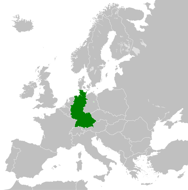
- 2011-10-30T04:43:42Z Alphathon 450x456 (485146 Bytes) == {{int:filedesc}} == {{Information |Description={{en|Blank map of Europe showing national borders as they stood from 1956-1990.}} |Source=*[[:File:Blank_map_of_Europe.svg|]] |Date=2011-10-30 04:42 (UTC) |Author=*[[:File:Bla
Ιστορικό αρχείου
Πατήστε σε μια ημερομηνία/ώρα για να δείτε το αρχείο όπως εμφανιζόταν εκείνη την χρονική στιγμή.
| Ημερομηνία/Ώρα | Μικρογραφία | Διαστάσεις | Χρήστης | Σχόλιο | |
|---|---|---|---|---|---|
| τρέχον | 01:31, 28 Σεπτεμβρίου 2018 | | 450 × 456 (471 KB) | FelipeRev (συζήτηση | Συνεισφορά) | Se incluye Berlín Oeste pero con un color diferente, para marcar que pertenecía a su espacio económico |
| 04:04, 15 Ιουλίου 2015 |  | 450 × 456 (476 KB) | Elevatorrailfan (συζήτηση | Συνεισφορά) | Breaking apart West Germany and West Berlin paths. | |
| 01:43, 10 Δεκεμβρίου 2014 |  | 450 × 456 (476 KB) | Elevatorrailfan (συζήτηση | Συνεισφορά) | West Berlin was not part of West Germany. | |
| 00:39, 26 Νοεμβρίου 2011 |  | 450 × 456 (474 KB) | StalwartUK (συζήτηση | Συνεισφορά) | == {{int:filedesc}} == {{Information |Description={{en|Map of West Germany (Federal Republic of Germany) as it was from 1949-1990. Surrounding countries accurate from 1956-1990.}} |Source=*[[:File:Blank_map_of_Europe_1956-1990.svg|Bla |
Δεν μπορείτε να αντικαταστήσετε αυτό το αρχείο.
Χρήση αρχείου
Περισσότεροι από 100 σελίδες χρησιμοποιούν αυτό το αρχείο. Η ακόλουθη λίστα δείχνει τις πρώτες 100 σελίδες που συνδέονται με αυτό το αρχείο μονοσήμαντα. Η πλήρης λίστα είναι διαθέσιμη.
- User:Alphathon/Historical Europe
- File:Albania 1956-1990.svg
- File:Albanian Kingdom (1935).svg
- File:Albanian Kingdom (1939).svg
- File:Austro-Hungarian Monarchy (1914).svg
- File:Blank map of Europe 1812.svg
- File:Blank map of Europe 1890.svg
- File:Blank map of Europe 1914.svg
- File:Blank map of Europe 1929-1938.svg
- File:Blank map of Europe 1956-1990.svg
- File:Blank map of Europe October 1938 - March 1939.svg
- File:Bulgaria 1956-1990.svg
- File:Confederation of the Rhine (1812).svg
- File:Cortina di ferro.png
- File:Czechoslovakia 1956–1990.svg
- File:Duchy of Warsaw (1812).svg
- File:East Germany 1956-1990.svg
- File:Europe Jewish % change 1945 2010.png
- File:First French Empire 1812.svg
- File:Free City Danzig 1930.svg
- File:Free City of Danzig (1812).svg
- File:German Empire 1914.svg
- File:German Reich (1939).svg
- File:Grand Principality of Finland (1914).svg
- File:Hellenic Republic (1935).svg
- File:Hungary 1956-1990.svg
- File:InterwarCentralEurope.png
- File:Kingdom of Bulgaria (1914).svg
- File:Kingdom of Greece (1890).svg
- File:Kingdom of Greece (1914).svg
- File:Kingdom of Greece (1973).svg
- File:Kingdom of Italy (Napoleonic).svg
- File:Kingdom of Montenegro (1914).svg
- File:Kingdom of Romania (1890).svg
- File:Kingdom of Romania (1914).svg
- File:Kingdom of Romania (1939).svg
- File:Kingdom of Serbia (1890).svg
- File:Kingdom of Serbia (1914).svg
- File:Map of the Republic of Serbia (2006–2008).svg
- File:Poland 1930.svg
- File:Poland 1956-1990.svg
- File:Prince-Bishopric of Montenegro (1812).svg
- File:Principality of Albania (1914).svg
- File:Principality of Bulgaria (1890).svg
- File:Principality of Montenegro (1890).svg
- File:Republic of Montenegro (2006).svg
- File:Romania 1956-1990.svg
- File:Territory of the Serbian Uprising (1812).svg
- File:Voivodeship of Moldavia (1812).svg
- File:Voivodeship of Wallachia (1812).svg
- File:Weimar Republic 1930.svg
- File:West Germany 1956-1990.svg
- File:Yugoslavia 1956-1990.svg
- Category:1949 in West Germany
- Category:1950 in West Germany
- Category:1951 in West Germany
- Category:1952 in West Germany
- Category:1953 in West Germany
- Category:1954 in West Germany
- Category:1955 in West Germany
- Category:1956 in West Germany
- Category:1957 in West Germany
- Category:1958 in West Germany
- Category:1960 in West Germany
- Category:1961 in West Germany
- Category:1962 in West Germany
- Category:1963 in West Germany
- Category:1964 in West Germany
- Category:1965 in West Germany
- Category:1966 in West Germany
- Category:1967 in West Germany
- Category:1968 in West Germany
- Category:1969 in West Germany
- Category:1970 in West Germany
- Category:1971 in West Germany
- Category:1972 in West Germany
- Category:1973 in West Germany
- Category:1974 in West Germany
- Category:1975 in West Germany
- Category:1976 in West Germany
- Category:1977 in West Germany
- Category:1978 in West Germany
- Category:1979 in West Germany
- Category:1980 in West Germany
- Category:1981 in West Germany
- Category:1982 in West Germany
- Category:1983 in West Germany
- Category:1984 in West Germany
- Category:1985 in West Germany
- Category:1986 in West Germany
- Category:1987 in West Germany
- Category:1988 in West Germany
- Category:1989 in West Germany
- Category:1990 in West Germany
- Category:History of West Germany
- Category:West Germany by decade
- Category:West Germany by year
- Category:West Germany in the 1950s
- Category:West Germany in the 1960s
- Category:West Germany in the 1970s
.svg)
.svg)
.svg)
.svg)
Δείτε περισσότερους συνδέσμους προς αυτό το αρχείο.
Καθολική χρήση αρχείου
Τα ακόλουθα άλλα wiki χρησιμοποιούν αυτό το αρχείο:
- Χρήση σε af.wikipedia.org
- Χρήση σε an.wikipedia.org
- Χρήση σε ar.wikipedia.org
- Χρήση σε ast.wikipedia.org
- Χρήση σε be.wikipedia.org
- Χρήση σε bn.wikipedia.org
- Χρήση σε bs.wikipedia.org
- Χρήση σε ca.wikipedia.org
- Χρήση σε cs.wikipedia.org
- Χρήση σε da.wikipedia.org
- Χρήση σε el.wikipedia.org
- Χρήση σε en.wikipedia.org
- Χρήση σε eo.wikipedia.org
- Χρήση σε es.wikipedia.org
- Χρήση σε eu.wikipedia.org
- Χρήση σε fi.wikipedia.org
- Χρήση σε fr.wikipedia.org
- Χρήση σε fr.wiktionary.org
- Χρήση σε ga.wikipedia.org
- Χρήση σε gl.wikipedia.org
- Χρήση σε gv.wikipedia.org
- Χρήση σε ha.wikipedia.org
- Χρήση σε he.wikipedia.org
- Χρήση σε hi.wikipedia.org
- Χρήση σε hr.wikipedia.org
- Χρήση σε ia.wikipedia.org
- Χρήση σε id.wikipedia.org
- Χρήση σε io.wikipedia.org
- Χρήση σε it.wikipedia.org
- Χρήση σε ja.wikipedia.org
- Χρήση σε ka.wikipedia.org
- Χρήση σε ko.wikipedia.org
- Χρήση σε ku.wikipedia.org
- Χρήση σε lij.wikipedia.org
- Χρήση σε lld.wikipedia.org
- Χρήση σε lmo.wikipedia.org
- Χρήση σε lt.wikipedia.org
- Χρήση σε lv.wikipedia.org
- Χρήση σε mk.wikipedia.org
- Χρήση σε ml.wikipedia.org
- Χρήση σε mr.wikipedia.org
- Χρήση σε ms.wikipedia.org
Δείτε περισσότερη καθολική χρήση αυτού του αρχείου.