File:West Germany 1956-1990.svg
Pumunta sa nabigasyon
Pumunta sa paghahanap

Size of this PNG preview of this SVG file: 450 x 456 na pixel. Ibang resolusyon: 237 x 240 na pixel | 474 x 480 na pixel | 758 x 768 na pixel | 1,011 x 1,024 na pixel | 2,021 x 2,048 na pixel.
Orihinal na file (SVG na file, nominal na 450 × 456 (na) pixel, laki: 471 KB)
Captions
Captions
Add a one-line explanation of what this file represents
Buod[baguhin]


.svg)
.svg)
.svg)
.svg)
.svg)


.svg)
.svg)
.svg)


.png)
.png)


.svg)


.svg)

.svg)


.svg)
.svg)
.svg)
.svg)


.svg)
.png)


.svg)


.svg)
.svg)


.svg)


.svg)


.svg)
.svg)
.svg)
.svg)
.svg)
.svg)
.svg)
_cropped.svg)
.svg)
.svg)
.svg)
.svg)
.svg)
.svg)
.svg)
.svg)
.svg)
.svg)
.svg)
.svg)
.svg)
.svg)
.svg)
.svg)
.svg)
.svg)
.svg)
.svg)
.svg)
.svg)
.svg)
.svg)
.svg)
.svg)
.svg)
.svg)
.svg)
.svg)
.svg)
.svg)
.svg)
.svg)
.svg)
.svg)
.svg)
.svg)
.svg)
.svg)
.svg)
.svg)
.svg)
.svg)
.svg)
| This is a retouched picture, which means that it has been digitally altered from its original version. The original can be viewed here: Blank map of Europe 1956-1990.svg:
|
Paglilisensiya[baguhin]
Ako, na may karapatang-ari ng akdang ito, ang naglalathala nito alinsunod sa ilalim ng sumusunod na mga lisensya:
Lisensyado ang file na ito sa ilalim ng lisensiyang Creative Commons Attribution-Share Alike 3.0 Unported.
- Malaya kang:
- para ibahagi – para kopyahin, ipamahagi, at i-transmit ang akda
- para i-remix – para i-adapt ang akda
- Sa ilalim ng mga kondisyong ito:
- atribusyon – Dapat magbigay ka ng isang maayos na pag-credit, ibigay ang link sa lisensiya, at tukuyin kung may mga pagbabagong ginawa. Magagawa mo ito sa isang risonableng paraan, pero hindi sa paraan na para bang ineendorso ka o ng paggamit mo ng naglisensiya sa'yo.
- share alike – Kung ire-remix mo, babaguhin, o magdadagdag ka sa materyal, dapat mong ipamahagi ang mga ambag mo sa ilalim ng pareho o katulad na lisensiya.
Tala ng orihinal na pagkarga[baguhin]
This image is a derivative work of the following images:
- File:Blank_map_of_Europe_1956-1990.svg licensed with Cc-by-sa-3.0
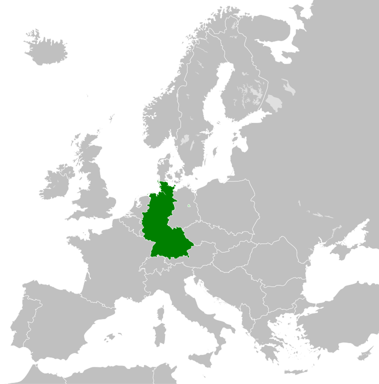
- 2011-10-30T04:43:42Z Alphathon 450x456 (485146 Bytes) == {{int:filedesc}} == {{Information |Description={{en|Blank map of Europe showing national borders as they stood from 1956-1990.}} |Source=*[[:File:Blank_map_of_Europe.svg|]] |Date=2011-10-30 04:42 (UTC) |Author=*[[:File:Bla
Nakaraan ng file
Pindutin ang isang petsa/oras para makita ang file noong puntong yon.
| Petsa/Oras | Thumbnail | Sukat | Tagagamit | Komento | |
|---|---|---|---|---|---|
| ngayon | 01:31, 28 Setyembre 2018 | | 450 × 456 (471 KB) | FelipeRev (usapan | ambag) | Se incluye Berlín Oeste pero con un color diferente, para marcar que pertenecía a su espacio económico |
| 04:04, 15 Hulyo 2015 |  | 450 × 456 (476 KB) | Elevatorrailfan (usapan | ambag) | Breaking apart West Germany and West Berlin paths. | |
| 01:43, 10 Disyembre 2014 |  | 450 × 456 (476 KB) | Elevatorrailfan (usapan | ambag) | West Berlin was not part of West Germany. | |
| 00:39, 26 Nobyembre 2011 |  | 450 × 456 (474 KB) | StalwartUK (usapan | ambag) | == {{int:filedesc}} == {{Information |Description={{en|Map of West Germany (Federal Republic of Germany) as it was from 1949-1990. Surrounding countries accurate from 1956-1990.}} |Source=*[[:File:Blank_map_of_Europe_1956-1990.svg|Bla |
Hindi mo mao-overwrite ang file na ito.
Paggamit sa file
Lagpas sa 100 pahina ang gumagamit sa file na ito. Ipinapakita lang ng talaan sa baba ang unang pahina na gumagamit sa file na ito. May buong talaan ding magagamit.
- User:Alphathon/Historical Europe
- File:Albania 1956-1990.svg
- File:Albanian Kingdom (1935).svg
- File:Albanian Kingdom (1939).svg
- File:Austro-Hungarian Monarchy (1914).svg
- File:Blank map of Europe 1812.svg
- File:Blank map of Europe 1890.svg
- File:Blank map of Europe 1914.svg
- File:Blank map of Europe 1929-1938.svg
- File:Blank map of Europe 1956-1990.svg
- File:Blank map of Europe October 1938 - March 1939.svg
- File:Bulgaria 1956-1990.svg
- File:Confederation of the Rhine (1812).svg
- File:Cortina di ferro.png
- File:Czechoslovakia 1956–1990.svg
- File:Duchy of Warsaw (1812).svg
- File:East Germany 1956-1990.svg
- File:Europe Jewish % change 1945 2010.png
- File:First French Empire 1812.svg
- File:Free City Danzig 1930.svg
- File:Free City of Danzig (1812).svg
- File:German Empire 1914.svg
- File:German Reich (1939).svg
- File:Grand Principality of Finland (1914).svg
- File:Hellenic Republic (1935).svg
- File:Hungary 1956-1990.svg
- File:InterwarCentralEurope.png
- File:Kingdom of Bulgaria (1914).svg
- File:Kingdom of Greece (1890).svg
- File:Kingdom of Greece (1914).svg
- File:Kingdom of Greece (1973).svg
- File:Kingdom of Italy (Napoleonic).svg
- File:Kingdom of Montenegro (1914).svg
- File:Kingdom of Romania (1890).svg
- File:Kingdom of Romania (1914).svg
- File:Kingdom of Romania (1939).svg
- File:Kingdom of Serbia (1890).svg
- File:Kingdom of Serbia (1914).svg
- File:Map of the Republic of Serbia (2006–2008).svg
- File:Poland 1930.svg
- File:Poland 1956-1990.svg
- File:Prince-Bishopric of Montenegro (1812).svg
- File:Principality of Albania (1914).svg
- File:Principality of Bulgaria (1890).svg
- File:Principality of Montenegro (1890).svg
- File:Republic of Montenegro (2006).svg
- File:Romania 1956-1990.svg
- File:Territory of the Serbian Uprising (1812).svg
- File:Voivodeship of Moldavia (1812).svg
- File:Voivodeship of Wallachia (1812).svg
- File:Weimar Republic 1930.svg
- File:West Germany 1956-1990.svg
- File:Yugoslavia 1956-1990.svg
- Category:1949 in West Germany
- Category:1950 in West Germany
- Category:1951 in West Germany
- Category:1952 in West Germany
- Category:1953 in West Germany
- Category:1954 in West Germany
- Category:1955 in West Germany
- Category:1956 in West Germany
- Category:1957 in West Germany
- Category:1958 in West Germany
- Category:1960 in West Germany
- Category:1961 in West Germany
- Category:1962 in West Germany
- Category:1963 in West Germany
- Category:1964 in West Germany
- Category:1965 in West Germany
- Category:1966 in West Germany
- Category:1967 in West Germany
- Category:1968 in West Germany
- Category:1969 in West Germany
- Category:1970 in West Germany
- Category:1971 in West Germany
- Category:1972 in West Germany
- Category:1973 in West Germany
- Category:1974 in West Germany
- Category:1975 in West Germany
- Category:1976 in West Germany
- Category:1977 in West Germany
- Category:1978 in West Germany
- Category:1979 in West Germany
- Category:1980 in West Germany
- Category:1981 in West Germany
- Category:1982 in West Germany
- Category:1983 in West Germany
- Category:1984 in West Germany
- Category:1985 in West Germany
- Category:1986 in West Germany
- Category:1987 in West Germany
- Category:1988 in West Germany
- Category:1989 in West Germany
- Category:1990 in West Germany
- Category:History of West Germany
- Category:West Germany by decade
- Category:West Germany by year
- Category:West Germany in the 1950s
- Category:West Germany in the 1960s
- Category:West Germany in the 1970s
.svg)
.svg)
.svg)
.svg)
Tingnan ang mas marami pang mga kawing para sa pahinang ito.
Pandaigdigang paggamit sa file
Ginagamit ng mga sumusunod na wiki ang file na ito:
- Paggamit sa af.wikipedia.org
- Paggamit sa an.wikipedia.org
- Paggamit sa ar.wikipedia.org
- Paggamit sa ast.wikipedia.org
- Paggamit sa be.wikipedia.org
- Paggamit sa bn.wikipedia.org
- Paggamit sa bs.wikipedia.org
- Paggamit sa ca.wikipedia.org
- Paggamit sa cs.wikipedia.org
- Paggamit sa da.wikipedia.org
- Paggamit sa el.wikipedia.org
- Paggamit sa en.wikipedia.org
- Paggamit sa eo.wikipedia.org
- Paggamit sa es.wikipedia.org
- Paggamit sa eu.wikipedia.org
- Paggamit sa fi.wikipedia.org
- Paggamit sa fr.wikipedia.org
- Paggamit sa fr.wiktionary.org
- Paggamit sa ga.wikipedia.org
- Paggamit sa gl.wikipedia.org
- Paggamit sa gv.wikipedia.org
- Paggamit sa ha.wikipedia.org
- Paggamit sa he.wikipedia.org
- Paggamit sa hi.wikipedia.org
- Paggamit sa hr.wikipedia.org
- Paggamit sa ia.wikipedia.org
- Paggamit sa id.wikipedia.org
- Paggamit sa io.wikipedia.org
- Paggamit sa it.wikipedia.org
- Paggamit sa ja.wikipedia.org
- Paggamit sa ka.wikipedia.org
- Paggamit sa ko.wikipedia.org
- Paggamit sa ku.wikipedia.org
- Paggamit sa lij.wikipedia.org
- Paggamit sa lld.wikipedia.org
- Paggamit sa lmo.wikipedia.org
- Paggamit sa lt.wikipedia.org
- Paggamit sa lv.wikipedia.org
- Paggamit sa mk.wikipedia.org
- Paggamit sa ml.wikipedia.org
- Paggamit sa mr.wikipedia.org
- Paggamit sa ms.wikipedia.org
Tingnan ang karagdagang pandaigdigang paggamit sa file na ito.