File:Western-ganga-empire-map.svg
跳至導覽
跳至搜尋

此 SVG 檔案的 PNG 預覽的大小:565 × 600 像素。 其他解析度:226 × 240 像素 | 452 × 480 像素 | 723 × 768 像素 | 964 × 1,024 像素 | 1,929 × 2,048 像素 | 1,651 × 1,753 像素。
原始檔案 (SVG 檔案,表面大小:1,651 × 1,753 像素,檔案大小:430 KB)
說明
說明
添加單行說明來描述出檔案所代表的內容
摘要
[編輯]
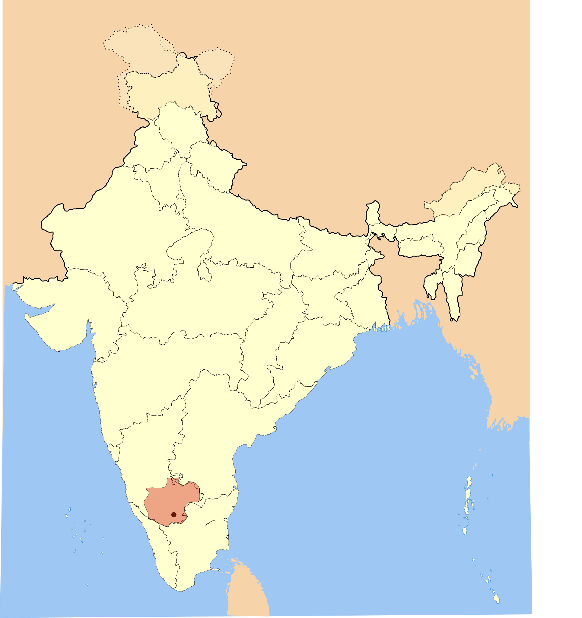
I used Image:India-locator-map-blank.svg as base and edited myself using inkspace and created it by looking at the following sources.
- Malini Adiga (2006), The Making of Southern Karnataka: Society, Polity and Culture in the early medieval period, AD 400-1030, Orient Longman, Chennai, , ISBN 81 250 2912 5 , p121
- Dr. Suryanath U. Kamath, A Concise history of Karnataka from pre-historic times to the present, Jupiter books, MCC, 2001 (Reprinted 2002) (page no - 329)
The Gangadomains map pertains to the "Western Ganga Dynasty" (Western Gangas). The double shaded region was under the control of their feudatories in 1st version. I deleted the double shade to avoid confusion and internalisation overhead in 2nd picture.
| 描述 | Western Ganga Empire Map |
| 日期 | |
| 來源 | 自己的作品 |
| 作者 | Mlpkr |
授權條款
[編輯]
我,本作品的著作權持有者,決定用以下授權條款發佈本作品:

|
已授權您依據自由軟體基金會發行的無固定段落、封面文字和封底文字GNU自由文件授權條款1.2版或任意後續版本,對本檔進行複製、傳播和/或修改。該協議的副本列在GNU自由文件授權條款中。 |
| 此檔案採用共享創意 姓名標示-相同方式分享 3.0 未在地化版本授權條款。 | ||
| ||
| 已新增授權條款標題至此檔案,作為GFDL授權更新的一部份。 |
您可以選擇您需要的授權條款。
檔案歷史
點選日期/時間以檢視該時間的檔案版本。
| 日期/時間 | 縮圖 | 尺寸 | 用戶 | 備註 | |
|---|---|---|---|---|---|
| 目前 | 2007年5月28日 (一) 00:40 | | 1,651 × 1,753(430 KB) | Mlpkr(對話 | 貢獻) | I used Image:India-locator-map-blank.svg as base and edited myself using inkspace and created it by looking at the following sources. * Malini Adiga (2006), The Making of Southern Karnataka: Society, Polity and Culture in the early medieval period, |
| 2007年5月28日 (一) 00:16 |  | 1,651 × 1,753(431 KB) | Mlpkr(對話 | 貢獻) | I used Image:India-locator-map-blank.svg as base and edited myself using inkspace and created it by looking at the following sources. * Malini Adiga (2006), The Making of Southern Karnataka: Society, Polity and Culture in the early medieval period, |
無法覆蓋此檔案。
檔案用途
下列頁面有用到此檔案:
全域檔案使用狀況
以下其他 wiki 使用了這個檔案:
- ar.wikipedia.org 的使用狀況
- azb.wikipedia.org 的使用狀況
- bn.wikipedia.org 的使用狀況
- ca.wikipedia.org 的使用狀況
- en.wikipedia.org 的使用狀況
- es.wikipedia.org 的使用狀況
- fa.wikipedia.org 的使用狀況
- fr.wikipedia.org 的使用狀況
- hi.wikipedia.org 的使用狀況
- hu.wikipedia.org 的使用狀況
- id.wikipedia.org 的使用狀況
- it.wikipedia.org 的使用狀況
- ka.wikipedia.org 的使用狀況
- kn.wikipedia.org 的使用狀況
- ko.wikipedia.org 的使用狀況
- lt.wikipedia.org 的使用狀況
- ml.wikipedia.org 的使用狀況
- ne.wikipedia.org 的使用狀況
- pnb.wikipedia.org 的使用狀況
- pt.wikipedia.org 的使用狀況
- ru.wikipedia.org 的使用狀況
- sh.wikipedia.org 的使用狀況
- ta.wikipedia.org 的使用狀況
- te.wikipedia.org 的使用狀況
- tr.wikipedia.org 的使用狀況
- uk.wikipedia.org 的使用狀況
- ur.wikipedia.org 的使用狀況
- www.wikidata.org 的使用狀況
- zh.wikipedia.org 的使用狀況