File:Whole world - land and oceans 12000.jpg
跳至導覽
跳至搜尋

預覽大小:800 × 400 像素。 其他解析度:320 × 160 像素 | 640 × 320 像素 | 1,024 × 512 像素 | 1,280 × 640 像素 | 2,560 × 1,280 像素 | 24,000 × 12,000 像素。
原始檔案 (24,000 × 12,000 像素,檔案大小:19.11 MB,MIME 類型:image/jpeg)
說明
說明
添加單行說明來描述出檔案所代表的內容
摘要
[編輯]| 警告 | 部分瀏覽器在瀏覽此圖片的完整大小時可能會遇到困難:該圖片中有數量巨大的像素點,可能無法完全載入或者導致您的瀏覽器停止回應。 |
|---|
| 描述 |
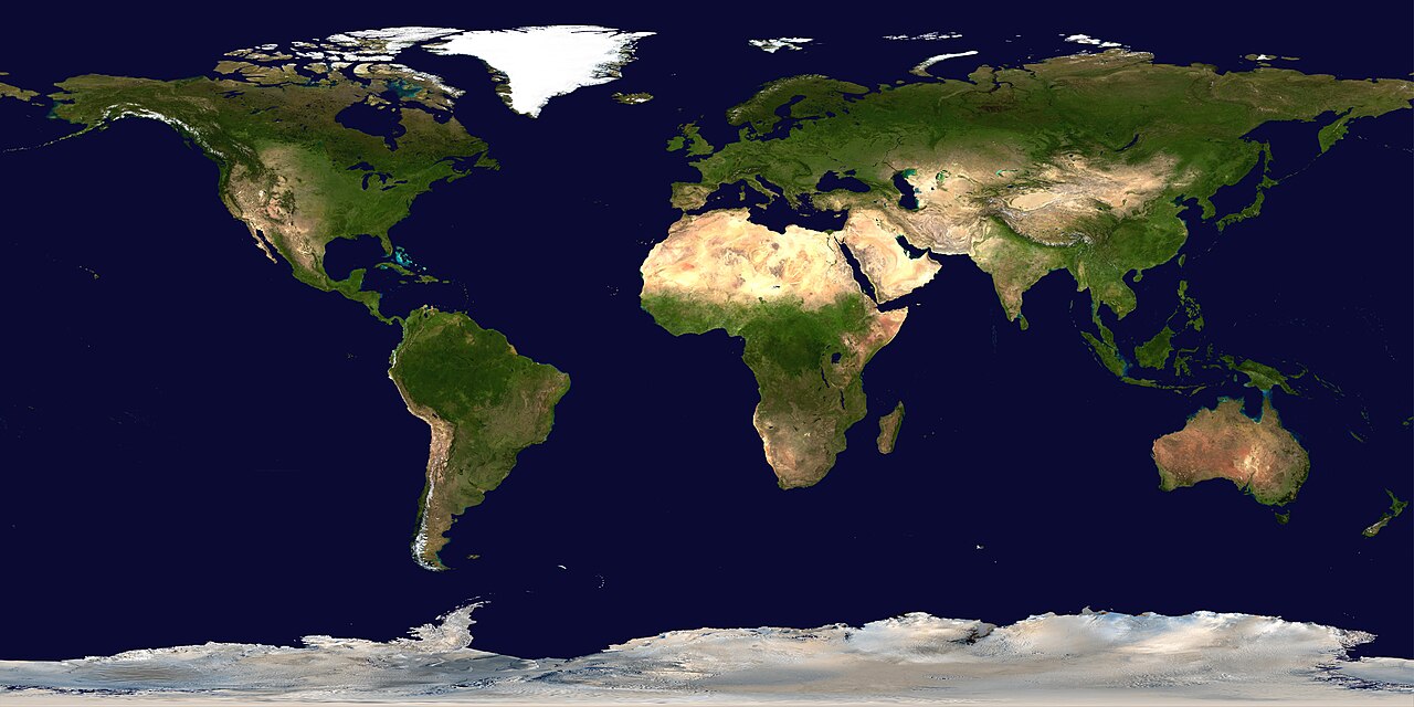
Deutsch: Satellitenbild der Erdoberoberfläche.
English: Satellite composition of the whole Earth's surface.
العربية: صور ساتليَّة مُجمَّعة لتُظهر سطح الأرض كاملًا. |
| 日期 | image released 11. Feb. 2002 |
| 來源 |
NASA - Visible Earth, images combined and scaled down by HighInBC (20 megabyte upload limit) |
| 作者 | NASA/Goddard Space Flight Center |
| 授權許可 (重用此檔案) |
Copyright information from http://visibleearth.nasa.gov/useterms.php - With the exception of images produced by the SeaWiFS, QuickBird, and IKONOS instruments all images on the Visible Earth are governed by NASA's Terms of Use below. [...] For all non-private uses, NASA's Terms Of Use are as follows: 1. The imagery is free of licensing fees 2. NASA requires that they be provided a credit as the owners of the imagery [...] |
| 其他版本 |
|


|

授權條款
[編輯]
| 本作品由NASA創作,屬於公有領域。根據NASA的版權政策:“NASA的創作除非另有聲明否則不受版權保護。”(參見:Template:PD-USGov/zh,NASA版權政策或JPL圖像使用政策) | ||
 |
警告:
|
檔案歷史
點選日期/時間以檢視該時間的檔案版本。
| 日期/時間 | 縮圖 | 尺寸 | 用戶 | 備註 | |
|---|---|---|---|---|---|
| 目前 | 2006年8月14日 (一) 19:58 | | 24,000 × 12,000(19.11 MB) | HInBC(對話 | 貢獻) | {{Information| |Description = Satellite composition of the whole Earth's surface. |Source = NASA - Visible Earth, images combined and scaled down by HighInBC (20 megabyte upload limit) * [http://visibleearth.nasa.gov/view_rec.php?vev1id= |
無法覆蓋此檔案。
檔案用途
下列27個頁面有用到此檔案:
- Atlas of the World/Geological
- Atlas of the world
- User:Lapost/Gallery
- User:Mo-Slimy
- Commons:Village pump/Archive/2006/11
- File:Blue Marble 2002.jpg
- File:Blue Marble 2002.png
- File:Caucasus WV banner.jpg
- File:Central Africa WV banner.jpg
- File:Central Asia WV banner.jpg
- File:Central Europe WV banner.jpg
- File:Cricetulus longicaudatus distribution.svg
- File:Distribution - Colias phicomone.png
- File:Distribution - Colias werdandi.png
- File:East Africa WV banner.jpg
- File:East Asia WV banner.jpg
- File:MODIS Map.jpg
- File:North Africa WV banner.jpg
- File:Sahel countries WV banner.jpg
- File:South Asia WV banner.jpg
- File:Southeast Asia WV banner.jpg
- File:Southeast Asia WV banner 2.jpg
- File:Southern Africa WV banner.jpg
- File:West Africa WV banner.jpg
- File:Whole world - land and oceans.jpg
- File:Whole world cropped.jpg (檔案重新導向)
- File:Wikivoyage satellite map for the Scandinavian peninsula.jpg
全域檔案使用狀況
以下其他 wiki 使用了這個檔案:
- als.wikipedia.org 的使用狀況
- arc.wikipedia.org 的使用狀況
- ar.wikipedia.org 的使用狀況
- مستخدم:ديفيد/صور ساهمت في جعلها مختارة
- ويكيبيديا:ترشيحات الصور المختارة/صورة لقارات العالم بالقمر الصناعي
- ويكيبيديا:صورة اليوم المختارة/يوليو 2015
- قالب:صورة اليوم المختارة/2015-07-26
- ويكيبيديا:صورة اليوم المختارة/أكتوبر 2016
- قالب:صورة اليوم المختارة/2016-10-03
- ويكيبيديا:صورة اليوم المختارة/يوليو 2018
- قالب:صورة اليوم المختارة/2018-07-22
- ويكيبيديا:صورة اليوم المختارة/سبتمبر 2022
- قالب:صورة اليوم المختارة/2022-09-10
- ويكيبيديا:ترشيحات الصور المختارة/سحب/الرخام الأزرق
- arz.wikipedia.org 的使用狀況
- ast.wikipedia.org 的使用狀況
- bg.wikipedia.org 的使用狀況
- bi.wikipedia.org 的使用狀況
- bpy.wikipedia.org 的使用狀況
- br.wikipedia.org 的使用狀況
- ca.wikipedia.org 的使用狀況
- ca.wikibooks.org 的使用狀況
- ceb.wikipedia.org 的使用狀況
- co.wikipedia.org 的使用狀況
- cs.wikipedia.org 的使用狀況
- de.wikipedia.org 的使用狀況
- de.wikinews.org 的使用狀況
- de.wiktionary.org 的使用狀況
檢視此檔案的更多全域使用狀況。