File:Woleai old map.png
跳至導覽
跳至搜尋

預覽大小:800 × 562 像素。 其他解析度:320 × 225 像素 | 640 × 450 像素 | 1,024 × 719 像素 | 1,200 × 843 像素。
原始檔案 (1,200 × 843 像素,檔案大小:22 KB,MIME 類型:image/png)
說明
說明
添加單行說明來描述出檔案所代表的內容
摘要
[編輯]
| 描述 |
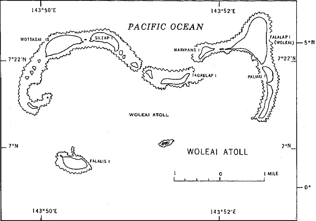
English: 1970 census of the (former) Trust Territory of the Pacific Islands (now Federated States of Micronesia, Palua, and Marshall Islands)
with several maps, including a map of Woleai Atoll, eastern Yap State |
| 日期 | |
| 來源 | http://www2.census.gov/prod2/decennial/documents/00496492v1p54-58ch5.pdf, page 8 |
| 作者 | U.S. Bureau of the Census |
授權條款
[編輯]
This image or file is a work of a United States Census Bureau employee, taken or made as part of that person's official duties. As a work of the U.S. federal government, the image is in the public domain.
|
 |
檔案歷史
點選日期/時間以檢視該時間的檔案版本。
| 日期/時間 | 縮圖 | 尺寸 | 使用者 | 備註 | |
|---|---|---|---|---|---|
| 目前 | 2010年1月10日 (日) 16:50 | | 1,200 × 843(22 KB) | Ratzer(留言 | 貢獻) | {{Information |Description={{en|1=1970 census of the (former) Trust Territory of the Pacific Islands (now Federated States of Micronesia, Palua, and Marshall Islands) with several maps, including a map of Woleai Atoll, eastern Yap State}} |Source=http://w |
無法覆蓋此檔案。
檔案用途
沒有使用此檔案的頁面。
全域檔案使用狀況
以下其他 wiki 使用了這個檔案: