File:WorldMap.svg
跳至導覽
跳至搜尋

此 SVG 檔案的 PNG 預覽的大小:800 × 405 像素。 其他解析度:320 × 162 像素 | 640 × 324 像素 | 1,024 × 519 像素 | 1,280 × 648 像素 | 2,560 × 1,297 像素 | 2,760 × 1,398 像素。
原始檔案 (SVG 檔案,表面大小:2,760 × 1,398 像素,檔案大小:729 KB)
說明
說明
添加單行說明來描述出檔案所代表的內容
摘要
[編輯]
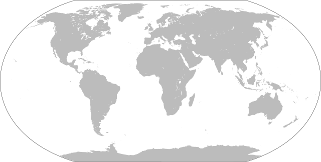
| 描述 | Blank world map |
| 日期 | |
| 來源 | 我個人以下列物件為基礎來創作: LocationWorld.png 由 David Kernow |
| 作者 |
原作者: 向量: |
| SVG開發 |
授權條款
[編輯]
|
|
 |
檔案歷史
點選日期/時間以檢視該時間的檔案版本。
| 日期/時間 | 縮圖 | 尺寸 | 用戶 | 備註 | |
|---|---|---|---|---|---|
| 目前 | 2022年1月26日 (三) 16:43 | | 2,760 × 1,398(729 KB) | Scratchinghead(對話 | 貢獻) | Islands disconnected-again |
| 2022年1月26日 (三) 16:26 |  | 2,760 × 1,398(236 KB) | Belbury(對話 | 貢獻) | Reverted to version as of 08:52, 12 September 2012 (UTC) also erased the sea and the map's border | |
| 2022年1月26日 (三) 16:22 |  | 5,365 × 2,796(714 KB) | Scratchinghead(對話 | 貢獻) | Some islands were connected to the mainland, changed that | |
| 2012年9月12日 (三) 08:52 |  | 2,760 × 1,398(236 KB) | Palosirkka(對話 | 貢獻) | Scrubbed with http://codedread.com/scour/ | |
| 2009年1月1日 (四) 14:51 |  | 2,760 × 1,398(508 KB) | CodeOne(對話 | 貢獻) | == Summary == This is a recreated version of Image:LocationWorld.png using vector graphics. Original description: Large plain-grey map of world created by adapting Image:LocationSouthAmerica.png. Previous image uploaded by User:UserLogin no |
無法覆蓋此檔案。
檔案用途
超過 100 個頁面有用到此檔案。 下列清單只列出前 100 筆有用到此檔案的頁面。 您也可以檢視完整清單。
- File:Abkhazia in Europe (relief).svg
- File:Abkhazia in Europe (relief) (-mini map).svg
- File:Akrotiri and Dhekelia in Europe (relief).svg
- File:Akrotiri and Dhekelia in Europe (relief) (-mini map).svg
- File:Aland in Europe (relief).svg
- File:Aland in Europe (relief) (-mini map).svg
- File:Albania in Europe (relief).svg
- File:Albania in Europe (relief) (-mini map).svg
- File:Andorra in Europe (relief).svg
- File:Andorra in Europe (relief) (-mini map).svg
- File:Andorra in Europe (relief) (special marker).svg
- File:Andorra in Europe (relief) (special marker) (-mini map).svg
- File:Armenia in Europe (relief).svg
- File:Armenia in Europe (relief) (-mini map).svg
- File:Artsakh in Europe (relief).svg
- File:Austria in Europe (relief).svg
- File:Austria in Europe (relief) (-mini map).svg
- File:Azerbaijan in Europe (relief).svg
- File:Azerbaijan in Europe (relief) (-mini map).svg
- File:BLANK in Europe (relief).svg
- File:BLANK in Europe (relief) (-mini map).svg
- File:Belarus in Europe (relief).svg
- File:Belarus in Europe (relief) (-mini map).svg
- File:Belgium in Europe (relief).svg
- File:Belgium in Europe (relief) (-mini map).svg
- File:BlankMap-World-large-noborders-no-Antarctica.png
- File:BlankMap-World-large-noborders.png
- File:Bosnia and Herzegovina in Europe (relief).svg
- File:Bosnia and Herzegovina in Europe (relief) (-mini map).svg
- File:Bulgaria in Europe (relief).svg
- File:Bulgaria in Europe (relief) (-mini map).svg
- File:Croatia in Europe (relief).svg
- File:Croatia in Europe (relief) (-mini map).svg
- File:Cyprus in Europe (relief).svg
- File:Cyprus in Europe (relief) (-mini map).svg
- File:Cyprus in Europe (relief) (de-facto).svg
- File:Cyprus in Europe (relief) (de-facto) (-mini map).svg
- File:Cyprus in Europe (relief) (de-facto) (special marker).svg
- File:Cyprus in Europe (relief) (de-facto) (special marker) (-mini map).svg
- File:Czech Republic in Europe (relief).svg
- File:Denmark in Europe (relief).svg
- File:Estonia in Europe (relief).svg
- File:European Union in Europe (relief).svg
- File:Faroe Islands in Europe (relief).svg
- File:Finland in Europe (relief).svg
- File:France in Europe (Blue Marble).svg
- File:France in Europe (natural).svg
- File:France in Europe (relief).svg
- File:Georgia in Europe (relief).svg
- File:Georgia in Europe (relief) (de-facto).svg
- File:Germany in Europe (relief).svg
- File:Gibraltar in Europe (relief).svg
- File:Greece in Europe (relief).svg
- File:Guernsey in Europe (relief).svg
- File:Hungary in Europe (relief).svg
- File:Iceland in Europe (relief).svg
- File:Ireland in Europe (relief).svg
- File:Isle of Man in Europe (relief).svg
- File:Italy in Europe (relief).svg
- File:Jersey in Europe (relief).svg
- File:Kazakhstan in Europe (relief).svg
- File:Kingdom of Denmark in Europe (relief).svg
- File:Kosovo in Europe (relief) (de-facto).svg
- File:Latvia in Europe (relief).svg
- File:Liechtenstein in Europe (relief).svg
- File:Liechtenstein in Europe (relief) (special marker).svg
- File:Lithuania in Europe (relief).svg
- File:LocationWorld.png
- File:Luxembourg in Europe (relief).svg
- File:Luxembourg in Europe (relief) (special marker).svg
- File:Macedonia in Europe (relief).svg
- File:Malta in Europe (relief).svg
- File:Moldova in Europe (relief).svg
- File:Monaco in Europe (relief).svg
- File:Monaco in Europe (relief) (special marker).svg
- File:Montenegro in Europe (relief).svg
- File:Netherlands in Europe (relief).svg
- File:Northern Cyprus in Europe (relief).svg
- File:Northern Cyprus in Europe (relief) (special marker).svg
- File:Norway in Europe (relief).svg
- File:Poland in Europe (relief).svg
- File:Portugal in Europe (relief).svg
- File:Romania in Europe (relief).svg
- File:Russia in Europe (relief).svg
- File:San Marino in Europe (relief).svg
- File:San Marino in Europe (relief) (special marker).svg
- File:Serbia in Europe (relief).svg
- File:Serbia in Europe (relief) (de-facto).svg
- File:Slovakia in Europe (relief).svg
- File:Slovenia in Europe (relief).svg
- File:South Ossetia in Europe (relief).svg
- File:Spain in Europe (relief).svg
- File:Sweden in Europe (relief).svg
- File:Switzerland in Europe (relief).svg
- File:Transnistria in Europe (relief).svg
- File:Turkey in Europe (relief).svg
- File:Ukraine in Europe (relief).svg
- File:United Kingdom in Europe (relief).svg
- File:United Kingdom in Europe (relief) (wo crown dependencies).svg
- File:Vatican City in Europe (relief).svg
.svg)
_(-mini_map).svg)
.svg)
_(-mini_map).svg)
.svg)
_(-mini_map).svg)
.svg)
_(-mini_map).svg)
.svg)
_(-mini_map).svg)
_(special_marker).svg)
_(special_marker)_(-mini_map).svg)
.svg)
_(-mini_map).svg)
.svg)
.svg)
_(-mini_map).svg)
.svg)
_(-mini_map).svg)
.svg)
_(-mini_map).svg)
.svg)
_(-mini_map).svg)
.svg)
_(-mini_map).svg)
.svg)
_(-mini_map).svg)
.svg)
_(-mini_map).svg)
.svg)
_(-mini_map).svg)
.svg)
_(-mini_map).svg)
_(de-facto).svg)
_(de-facto)_(-mini_map).svg)
_(de-facto)_(special_marker).svg)
_(de-facto)_(special_marker)_(-mini_map).svg)
.svg)
.svg)
.svg)
.svg)
.svg)
.svg)
.svg)
.svg)
.svg)
.svg)
_(de-facto).svg)
.svg)
.svg)
.svg)
.svg)
.svg)
.svg)
.svg)
.svg)
.svg)
.svg)
.svg)
.svg)
_(de-facto).svg)
.svg)
.svg)
_(special_marker).svg)
.svg)
.svg)
_(special_marker).svg)
.svg)
.svg)
.svg)
.svg)
_(special_marker).svg)
.svg)
.svg)
.svg)
_(special_marker).svg)
.svg)
.svg)
.svg)
.svg)
.svg)
.svg)
_(special_marker).svg)
.svg)
_(de-facto).svg)
.svg)
.svg)
.svg)
.svg)
.svg)
.svg)
.svg)
.svg)
.svg)
.svg)
_(wo_crown_dependencies).svg)
.svg)
檢視連結到這個檔案的更多連結。
全域檔案使用狀況
以下其他 wiki 使用了這個檔案:
- bn.wikibooks.org 的使用狀況
- da.wikipedia.org 的使用狀況
- en.wikipedia.org 的使用狀況
- en.wikibooks.org 的使用狀況
- es.wikipedia.org 的使用狀況
- fa.wikipedia.org 的使用狀況
- fr.wikipedia.org 的使用狀況
- he.wikipedia.org 的使用狀況
- hu.wiktionary.org 的使用狀況
- Central Europe
- Eastern Europe
- Southern Europe
- Northern Europe
- Antarctica
- North America
- South America
- Asia
- Indian Ocean
- Central America
- Micronesia
- Pacific Ocean
- Earth
- Caribbean
- Americas
- Arctic Ocean
- Central Africa
- Southern Ocean
- East Asia
- West Africa
- North Africa
- Western Europe
- West Asia
- Sablon:Earth Labelled Map
- South Asia
- Australasia
- Northern America
- East Africa
- Horn of Africa
- Southwest Asia
- Central Asia
檢視此檔案的更多全域使用狀況。