File:Xizang prfc map.png
跳至導覽
跳至搜尋
無更高解析度可提供。
Xizang_prfc_map.png (721 × 404 像素,檔案大小:63 KB,MIME 類型:image/png)
說明
說明
添加單行說明來描述出檔案所代表的內容
檔案歷史
點選日期/時間以檢視該時間的檔案版本。
| 日期/時間 | 縮圖 | 尺寸 | 用戶 | 備註 | |
|---|---|---|---|---|---|
| 目前 | 2018年12月1日 (六) 08:56 | | 721 × 404(63 KB) | 希望探险家(對話 | 貢獻) | Correct the border line of Ngari Prefecture and Nagqu city. |
| 2018年4月14日 (六) 08:26 |  | 721 × 404(45 KB) | ASDFGH(對話 | 貢獻) | update | |
| 2018年4月14日 (六) 03:16 |  | 721 × 404(44 KB) | ASDFGH(對話 | 貢獻) | update | |
| 2010年3月14日 (日) 23:30 |  | 721 × 404(72 KB) | Maggern87(對話 | 貢獻) | Added more disputes in the west | |
| 2010年2月18日 (四) 17:20 |  | 721 × 404(71 KB) | Maggern87(對話 | 貢獻) | Added disputed area in west | |
| 2010年2月8日 (一) 08:12 |  | 746 × 405(69 KB) | Maggern87(對話 | 貢獻) | Fixed disputes (mostly in Nyingchi prefecture) | |
| 2009年12月23日 (三) 02:42 |  | 921 × 500(54 KB) | ASDFGHJ(對話 | 貢獻) | Fix disputes | |
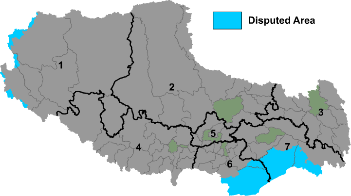
| 2009年12月1日 (二) 00:01 |  | 921 × 500(86 KB) | Maggern~commonswiki(對話 | 貢獻) | {{Information |Description={{en|1=Map of prefectures of Xizang Autonomous Region (Tibet)}} |Source={{own}} |Author=Maggern |Date= |Permission= |other_versions= }} |
無法覆蓋此檔案。
檔案用途
沒有使用此檔案的頁面。
全域檔案使用狀況
以下其他 wiki 使用了這個檔案:
- be-tarask.wikipedia.org 的使用狀況
- bn.wikipedia.org 的使用狀況
- bo.wikipedia.org 的使用狀況
- cs.wikipedia.org 的使用狀況
- da.wikipedia.org 的使用狀況
- en.wikipedia.org 的使用狀況
- es.wikipedia.org 的使用狀況
- fa.wikipedia.org 的使用狀況
- fi.wikipedia.org 的使用狀況
- fr.wikipedia.org 的使用狀況
- hr.wikipedia.org 的使用狀況
- incubator.wikimedia.org 的使用狀況
- it.wikipedia.org 的使用狀況
- ja.wikipedia.org 的使用狀況
- ms.wikipedia.org 的使用狀況
檢視此檔案的更多全域使用狀況。