File:Zealandia, topographic map.jpg
Aller à la navigation
Aller à la recherche

Taille de cet aperçu : 529 × 600 pixels. Autres résolutions : 212 × 240 pixels | 423 × 480 pixels | 678 × 768 pixels | 903 × 1 024 pixels | 1 500 × 1 700 pixels.
Fichier d’origine (1 500 × 1 700 pixels, taille du fichier : 4,57 Mio, type MIME : image/jpeg)
Légendes
Légendes
Ajoutez en une ligne la description de ce que représente ce fichier
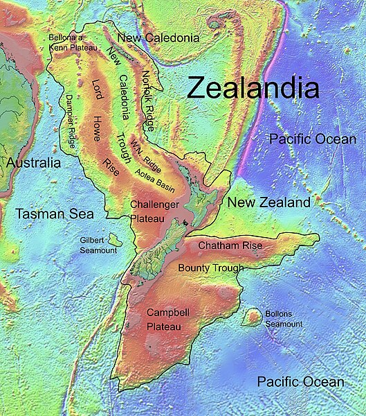
Topographic map of Zealandia
Description[modifier]
| Description |
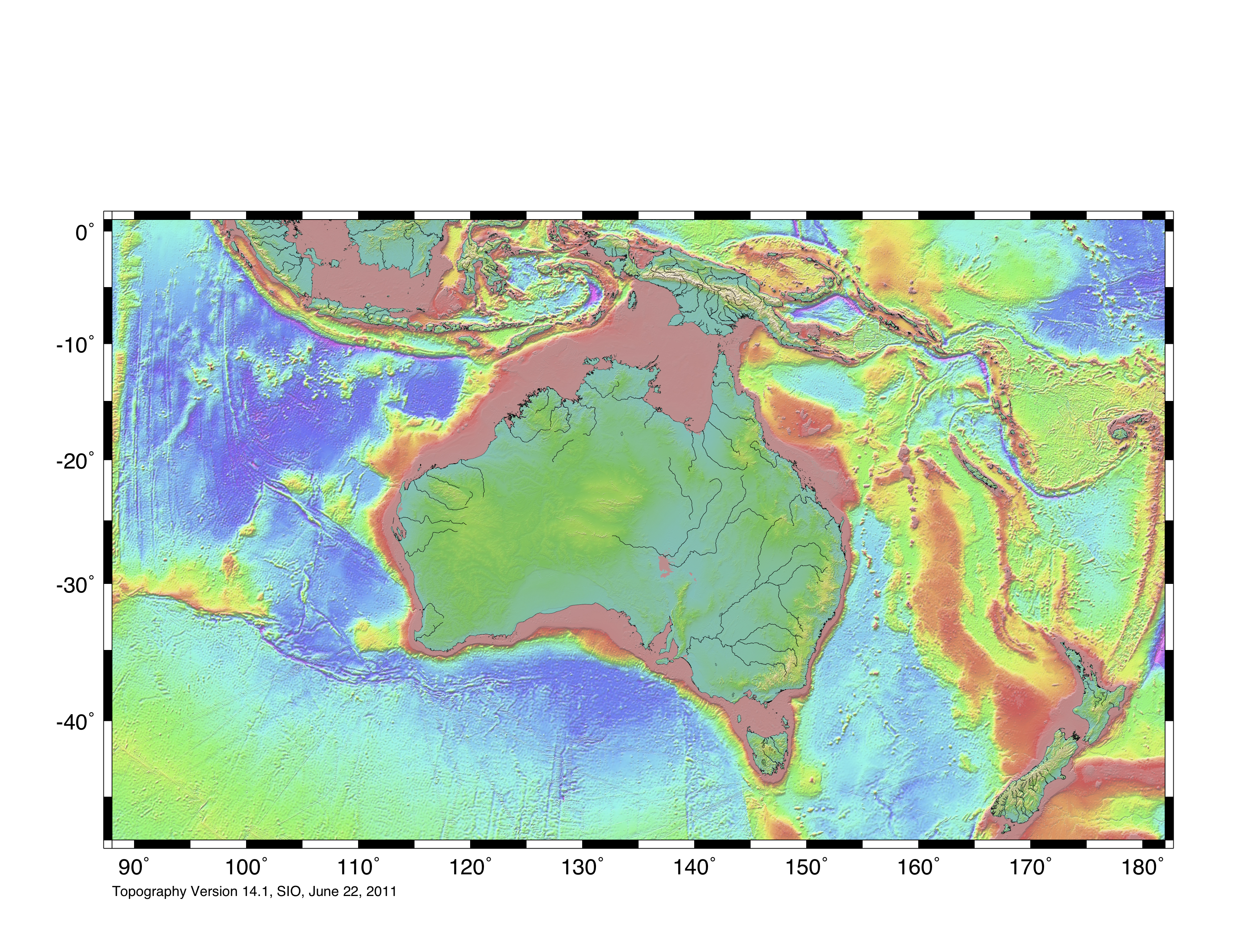
Deutsch: Die topografische Karte von Zealandia basiert auf den Bathymetrie-Daten des Scripps Institution of Oceanography, University of California, San Diego.
Die Umrandung zw. Grenzziehung basiert auf Informationen des Buches: Nick Mortimer; Hamish Campbell (2014) Zealandia - Our Continent Revealed, Londres : Penguin Books, p. 54 ISBN : 978-0-143-57156-8. English: Topographic map of Zealandia, based on bathymetry data from Scripps Institution of Oceanography, University of California, San Diego.
Boundary is based on information which was given in: Nick Mortimer; Hamish Campbell (2014) Zealandia - Our Continent Revealed, Londres : Penguin Books, p. 54 ISBN : 978-0-143-57156-8. Français : Carte topographique du continent de Zealandia, basée sur des données bathymétriques du Scripps Institution of Oceanography, Université de Californie, San Diego, États-Unis. La limite du continent est tirée d'informations venant de : « Nick Mortimer; Hamish Campbell (2014) Zealandia - Our Continent Revealed, Londres : Penguin Books, p. 54 ISBN : 978-0-143-57156-8. ». |
| Date | |
| Source | http://topex.ucsd.edu/WWW_html/mar_topo.html; http://topex.ucsd.edu/marine_topo/jpg_images/topo10.jpg; http://topex.ucsd.edu/marine_topo/jpg_images/topo11.jpg; http://topex.ucsd.edu/marine_topo/jpg_images/topo14.jpg; http://topex.ucsd.edu/marine_topo/jpg_images/topo15.jpg |
| Auteur | Ulrich Lange, Bochum, Germany |
| Autres versions |
 |
There is no copyright on published bathmetry data, (free use)
Conditions d’utilisation[modifier]
Moi, en tant que détenteur des droits d’auteur sur cette œuvre, je la publie sous la licence suivante :
| Ce fichier est disponible selon les termes de la licence Creative Commons CC0 Don universel au domaine public. | |
| La personne qui a associé une œuvre avec cet acte l’a placée dans le domaine public en renonçant mondialement à tous ses droits sur cette œuvre en vertu des lois relatives au droit d’auteur, ainsi qu’à tous les droits juridiques connexes et voisins qu’elle possédait sur l’œuvre, sans autre limite que celles imposées par la loi. Vous pouvez copier, modifier, distribuer et utiliser cette œuvre, y compris à des fins commerciales, sans qu’il soit nécessaire d’en demander la permission.
|
Historique du fichier
Cliquer sur une date et heure pour voir le fichier tel qu'il était à ce moment-là.
| Date et heure | Vignette | Dimensions | Utilisateur | Commentaire | |
|---|---|---|---|---|---|
| actuel | 9 février 2019 à 16:55 | | 1 500 × 1 700 (4,57 Mio) | Ulanwp (d | contributions) | spelling of Bollons Seamount corrected |
| 21 mars 2017 à 20:43 |  | 1 500 × 1 700 (4,57 Mio) | Ulanwp (d | contributions) | Geographical Names inserted | |
| 20 mars 2017 à 19:59 |  | 1 500 × 1 700 (4,44 Mio) | Ulanwp (d | contributions) | {{Information |Description ={{en|1=Topographic map of Zealandia, based on bathmetry data from Scripps Institution of Oceanography, University of California, San Diego}} |Source =http://topex.ucsd.edu/WWW_html/mar_topo.html |Author =U... |
Vous ne pouvez pas remplacer ce fichier.
Utilisations locales du fichier
Les 5 pages suivantes utilisent ce fichier :
Utilisations du fichier sur d’autres wikis
Les autres wikis suivants utilisent ce fichier :
- Utilisation sur ar.wikipedia.org
- Utilisation sur ast.wikipedia.org
- Utilisation sur bg.wikipedia.org
- Utilisation sur ca.wikipedia.org
- Utilisation sur ceb.wikipedia.org
- Utilisation sur de.wikipedia.org
- Lord Howe Rise
- Zealandia
- Gisborne-Erdbeben von 2007
- Geologie Neuseelands
- Geographie Neuseelands
- Chatham Rise
- Campbell Plateau
- Bounty Trough
- Norfolk Ridge
- New Caledonia Trough
- Challenger Plateau
- Geologie der Antarktischen Halbinsel
- Geologie Ostantarktikas
- Vulkanische Provinzen der Antarktischen Halbinsel
- Utilisation sur en.wikipedia.org
- Chatham Rise
- Lord Howe Rise
- South Tasman Rise
- Campbell Plateau
- Meiolania
- Challenger Plateau
- Norfolk Ridge
- Lord Howe Seamount Chain
- Continent
- Submerged continent
- East Tasman Plateau
- Bollons Seamount
- Bounty Trough
- Tasmantid Seamount Chain
- Tasmantid hotspot
- Joseph Gilbert Seamount
- Gascoyne Seamount
- Geology of New Caledonia
- Taupo Bank
- Derwent Hunter Guyot
- Britannia Guyots
- Queensland Guyot
- Geology of Zealandia
- Three Kings Ridge
- Utilisation sur es.wikipedia.org
- Utilisation sur eu.wikipedia.org
- Utilisation sur fr.wikipedia.org
Voir davantage sur l’utilisation globale de ce fichier.