File:Zone Bizerte Ferryville 1955.jpg
Salta a la navegació
Salta a la cerca

Mida d'aquesta previsualització: 800 × 580 píxels. Altres resolucions: 320 × 232 píxels | 640 × 464 píxels | 1.024 × 742 píxels | 1.200 × 870 píxels.
Fitxer original (1.200 × 870 píxels, mida del fitxer: 192 Ko, tipus MIME: image/jpeg)
Llegendes
Llegendes
Afegeix una explicació d'una línia del que representa aquest fitxer
Resum
[modifica]
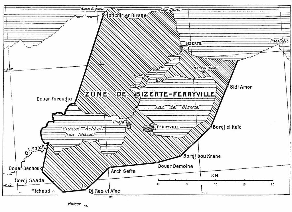
La zone de sécurité de Bizerte. Plan annexé à la convention du 3 juin 1955
Collection personnelle Bertrand Bouret http://profburp.com

|
File:Zone Bizerte Ferryville 1955-vect.svg és una versió vectorial (SVG) d'aquest fitxer. En cas de ser millor, hauria de ser emprada en lloc d'aquesta imatge tramada.
File:Zone Bizerte Ferryville 1955.jpg → File:Zone Bizerte Ferryville 1955-vect.svg
Per a més informació pel que fa als gràfics vectorials, llegiu la transició a SVG en Commons. També hi ha informació quant a la compatibilitat del MediaWiki amb les imatges SVG. |
 |
Llicència
[modifica]
This work was first published in Tunisia and is now in the public domain because its copyright protection has expired by virtue of the Law No. 94-36 of February 24, 1994, on Literary and Artistic Property, enacted 1994, amended 2009 (more details). The work meets one of the following criteria:
|
 |
derivative works
[modifica]
Derivative works of this file: Zone Bizerte Ferryville 1955-vect.svg
Historial del fitxer
Cliqueu una data/hora per veure el fitxer tal com era aleshores.
| Data/hora | Miniatura | Dimensions | Usuari/a | Comentari | |
|---|---|---|---|---|---|
| actual | 16:25, 8 juny 2007 | | 1.200 × 870 (192 Ko) | Profburp (discussió | contribucions) | == Description == La zone de sécurité de Bizerte. Plan annexé à la convention du 3 juin 1955 Collection personnelle Bertrand Bouret http://profburp.com == Licensing == {{PD-Tunisia}} Category:Historical maps of Tunisia Category:Bizerte |
No podeu sobreescriure aquest fitxer.
Ús del fitxer
La pàgina següent utilitza aquest fitxer:
Ús global del fitxer
Utilització d'aquest fitxer en altres wikis:
- Utilització a ru.wikipedia.org