File:(Vercelli) Italian Alps and plains (41587684585) (cropped).jpg

File originale (905 × 910 pixel, dimensione del file: 150 KB, tipo MIME: image/jpeg)
Didascalie
Didascalie
Dettagli[modifica]
| Descrizione |
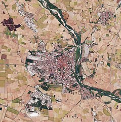
The Copernicus Sentinel-2B satellite takes us over the Italian Alps and down to the low plains that surround the city of Milan. The image captures the transition between the high snow-capped peaks of the Italian Alps and the flatlands of the northwest Po Valley. This transition cuts a sharp diagonal across the image, with the mountains in the top left triangle and the flat low-lying land in the bottom right. The southern part of the beautiful Lake Maggiore can also be seen in the image. Although its northern end crosses into Switzerland, Lake Maggiore is Italy’s longest lake and its character changes accordingly. The upper end is completely alpine in nature and the water is cool and clear, the middle region is milder lying between gentle hills and Mediterranean flora, and the lower end advances to the verge of the plain of Lombardy. The River Ticino, which rises in Switzerland and flows through Lake Maggiore, can be seen emerging from the lake’s southern tip. Here, the land, which is one of the most fertile regions in Italy, gives way to numerous agricultural fields, which are clearly visible to the west of the river. The city of Milan lies to the east of the river. In May 2019, Milan will host ESA’s Living Planet Symposium. Held every three years, these symposia draw thousands of scientists and data users from around the world to discuss their latest findings on the environment and climate. This image, which was captured on 9 October 2017, is also featured on the <a href="https://www.youtube.com/watch?v=4wVTwqMMOFc&lc=Ugyt_DqcyEzmpEDRNP14AaABAg" rel="noreferrer nofollow">Earth from Space video programme</a>. contains modified Copernicus Sentinel data (2017), processed by ESA, <a href="https://creativecommons.org/licenses/by-sa/3.0/igo/" rel="noreferrer nofollow">CC BY-SA 3.0 IGO</a> |
| Data | |
| Fonte | Italian Alps and plains |
| Autore | European Space Agency |
| Altre versioni |

_Italian_Alps_and_plains_(41587684585)_(cropped).jpg&action=edit§ion=1)
| Luogo dello scatto | | Posizione di questa e altre immagini su: OpenStreetMap |
|---|
_Italian_Alps_and_plains_(41587684585)_(cropped).jpg¶ms=045.851760_N_0008.849487_E_globe:Earth_type:camera_source:Flickr_&language=it)
Licenza[modifica]
_Italian_Alps_and_plains_(41587684585)_(cropped).jpg&action=edit§ion=2)
- Tu sei libero:
- di condividere – di copiare, distribuire e trasmettere quest'opera
- di modificare – di adattare l'opera
- Alle seguenti condizioni:
- attribuzione – Devi fornire i crediti appropriati, un collegamento alla licenza e indicare se sono state apportate modifiche. Puoi farlo in qualsiasi modo ragionevole, ma non in alcun modo che suggerisca che il licenziante approvi te o il tuo uso.
- condividi allo stesso modo – Se remixi, trasformi o sviluppi il materiale, devi distribuire i tuoi contributi in base alla stessa licenza o compatibile all'originale.
| Annotazioni | Questa immagine è annotata: Vedi le annotazioni su Commons |
_Italian_Alps_and_plains_(41587684585)_(cropped).jpg)
Cronologia del file
Fare clic su un gruppo data/ora per vedere il file come si presentava nel momento indicato.
| Data/Ora | Miniatura | Dimensioni | Utente | Commento | |
|---|---|---|---|---|---|
| attuale | 22:29, 1 mar 2020 | | 905 × 910 (150 KB) | Up and Go (discussione | contributi) | File:Italian Alps and plains (41587684585).jpg cropped 93 % horizontally, 89 % vertically using CropTool with lossless mode. |
.jpg)
Impossibile sovrascrivere questo file.
Utilizzo del file
Le seguenti 8 pagine usano questo file:
Utilizzo globale del file
Anche i seguenti wiki usano questo file:
- Usato nelle seguenti pagine di ca.wikipedia.org:
- Usato nelle seguenti pagine di eo.wikivoyage.org:
- Usato nelle seguenti pagine di gl.wikipedia.org:
- Usato nelle seguenti pagine di it.wikipedia.org:
- Usato nelle seguenti pagine di www.wikidata.org:
_Italian_Alps_and_plains_(41587684585)_(cropped).jpg&oldid=878767502)