File:1598 map of the Polar Regions by Willem Barentsz.jpg
Vai alla navigazione
Vai alla ricerca

Dimensioni di questa anteprima: 800 × 592 pixel. Altre risoluzioni: 320 × 237 pixel | 640 × 474 pixel | 1 024 × 758 pixel | 1 280 × 948 pixel | 2 560 × 1 896 pixel | 13 719 × 10 160 pixel.
File originale (13 719 × 10 160 pixel, dimensione del file: 30,66 MB, tipo MIME: image/jpeg)
Didascalie
Didascalie
Aggiungi una brevissima spiegazione di ciò che questo file rappresenta
1598 map of the Polar Regions by Willem Barentsz
Dettagli[modifica]
| Attenzione | Alcuni browser potrebbero avere dei problemi nel mostrare questa immagine a piena risoluzione: questa immagine è composta da un numero insolitamente alto di pixel e potrebbe non essere visualizzata correttamente o causare l'arresto del browser. |
|---|
| Descrizione |
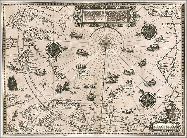
English: 1598 map of the Polar Regions by Willem Barentsz
Latina: Deliniatio cartae trium navigationum per Batavos, ad Septentrionalem plagam, Norvegiae, Moscoviae, et novae Semblae, et perque fretum Weygatis Nassovicum dictum, ac juxta Groenlandiam, sub altitudine 80. graduum nec non adiacentium partium Tartariae, promontorij Tabin, freti Anian atque regionis Bargi et partis Americae versus orientem, Authore Wilhelmo Bernardo Amstelredamo experissimo pilota.
Nederlands: Beschryvinghe vande drie seylagien door de Hollanders gedaen ande Noordt syde van Noorweghen, Moscovia, nova Sembla, ende door de Weygats ofte Strate de Nassou so mede het' deel van Groenlandt op de 80. graeden ende de omleggende grensen van Tartaryen, ende de Capo de Tabin ende des landtschaps Bargi, so oock het Oostersche deel van America: door Willem Barents van Amstelredam de vermaerde Piloot |
| Data | |
| Fonte | Barry Lawrence Rare Maps, from an original 1598 print. |
| Autore | Original charts by Willem Barentsz, map drawn by Cornelis Claesz ("Cornelius Nicolai"), engraved by Baptista van Doetecum ("Baptista a Doetechum") |
| Altre versioni |
|
.jpg)

_door_Willem_Barendsz_(titel_op_object),_NG-800.jpg)


Licenza[modifica]
|
Quest'opera è nel pubblico dominio anche in tutti i Paesi e nelle aree in cui la durata del copyright è la vita dell'autore più 70 anni o meno. Quest'opera è nel pubblico dominio negli Stati Uniti in quanto pubblicata (o registrata all'U.S. Copyright Office) prima del 1º gennaio 1929. | |
| Questo file è stato identificato come libero da restrizioni conosciute riguardanti le leggi sul copyright, compresi tutti i diritti connessi e vicini. | |
| Annotazioni | Questa immagine è annotata: Vedi le annotazioni su Commons |
Cronologia del file
Fare clic su un gruppo data/ora per vedere il file come si presentava nel momento indicato.
| Data/Ora | Miniatura | Dimensioni | Utente | Commento | |
|---|---|---|---|---|---|
| attuale | 18:42, 22 mar 2020 | | 13 719 × 10 160 (30,66 MB) | Balkanique (discussione | contributi) | Uploaded a work by Willem Barentsz from https://www.raremaps.com/gallery/detail/59238/deliniatio-cartae-trium-navigationum-per-batavos-ad-septent-barentsz with UploadWizard |
Impossibile sovrascrivere questo file.
Utilizzo del file
Le seguenti 9 pagine usano questo file:
- Arctic
- File:Barents third voyage.jpg
- File:Barentskartet, 1598 (12068020364).jpg
- File:Barentsz Full Map.jpg
- File:Barentsz arctic map.jpg
- File:Forminsket utgave av Barentskartet - no-nb krt 00487.jpg
- File:Kaart van de landen rond de poolcirkel met de drie reizen van de Nederlanders, 1598 Beschrijvinghe van de drie seylagien door de Hollanders gedaen ande Noordt syde van Noorweghen, Moscovia, nova Sembla, ende door het de, RP-P-OB-80.320.jpg
- File:Kaart van het Noordpoolgebied, 1598 Beschrijvinghe van de drie seylagien door de Hollanders gedaan (..) door Willem Barendsz (titel op object), NG-800.jpg
- File:Pontanus 1611 Arctic Map.jpg
Utilizzo globale del file
Anche i seguenti wiki usano questo file:
- Usato nelle seguenti pagine di ar.wikipedia.org:
- Usato nelle seguenti pagine di ast.wikipedia.org:
- Usato nelle seguenti pagine di ca.wikipedia.org:
- Usato nelle seguenti pagine di cs.wikipedia.org:
- Usato nelle seguenti pagine di da.wikipedia.org:
- Usato nelle seguenti pagine di de.wikipedia.org:
- Usato nelle seguenti pagine di en.wikipedia.org:
- Usato nelle seguenti pagine di es.wikipedia.org:
- Usato nelle seguenti pagine di fr.wikipedia.org:
- Usato nelle seguenti pagine di hy.wikipedia.org:
- Usato nelle seguenti pagine di is.wikipedia.org:
- Usato nelle seguenti pagine di it.wikipedia.org:
- Usato nelle seguenti pagine di ja.wikipedia.org:
- Usato nelle seguenti pagine di la.wikipedia.org:
- Usato nelle seguenti pagine di nl.wikipedia.org:
- Usato nelle seguenti pagine di no.wikipedia.org:
- Usato nelle seguenti pagine di pl.wikipedia.org:
- Usato nelle seguenti pagine di pt.wikipedia.org:
- Usato nelle seguenti pagine di sl.wikipedia.org:
- Usato nelle seguenti pagine di sr.wikipedia.org:
- Usato nelle seguenti pagine di uk.wikipedia.org:
- Usato nelle seguenti pagine di vi.wikipedia.org:
- Usato nelle seguenti pagine di zh.wikipedia.org:
Categorie:
- Third voyage of Willem Barentsz
- History of Dutch sea fisheries
- 1598 maps
- 1598 maps of Russia
- Historical maps of Spitsbergen
- Old maps of Scandinavia
- Maps of Novaya Zemlya
- Old maps of the Arctic
- Old maps of the White Sea
- Maps of the Barents Sea
- Maps of the Greenland Sea
- Old maps of the Arctic Ocean
- Old maps of Svalbard
- 1590s maps of Norway
- 1590s maps of Sweden
- 1590s maps of Denmark
- 1590s maps of Iceland
- 1590s maps of Greenland
- 1590s maps of Scotland
- Magnetic pole
- Strait of Anian
- Davis Strait
- Frobisher Bay
- Terra incognita
- Phantom islands
- Latin-language maps
- Dutch-language maps
- Animals on maps
- Whales on maps
- Monsters on maps
- Seals in art
- Maps of the Kara Sea
- Maps of the Beaufort Sea
- Maps of Baffin Bay
- Maps of the East Siberian Sea
- Maps of the Laptev Sea
- Maps of the Chukchi Sea
- 1590s maps of Finland
- Baptista van Doetecum
- Cornelis Claesz
- Maps of voyages
- Maps of the North Pole
- Reindeer sleds in art
- Northern Sea Route
- 16th-century maps of the Arctic