File:Aerial view of Crenshaw Boulevard, Los Angeles County, California.jpg
לקובץ המקורי (4,000 × 3,000 פיקסלים, גודל הקובץ: 4.17 מ"ב, סוג MIME: image/jpeg)
כיתובים
כיתובים
תקציר
[עריכה]
| תיאור |
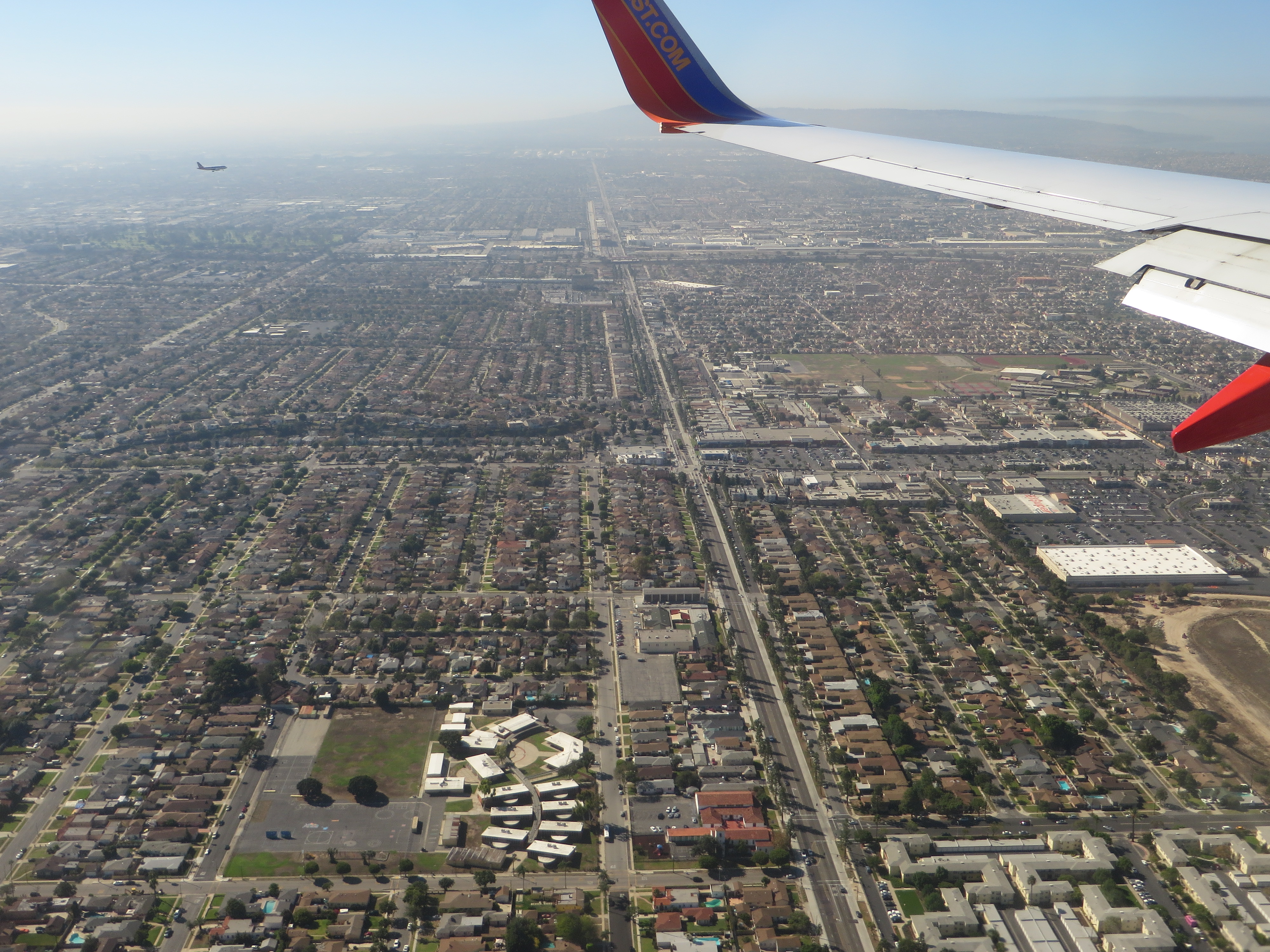
Crenshaw Boulevard is a major thoroughfare street in Los Angeles, California that runs through, and outside, the Crenshaw district. The street starts at Wilshire Boulevard in Hancock Park and runs through several demographically diverse areas to end in Rolling Hills. Tracks for the No. 5 Los Angeles Railway "yellow" streetcars in the 1920s through 1950s ran in the median between Leimert Boulevard on the north to near Florence Ave on the south. Since the abandonment of the streetcars, the former railway median has been narrowed, the driving lanes improved and the street reconfigured. Many local residents were disappointed to see 71 mature trees chopped down to make way for the Space Shuttle Endeavour to be moved from LAX to the California Science Center. Additional trees were to be removed for the under construction Crenshaw/LAX Line, but various officials have promised an aesthetically cohesive boulevard with more trees being planted than were removed. The name "Crenshaw" has become associated with African-American culture because it traverses as a large black community. Crenshaw Boulevard has been mentioned in hip hop songs by artists such as Eminem, Eazy-E, Nas, 2Pac, Montell Jordan, DJ Quik, Raekwon from the Wu-Tang Clan, Skee-Lo, Dr. Dre, The Game, Nipsey Hussle, Dom Kennedy, MC Allergy, and The Pharcyde. The street was named in 1904 after banker and real estate developer George Lafayette Crenshaw. The street also has a history of Sunday night "gatherings", where a large number of cars would meet up. However, due to a police crackdown, this tradition has now declined. en.wikipedia.org/wiki/Crenshaw_Boulevard en.wikipedia.org/wiki/Wikipedia:Text_of_Creative_Commons_... |
| תאריך יצירה | |
| מקור | Crenshaw Boulevard, Inglewood, California |
| יוצר | Ken Lund from Reno, Nevada, USA |
| מיקום המצלמה | | תמונה זו ותמונות נוספות במיקום: OpenStreetMap |
|---|
רישיון
[עריכה]
- הנכם רשאים:
- לשתף – להעתיק, להפיץ ולהעביר את העבודה
- לערבב בין עבודות – להתאים את העבודה
- תחת התנאים הבאים:
- ייחוס – יש לתת ייחוס הולם, לתת קישור לרישיון, ולציין אם נעשו שינויים. אפשר לעשות את זה בכל צורה סבירה, אבל לא בשום צורה שמשתמע ממנה שמעניק הרישיון תומך בך או בשימוש שלך.
- שיתוף זהה – אם תיצרו רמיקס, תשנו, או תבנו על החומר, חובה עליכם להפיץ את התרומות שלך לפי תנאי רישיון זהה או תואם למקור.
| This image was originally posted to Flickr by Ken Lund at https://flickr.com/photos/75683070@N00/21399133140. It was reviewed on 27 בדצמבר 2015 by FlickreviewR and was confirmed to be licensed under the terms of the cc-by-sa-2.0. |
היסטוריית הקובץ
ניתן ללחוץ על תאריך/שעה כדי לראות את הקובץ כפי שנראה באותו זמן.
| תאריך/שעה | תמונה ממוזערת | ממדים | משתמש | הערה | |
|---|---|---|---|---|---|
| נוכחית | 22:59, 27 בדצמבר 2015 | | 3,000 × 4,000 (4.17 מ"ב) | Kingofthedead (שיחה | תרומות) | Transferred from Flickr via Flickr2Commons |
אין באפשרותך לדרוס את הקובץ הזה.
שימוש בקובץ
הדף הבא משתמש בקובץ הזה:
- File:Aerial view of Inglewood, California.jpg (הפניה של קובץ)
שימוש גלובלי בקובץ
אתרי הוויקי השונים הבאים משתמשים בקובץ זה:
- שימוש באתר he.wikipedia.org
- שימוש באתר ja.wikipedia.org