File:AncientEgyptJamesRennell01.jpg
קפיצה לניווט
קפיצה לחיפוש

גודל התצוגה המקדימה הזאת: 541 × 599 פיקסלים. רזולוציות אחרות: 217 × 240 פיקסלים | 433 × 480 פיקסלים | 693 × 768 פיקסלים | 924 × 1,024 פיקסלים | 1,548 × 1,715 פיקסלים.
לקובץ המקורי (1,548 × 1,715 פיקסלים, גודל הקובץ: 384 ק"ב, סוג MIME: image/jpeg)
כיתובים
כיתובים
נא להוסיף משפט שמסביר מה הקובץ מייצג
תקציר
[עריכה]
| תיאור |
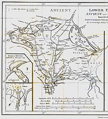
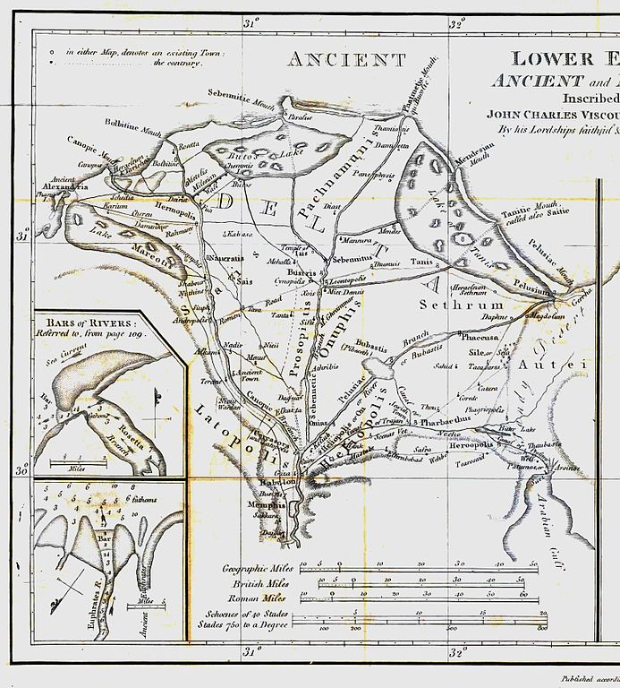
English: Map of ancient Egypt created by James Rennell as an insert for his book "The geographical system of Herodotus examined and explained" (published 1800 and 1830). This map shows Rennell's understanding of the geography of Egypt's Nile delta during the Greek Classical period (510 BC - 323 BC) based on the writings of Herodotus (484 BC - 425 BC). |
| תאריך יצירה | |
| מקור | Book "The geographical system of Herodotus examined and explained", by James Rennell (published 1800 and 1830). |
| יוצר | Carl Drews scanned the map and enhanced the color contrast. |
רישיון
[עריכה]
|
יצירה זו נמצאת בנחלת הכלל במדינת המקור ובמדינות אחרות בהם תקופת זכויות היוצרים היא משך חיי היוצר ו-100 שנה (או פחות) מפטירתו.
| |
| הקובץ הזה זוהה כקובץ חופשי מכל מגבלה ידועה תחת חוק זכויות היוצרים, כולל כל הזכויות הקשורות והסמוכות. | |
היסטוריית הקובץ
ניתן ללחוץ על תאריך/שעה כדי לראות את הקובץ כפי שנראה באותו זמן.
| תאריך/שעה | תמונה ממוזערת | ממדים | משתמש | הערה | |
|---|---|---|---|---|---|
| נוכחית | 19:23, 12 באוגוסט 2010 | | 1,715 × 1,548 (384 ק"ב) | CarlDrews~commonswiki (שיחה | תרומות) | {{Information |Description={{en|1=Map of ancient Egypt created by James Rennell as an insert for his book "The geographical system of Herodotus examined and explained" (published 1800 and 1830). This map shows Rennell's understanding of the geography of E |
אין באפשרותך לדרוס את הקובץ הזה.
שימוש בקובץ
אין דפים המשתמשים בקובץ זה.
שימוש גלובלי בקובץ
אתרי הוויקי השונים הבאים משתמשים בקובץ זה:
- שימוש באתר ar.wikipedia.org
- שימוש באתר bg.wikipedia.org
- שימוש באתר de.wikipedia.org
- שימוש באתר el.wikipedia.org
- שימוש באתר en.wikipedia.org
- שימוש באתר es.wikipedia.org
- שימוש באתר fr.wikipedia.org
- שימוש באתר he.wikipedia.org
- שימוש באתר ja.wikipedia.org
- שימוש באתר ja.wikibooks.org
- שימוש באתר nl.wikipedia.org
- שימוש באתר sl.wikipedia.org
- שימוש באתר uk.wikipedia.org
- שימוש באתר zh.wikipedia.org