File:Ancient monuments fort ancient map.gif
קפיצה לניווט
קפיצה לחיפוש
גודל התצוגה המקדימה הזאת: 457 × 599 פיקסלים. רזולוציות אחרות: 183 × 240 פיקסלים | 366 × 480 פיקסלים | 1,000 × 1,311 פיקסלים.
לקובץ המקורי (1,000 × 1,311 פיקסלים, גודל הקובץ: 177 ק"ב, סוג MIME: image/gif)
כיתובים
כיתובים
נא להוסיף משפט שמסביר מה הקובץ מייצג
תקציר[עריכה]
| תיאור |
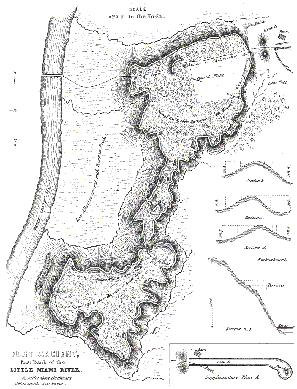
English: Map of Fort Ancient, Warren County. Surveyed by John Lock, 1843. Published in Ancient Monuments of the Mississippi Valley, Ephraim G. Squier and Edwin H. Davis, 1848. |
| מקור | see above |
| יוצר | see above |
|
This is an image of a place or building that is listed on the National Register of Historic Places in the United States of America. Its reference number is 66000625. |
רישיון[עריכה]
|
יצירה זו נמצאת בנחלת הכלל במדינת המקור ובמדינות אחרות בהם תקופת זכויות היוצרים היא משך חיי היוצר ו-100 שנה (או פחות) מפטירתו.
| |
| הקובץ הזה זוהה כקובץ חופשי מכל מגבלה ידועה תחת חוק זכויות היוצרים, כולל כל הזכויות הקשורות והסמוכות. | |
יומן העלאה מקורי[עריכה]
תיאור הקובץ המקורי נמצא כאן. כל שמות המשתמשים הבאים מתייחסים ל-en.wikipedia.
| תאריך/שעה | ממדים | משתמש | הערה |
|---|---|---|---|
| 2006-06-28 23:52 | 1000×1311× (181175 bytes) | RickDikeman | Map of [[Fort Ancient, Ohio|Fort Ancient]], [[Warren County, Ohio]]. Surveyed by John Lock, 1843. Published in ''[[Ancient Monuments of the Mississippi Valley]]'', Ephraim G. Squier and Edwin H. Davis, 1848. |
היסטוריית הקובץ
ניתן ללחוץ על תאריך/שעה כדי לראות את הקובץ כפי שנראה באותו זמן.
| תאריך/שעה | תמונה ממוזערת | ממדים | משתמש | הערה | |
|---|---|---|---|---|---|
| נוכחית | 03:50, 8 ביולי 2016 | | 1,311 × 1,000 (177 ק"ב) | TheCatalyst31 (שיחה | תרומות) | Transferred from en.wikipedia |
אין באפשרותך לדרוס את הקובץ הזה.
שימוש בקובץ
אין דפים המשתמשים בקובץ זה.
שימוש גלובלי בקובץ
אתרי הוויקי השונים הבאים משתמשים בקובץ זה:
- שימוש באתר de.wikipedia.org
- שימוש באתר en.wikipedia.org
- שימוש באתר fr.wikipedia.org
- שימוש באתר he.wikipedia.org
- שימוש באתר uz.wikipedia.org