File:BlankMap-World-Flattened.svg
קפיצה לניווט
קפיצה לחיפוש

גודל התצוגה המקדימה הזאת מסוג PNG של קובץ ה־SVG הזה: 800 × 406 פיקסלים. רזולוציות אחרות: 320 × 162 פיקסלים | 640 × 325 פיקסלים | 1,024 × 519 פיקסלים | 1,280 × 649 פיקסלים | 2,560 × 1,299 פיקסלים | 2,754 × 1,397 פיקסלים.
לקובץ המקורי (קובץ SVG, הגודל המקורי: 2,754 × 1,397 פיקסלים, גודל הקובץ: 1.68 מ"ב)
כיתובים
כיתובים
נא להוסיף משפט שמסביר מה הקובץ מייצג
תקציר
[עריכה]
| תיאור |
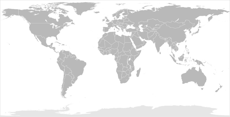
English: Blank political map of the world in modified (flattened) Robinson projection. This image is a sample of output from nugsl-worldmap, a Python script for the manipulation of this map. The script can also produce rotated images, add pinpoint marks at particular geographic coordinates, and produce web pages with clickable areas for specific countries and pinpoint marks.
Note that this map is not equirectangular, and cannot be used as a push-pin map to identify coordinates assuming equal latitude and longitude spacing. A map using the equirectangular projection is available at File:BlankMap-World6-Equirectangular.svg. |
| תאריך יצירה | (for the script only) |
| מקור |
http://www.law.nagoya-u.ac.jp/en/appendix/software/worldmap/ Refactored from Image:BlankMap-World.svg, q.v. |
| יוצר | Frank Bennett |
| אישורים והיתרים (שימוש חוזר בקובץ זה) |
The map data manipulated by the script is in the public domain. The raw output of the script, including the file shown here, is also in the public domain. |
| גרסאות אחרות |
Derivative works of this file:
|
| SVGהתפתחות | . Inkscape עם נוצרה ה גרפיקה וקטורית |
רישיון
[עריכה]
| ברצוני, בעלי זכויות היוצרים על יצירה זו, לשחרר יצירה זו לנחלת הכלל. זה תקף בכל העולם. יש מדינות שבהן הדבר אינו אפשרי על פי חוק, אם כך: אני מעניק לכל אחד את הזכות להשתמש בעבודה זו לכל מטרה שהיא, ללא תנאים כלשהם, אלא אם כן תנאים כאלה נדרשים על פי חוק. |
היסטוריית הקובץ
ניתן ללחוץ על תאריך/שעה כדי לראות את הקובץ כפי שנראה באותו זמן.
| תאריך/שעה | תמונה ממוזערת | ממדים | משתמש | הערה | |
|---|---|---|---|---|---|
| נוכחית | 10:44, 20 במרץ 2014 | | 1,397 × 2,754 (1.68 מ"ב) | Underlying lk (שיחה | תרומות) | fix classes for Soudan and South Soudan |
| 16:01, 16 במרץ 2013 |  | 1,397 × 2,754 (1.68 מ"ב) | Flappiefh (שיחה | תרומות) | South Sudan added. | |
| 11:47, 14 בינואר 2008 |  | 1,397 × 2,754 (1.67 מ"ב) | Biercenator (שיחה | תרומות) | Updated to current version of map produced by the script. | |
| 13:22, 19 בדצמבר 2007 |  | 477 × 940 (1.99 מ"ב) | Biercenator (שיחה | תרומות) | == Summary == Refactored from en:Image:BlankMap-World6.svg, q.v. This image is a sample of output from [http://gsl-nagoya-u.net/appendix/software/worldmap/ nugsl-worldmap], a Python script for the manipulation and maintenance of this map. The flatt | |
| 15:31, 15 בדצמבר 2007 |  | 477 × 940 (2 מ"ב) | Biercenator (שיחה | תרומות) | Refactored from en:Image:BlankMap-World6.svg, q.v. This image might prove useful if you want to change the area shown in the center of the Robinson projection version, since the conversion can be reversed. | |
| 15:18, 15 בדצמבר 2007 |  | 477 × 940 (2 מ"ב) | Biercenator (שיחה | תרומות) | == Summary == Refactored from en:BlankMap-World6.svg, q.v. This image might prove useful if you want to area shown in the center of the Robinson projection version, since the conversion can be reversed. |
אין באפשרותך לדרוס את הקובץ הזה.
שימוש בקובץ
יותר מ־100 דפים משתמשים בקובץ זה. הרשימה הבאה מראה רק את 100 הדפים הראשונים שמשתמשים בקובץ. ניתן לצפות ברשימה המלאה.
- User talk:Biercenator
- Commons:Graphic Lab/Map workshop/Archive/2014
- File:Algeria–United States Location.svg
- File:Angleterre bilan.svg
- File:Arabic Wikipedia – Most popular edition of Wikipedia by country – Wikimedia Traffic Analysis Report – 1 Jul 2009-31 Oct 2013.svg
- File:Argentina in the World (with Antarctica claims).svg
- File:Army2017-participants.svg
- File:Australia in the World.svg
- File:Australia in the World (+Antarctica claims).svg
- File:Azerbaijan in the World.svg
- File:Bangladesh–European Union Location.svg
- File:Bermuda–United States Location.svg
- File:BlankMap-FlatWorld6.svg (הפניה של קובץ)
- File:BlankMap-World.svg
- User talk:Biercenator
- File:China contour.svg
- File:Indian world contour.svg
- File:Globale Präsenz von Brose.png
- File:EAFF membres.svg
- File:SAFF membres.svg
- File:Angleterre bilan.svg
- File:Russia European part location map.png
- File:Egypt in the World.svg
- File:Argentina in the World (with Antarctica claims).svg
- File:Australia in the World (+Antarctica claims).svg
- File:Australia in the World.svg
- File:BlankMap-World.svg
- File:Brunei in the World.svg
- File:Chile in the World.svg
- File:Chile in the World (+Antarctica claims).svg
- File:China contour.svg
- File:Colombia in the World.svg
- File:Dimitri mitropoulos international music competition candidates by nation.svg
- File:EAFF membres.svg
- File:Egypt in the World.svg
- File:English Wikipedia – Most popular edition of Wikipedia by country – Wikimedia Traffic Analysis Report – 1 Jul 2009-31 Oct 2013.svg
- File:European Union in the World.svg
- File:European Union–Nepal Location.svg
- File:France in the World.svg
- File:France in the World (+Antarctica claims).svg
- File:France in the World (+Antarctica claims) (+EU).svg
- File:France in the World (+EU).svg
- File:French Wikipedia – Most popular edition of Wikipedia by country – Wikimedia Traffic Analysis Report – 1 Jul 2009-31 Oct 2013.svg
- File:Georgia in the World.svg
- File:Globale Präsenz von Brose.png
- File:Greece in the World.svg
- File:Greece in the World (+EU).svg
- File:Greenland in the World (+EU).svg
- File:Iceland in the World.svg
- File:Indian world contour.svg
- File:Indonesia in the World.svg
- File:Italy in the World.svg
- File:Italy in the World (+EU).svg
- File:Japan in the World.svg
- File:Kazakhstan in the World.svg
- File:Kingdom of Denmark in the World.svg
- File:Kingdom of Denmark in the World (+EU).svg
- File:Malaysia in the World.svg
- File:Malta in the World.svg
- File:Malta in the World (+EU).svg
- File:Mandatory bicycle helmet legislation.svg
- File:Map of Star Academy countries.svg
- File:Most popular edition of Wikipedia by country – Wikimedia Traffic Analysis Report – 1 Jul 2016-31 Jul 2016.svg
- File:Netherlands in the World.svg
- File:Netherlands in the World (+EU).svg
- File:New Zealand in the World.svg
- File:New Zealand in the World (+Antarctica claims).svg
- File:Norway in the World.svg
- File:Norway in the World (+Antarctica claims).svg
- File:Norway in the World (+Antarctica claims) cropped.svg
- File:Panama in the World.svg
- File:Papua New Guinea in the World.svg
- File:Philippines in the World.svg
- File:Portugal in the World.svg
- File:Portugal in the World (+EU).svg
- File:Portuguese Wikipedia – Most popular edition of Wikipedia by country – Wikimedia Traffic Analysis Report – 1 Jul 2009-31 Oct 2013.svg
- File:Prediction map of World War III.svg
- File:Quoll range.png
- File:Quoll range map.jpg
- File:Russia European part location map.png
- File:Russia in the World.svg
- File:Russian Wikipedia – Most popular edition of Wikipedia by country – Wikimedia Traffic Analysis Report – 1 Jul 2009-31 Oct 2013.svg
- File:SAFF membres.svg
- File:Singapore in the World.svg
- File:South Africa in the World.svg
- File:Spaceports on Earth.svg
- File:Spain in the World.svg
- File:Spain in the World (+EU).svg
- File:Spanish Wikipedia – Most popular edition of Wikipedia by country – Wikimedia Traffic Analysis Report – 1 Jul 2009-31 Oct 2013.svg
- File:Suisse bilan.svg
- File:Timor-Leste in the World.svg
- File:Trinidad and Tobago in the World.svg
- File:Turkey in the World.svg
- File:UTC hue4map X world flat6.svg
- File:United Kingdom (+overseas territories and crown dependencies) in the World.svg
- File:United Kingdom (+overseas territories and crown dependencies) in the World (+Antarctica claims).svg
- File:United Kingdom (+overseas territories and crown dependencies) in the World (+Antarctica claims) (+EU).svg
- File:United Kingdom (+overseas territories and crown dependencies) in the World (+EU).svg
- File:United States in the World.svg
- File:United States–Seychelles Location.svg
.svg)
.svg)
.svg)
.svg)
_(%2BEU).svg)
.svg)
.svg)
.svg)
.svg)
.svg)
.svg)
.svg)
.svg)
.svg)
_cropped.svg)
.svg)
.svg)
_in_the_World.svg)
_in_the_World_(%2BAntarctica_claims).svg)
_in_the_World_(%2BAntarctica_claims)_(%2BEU).svg)
_in_the_World_(%2BEU).svg)
ישנם דפים נוספים שמשתמשים בקובץ זה.
שימוש גלובלי בקובץ
אתרי הוויקי השונים הבאים משתמשים בקובץ זה:
- שימוש באתר ca.wikipedia.org
- שימוש באתר de.wikipedia.org
- שימוש באתר en.wikipedia.org
- שימוש באתר es.wikipedia.org
- שימוש באתר fr.wikipedia.org
- שימוש באתר he.wikipedia.org