File:Boso Peninsula Chiba Japan SRTM.jpg
둘러보기로 이동
검색으로 이동
미리 보기 크기: 665 × 599 픽셀 다른 해상도: 266 × 240 픽셀 | 533 × 480 픽셀 | 929 × 837 픽셀
원본 파일 (929 × 837 픽셀, 파일 크기: 150 KB, MIME 종류: image/jpeg)
캡션
설명
이 파일이 나타내는 바에 대한 한 줄 설명을 추가합니다
파일 설명[편집]
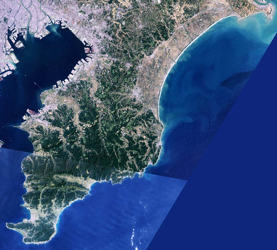
| 설명 | Boso Peninsula in Chiba Prefecture, Japan. |
| 날짜 | |
| 출처 | image with high-resolution data from Space Shuttle. |
| 저자 | っ |
| 다른 버전 |
|

라이선스[편집]
This image uses high-resolution digital topography data from NASA's Shuttle Radar Topography Mission (SRTM) at JPL-Caltech [1]. It is in the public domain in the United States.
|
 | |
파일 역사
날짜/시간 링크를 클릭하면 해당 시간의 파일을 볼 수 있습니다.
| 날짜/시간 | 섬네일 | 크기 | 사용자 | 설명 | |
|---|---|---|---|---|---|
| 현재 | 2005년 1월 12일 (수) 05:42 | | 929 × 837 (150 KB) | っ (토론 | 기여) | Boso Peninsula, Chiba, Japan. Landsat image with high-resolution data from Space Shuttle. {{GFDL-Landsat-Kashmir3d}} {{SpaceShuttle}} |
이 파일을 덮어쓸 수 없습니다.
이 파일을 사용하는 문서
다음 문서 1개가 이 파일을 사용하고 있습니다:
- File:BosoPeninsulaChibaJpLandsat.jpg (파일 넘겨주기)
이 파일을 사용하고 있는 모든 위키의 문서 목록
다음 위키에서 이 파일을 사용하고 있습니다:
- ar.wikipedia.org에서 이 파일을 사용하고 있는 문서 목록
- ja.wikipedia.org에서 이 파일을 사용하고 있는 문서 목록
- ko.wikipedia.org에서 이 파일을 사용하고 있는 문서 목록
- nl.wikipedia.org에서 이 파일을 사용하고 있는 문서 목록
- th.wikipedia.org에서 이 파일을 사용하고 있는 문서 목록
- zh.wikipedia.org에서 이 파일을 사용하고 있는 문서 목록