File:ChaleurBay23.jpg
ChaleurBay23.jpg (300 × 202 pixel, dimensione del file: 11 KB, tipo MIME: image/jpeg)
Didascalie
Didascalie
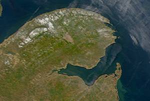
Description: Satellite image of Chaleur Bay below the Gaspé Peninsula.
From: SeaWiFS Level 1A image of the Canadian Maritime provinces and northeastern United States, acquired May 18, 2003.
Source: NASA Goddard Earth Sciences Data and Information Services Center
| This image is from the Sea-viewing Wide Field-of-view Sensor (SeaWiFS) Project and more than 5 years old.
Satellite data captured by the SeaWIFS sensor are released into the public domain 5 years after capture. Data less than five years old can be re-used only for educational or scientific purposes; any commercial use of such images must be coordinated with GeoEye. [1] |
| This work has been released into the public domain by its copyright holder, GeoEye. This applies worldwide. In alcuni paesi questo potrebbe non essere legalmente possibile. In tal caso: GeoEye garantisce a chiunque il diritto di utilizzare quest'opera per qualsiasi scopo, senza alcuna condizione, a meno che tali condizioni siano richieste dalla legge.
|
Cronologia del file
Fare clic su un gruppo data/ora per vedere il file come si presentava nel momento indicato.
| Data/Ora | Miniatura | Dimensioni | Utente | Commento | |
|---|---|---|---|---|---|
| attuale | 09:13, 25 mag 2005 | | 300 × 202 (11 KB) | Big iron (discussione | contributi) | Description: Satellite image of Chaleur Bay From: SeaWiFS Level 1A image of the Canadian Maritime provinces and northeastern United States, acquired May 18, 2003. Source: NASA Goddard Earth Sciences Data and Information Services Center {{PD-USGov-NASA} |
Impossibile sovrascrivere questo file.
Utilizzo del file
Le seguenti 2 pagine usano questo file:
Utilizzo globale del file
Anche i seguenti wiki usano questo file:
- Usato nelle seguenti pagine di ca.wikipedia.org:
- Usato nelle seguenti pagine di ceb.wikipedia.org:
- Usato nelle seguenti pagine di de.wikipedia.org:
- Usato nelle seguenti pagine di en.wikipedia.org:
- Usato nelle seguenti pagine di eo.wikipedia.org:
- Usato nelle seguenti pagine di es.wikipedia.org:
- Usato nelle seguenti pagine di fr.wikipedia.org:
- Usato nelle seguenti pagine di incubator.wikimedia.org:
- Usato nelle seguenti pagine di it.wikipedia.org:
- Usato nelle seguenti pagine di nl.wikipedia.org:
- Usato nelle seguenti pagine di no.wikipedia.org:
- Usato nelle seguenti pagine di pl.wikipedia.org:
- Usato nelle seguenti pagine di pt.wikipedia.org:
- Usato nelle seguenti pagine di ru.wikipedia.org:
- Usato nelle seguenti pagine di uk.wikipedia.org:
- Usato nelle seguenti pagine di www.wikidata.org: