File:Chandigarh Tricity.svg
跳至導覽
跳至搜尋

此 SVG 檔案的 PNG 預覽的大小:800 × 591 像素。 其他解析度:320 × 236 像素 | 640 × 473 像素 | 1,024 × 757 像素 | 1,280 × 946 像素 | 2,560 × 1,892 像素 | 1,444 × 1,067 像素。
原始檔案 (SVG 檔案,表面大小:1,444 × 1,067 像素,檔案大小:1.27 MB)
說明
說明
添加單行說明來描述出檔案所代表的內容
摘要
[編輯]
| 描述 |
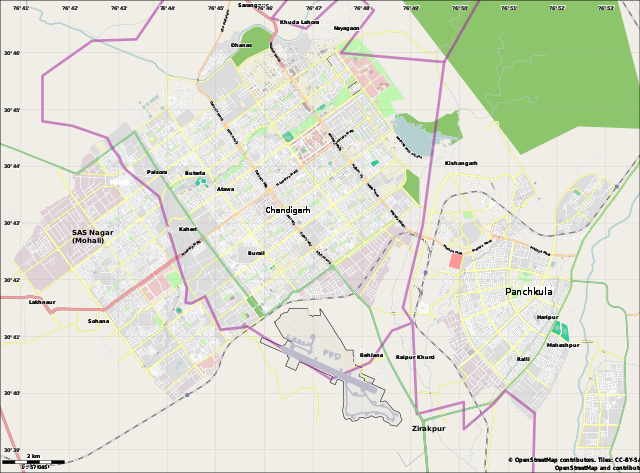
English: Location map for the Chandigarh Tricity, including Chandigarh UT, SAS Nagar, Panchkula and Zirakpur. |
| 日期 | |
| 來源 | OpenStreetMap.org (using Maperitive to create SVG file) |
| 作者 | Cropping by RaviC, OSM authors for map data |
| 拍攝地點 | | 位於此地的本圖片與其他圖片: OpenStreetMap |
|---|
授權條款
[編輯]
| This work contains information from OpenStreetMap, which is made available under the Open Database License (ODbL).
The ODbL does not require any particular license for maps produced from ODbL data. Prior to 1 August 2020, map tiles produced by the OpenStreetMap Foundation were licensed under the CC-BY-SA-2.0 license. Maps produced by other people may be subject to other licences. |
檔案歷史
點選日期/時間以檢視該時間的檔案版本。
| 日期/時間 | 縮圖 | 尺寸 | 用戶 | 備註 | |
|---|---|---|---|---|---|
| 目前 | 2021年3月20日 (六) 17:01 | | 1,444 × 1,067(1.27 MB) | RaviC(對話 | 貢獻) | fixed Zirakpur |
| 2014年6月11日 (三) 14:23 |  | 1,444 × 1,067(1.16 MB) | RaviC(對話 | 貢獻) | User created page with UploadWizard |
無法覆蓋此檔案。
檔案用途
沒有使用此檔案的頁面。
全域檔案使用狀況
以下其他 wiki 使用了這個檔案:
- bn.wikipedia.org 的使用狀況
- bs.wikipedia.org 的使用狀況
- ceb.wikipedia.org 的使用狀況
- en.wikipedia.org 的使用狀況
- Chandigarh
- Sukhna Lake
- Mani Majra
- Chandigarh Capital Region
- Chandigarh Airport
- Goswami Ganesh Dutta Sanatan Dharma College
- DAV College, Chandigarh
- Module:Location map/data/India Chandigarh/doc
- Open Hand Monument
- Secretariat Building, Chandigarh
- Palace of Assembly
- Chandigarh Junction railway station
- Sector 56, Mohali
- Parrot Bird Sanctuary, Chandigarh
- User:Xkd2626/sandbox
- Module:Location map/data/India Chandigarh
- January 1970
- User:Hstar24/sandbox
- Sector-17, Chandigarh
- Kaimbwala
- es.wikipedia.org 的使用狀況
- fa.wikipedia.org 的使用狀況
- fr.wikipedia.org 的使用狀況
- gu.wikipedia.org 的使用狀況
- id.wikipedia.org 的使用狀況
- kn.wikipedia.org 的使用狀況
- ml.wikipedia.org 的使用狀況
- or.wikipedia.org 的使用狀況
- pa.wikipedia.org 的使用狀況
- pl.wikipedia.org 的使用狀況
- pl.wikibooks.org 的使用狀況
- si.wikipedia.org 的使用狀況
- ta.wikipedia.org 的使用狀況
檢視此檔案的更多全域使用狀況。