File:Chippewa National Forest - Social - 2.jpg
Vai alla navigazione
Vai alla ricerca
Dimensioni di questa anteprima: 800 × 533 pixel. Altre risoluzioni: 320 × 213 pixel | 640 × 427 pixel | 1 024 × 683 pixel | 1 280 × 853 pixel | 2 048 × 1 365 pixel.
File originale (2 048 × 1 365 pixel, dimensione del file: 559 KB, tipo MIME: image/jpeg)
Didascalie
Didascalie
Aggiungi una brevissima spiegazione di ciò che questo file rappresenta
Dettagli
[modifica]
| Descrizione |
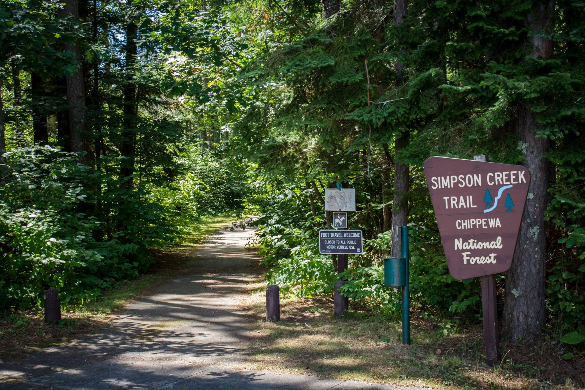
English: The Simpson Creek Trail system winds through towering pines, around a great walleye fishing lake, and into the rich history of the Cut Foot Sioux area. Simpson Creek is located on State Highway 46, about 17 miles northwest of Deer River, Minnesota. Access onto the trail can be gained at the Cut Foot Sioux Visitor Center off Highway 46; and off Eagle Nest Road (FR 2198), approximately 1/2 mile from crossing the bridge on that road; and near East Seelye Point. |
| Data | |
| Fonte | https://www.facebook.com/ChippewaNF/photos/a.670934996336374.1073741828.670927213003819/1384973181599215/?type=3&theater |
| Autore |
Chippewa National Forest U.S. Forest Service |
Licenza
[modifica]
This image is a work of the Forest Service of the United States Department of Agriculture. As a work of the U.S. federal government, the image is in the public domain.
|
Cronologia del file
Fare clic su un gruppo data/ora per vedere il file come si presentava nel momento indicato.
| Data/Ora | Miniatura | Dimensioni | Utente | Commento | |
|---|---|---|---|---|---|
| attuale | 06:23, 10 set 2017 | | 2 048 × 1 365 (559 KB) | Missvain (discussione | contributi) | User created page with UploadWizard |
Impossibile sovrascrivere questo file.
Utilizzo del file
Nessuna pagina utilizza questo file.
Utilizzo globale del file
Anche i seguenti wiki usano questo file:
- Usato nelle seguenti pagine di en.wikipedia.org:
- Usato nelle seguenti pagine di it.wikipedia.org:
- Usato nelle seguenti pagine di ml.wikipedia.org:
- Usato nelle seguenti pagine di ru.wikipedia.org: