File:Cupressus nootkatensis range map 3.png
Pereiti į navigaciją
Jump to search

Šios peržiūros dydis: 600 × 600 taškų. Kitos 6 rezoliucijos: 240 × 240 taškų | 480 × 480 taškų | 768 × 768 taškų | 1 024 × 1 024 taškų | 2 048 × 2 048 taškų | 4 038 × 4 038 taškų.
Pradinė rinkmena (4 038 × 4 038 taškų, rinkmenos dydis: 234 KiB, MIME tipas: image/png)
Captions
Captions
Add a one-line explanation of what this file represents
Aprašymas[keisti]
| Aprašymas |
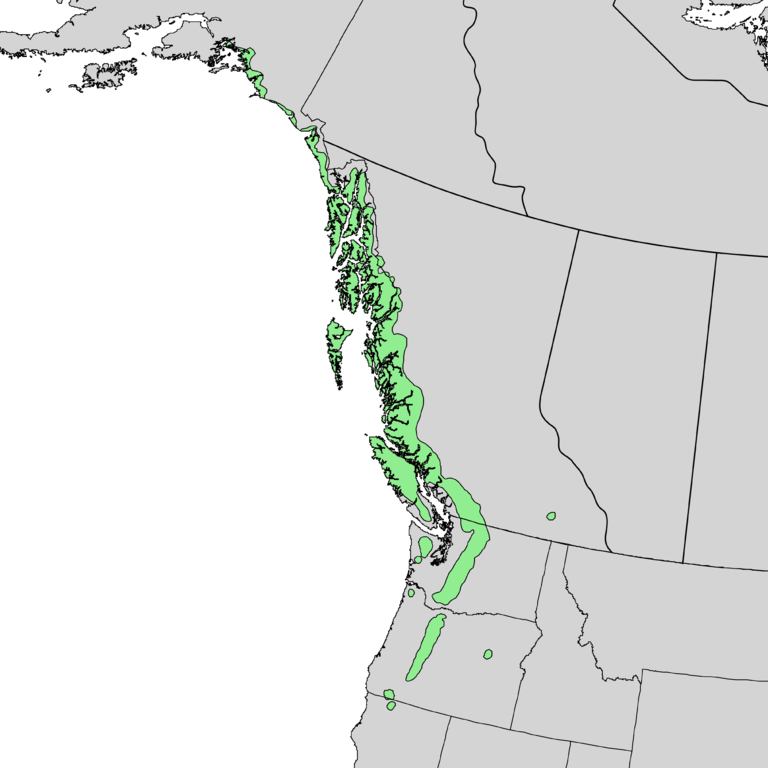
English: Natural distribution map for Cupressus nootkatensis |
| Data | |
| Šaltinis | USGS Geosciences and Environmental Change Science Center: Digital Representations of Tree Species Range Maps from "Atlas of United States Trees" by Elbert L. Little, Jr. (and other publications) |
| Autorius | Elbert L. Little, Jr., of the U.S. Department of Agriculture, Forest Service, and others |
| Kitos versijos |
Licencija[keisti]
This work is in the public domain in the United States because it is a work prepared by an officer or employee of the United States Government as part of that person’s official duties under the terms of Title 17, Chapter 1, Section 105 of the US Code.
Note: This only applies to original works of the Federal Government and not to the work of any individual U.S. state, territory, commonwealth, county, municipality, or any other subdivision. This template also does not apply to postage stamp designs published by the United States Postal Service since 1978. (See § 313.6(C)(1) of Compendium of U.S. Copyright Office Practices). It also does not apply to certain US coins; see The US Mint Terms of Use.
|
 | |
| This file has been identified as being free of known restrictions under copyright law, including all related and neighboring rights. | ||
Rinkmenos istorija
Paspauskite ant datos/laiko, kad pamatytumėte rinkmeną tokią, kokia ji buvo tuo metu.
| Data/Laikas | Miniatiūra | Matmenys | Naudotojas | Paaiškinimas | |
|---|---|---|---|---|---|
| dabartinis | 01:54, 30 gruodžio 2013 | | 4 038 × 4 038 (234 KiB) | Nonenmac (aptarimas | indėlis) | added province borders |
| 03:21, 20 lapkričio 2013 |  | 3 715 × 3 715 (121 KiB) | Nonenmac (aptarimas | indėlis) | User created page with UploadWizard |
Jūs negalite perrašyti šios rinkmenos.
Rinkmenos naudojimas
Šie puslapiai naudoja šią rinkmeną:
Visuotinis rinkmenos naudojimas
Ši rinkmena naudojama šiose viki svetainėse:
- Naudojama ceb.wikipedia.org
- Naudojama en.wikipedia.org
- Naudojama fi.wikipedia.org
- Naudojama gl.wikipedia.org
- Naudojama is.wikipedia.org
- Naudojama lt.wikipedia.org
- Naudojama nl.wikipedia.org
- Naudojama pl.wikipedia.org
- Naudojama pt.wikipedia.org
- Naudojama ru.wikipedia.org
- Naudojama uk.wikipedia.org
- Naudojama vi.wikipedia.org