File:FAA JFK Airport map 2011.svg
둘러보기로 이동
검색으로 이동

SVG 파일의 PNG 형식의 미리보기 크기: 390 × 599 픽셀. 다른 해상도: 156 × 240 픽셀 | 312 × 480 픽셀 | 500 × 768 픽셀 | 667 × 1,024 픽셀 | 1,334 × 2,048 픽셀 | 605 × 929 픽셀
원본 파일 (SVG 파일, 실제 크기 605 × 929 픽셀, 파일 크기: 1.36 MB)
캡션
설명
이 파일이 나타내는 바에 대한 한 줄 설명을 추가합니다

파일 설명
[편집]
| 설명 |
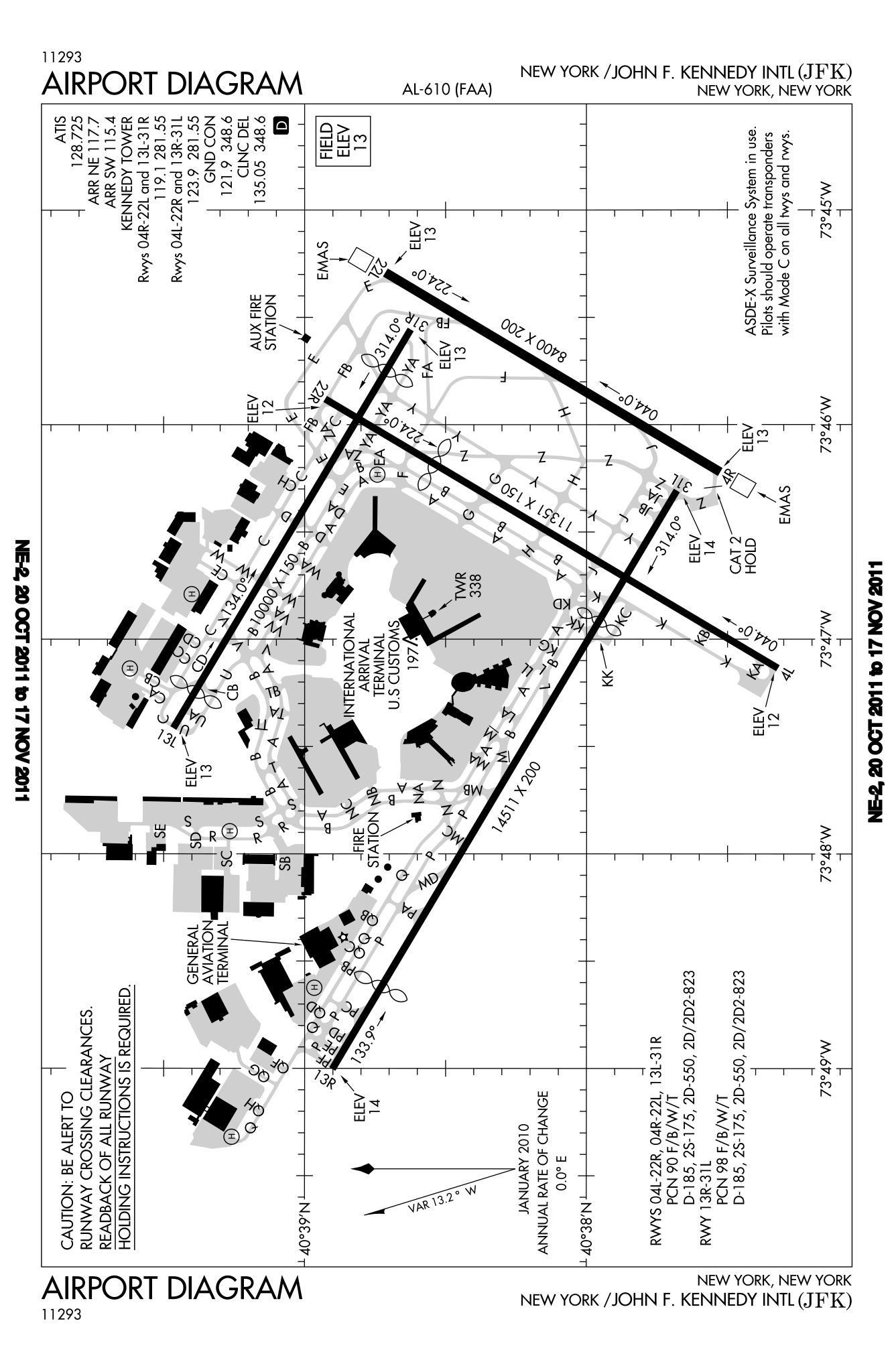
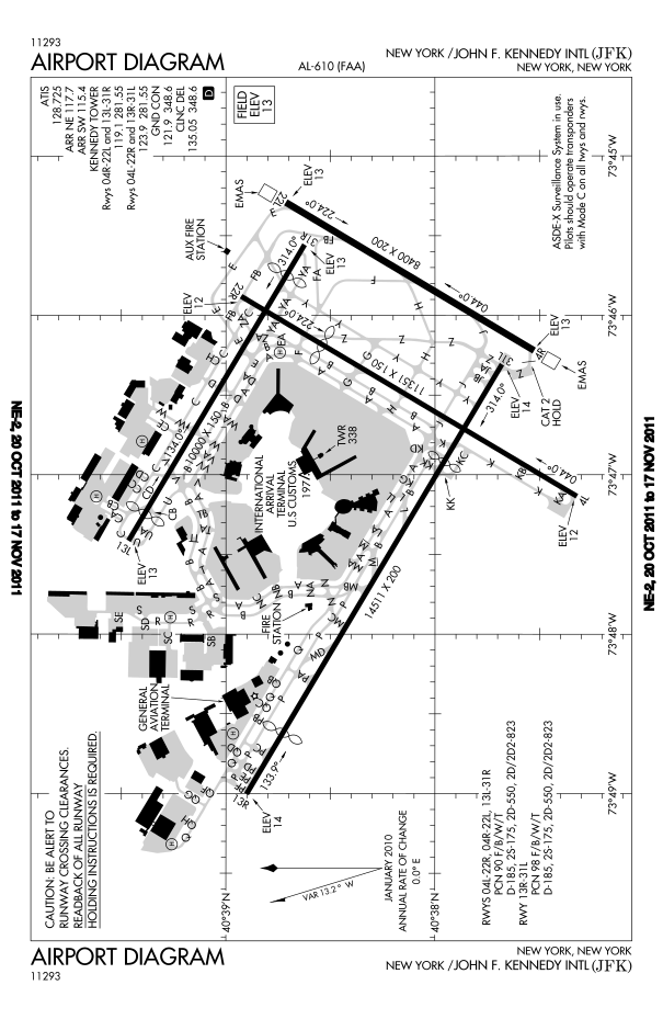
English: FAA diagram for John F. Kennedy International Airport in Queens, New York, United States. |
| 날짜 | |
| 출처 |
Website: http://www.avn.faa.gov/digital_tpp.asp Image: http://www.avn.faa.gov/d-tpp/0812/00610AD.PDF (changes every 28 days, see article for current link) |
| 저자 | National Aeronautical Charting Office (NACO), a department of the U.S. Federal Aviation Administration (FAA). |
| 저작권 (이 파일을 인용하기) |
Public Domain |
라이선스
[편집]
This image or file is a work of a Federal Aviation Administration employee, taken or made as part of that person's official duties. As a work of the U.S. federal government, the image is in the public domain in the United States.
|
 |
파일 역사
날짜/시간 링크를 클릭하면 해당 시간의 파일을 볼 수 있습니다.
| 날짜/시간 | 섬네일 | 크기 | 사용자 | 설명 | |
|---|---|---|---|---|---|
| 현재 | 2011년 10월 20일 (목) 22:46 | | 605 × 929 (1.36 MB) | Bluefist (토론 | 기여) | New version as of October 20, 2011. |
| 2010년 3월 1일 (월) 21:39 |  | 484 × 743 (709 KB) | Atmoz (토론 | 기여) | upload new version | |
| 2008년 11월 13일 (목) 23:29 |  | 379 × 576 (760 KB) | Phongn (토론 | 기여) | {{Information |Description={{en|1=FAA diagram of JFK.}} |Source=http://www.avn.faa.gov/digital_tpp.asp |Author=Federal Aviation Administration |Date= |Permission= |other_versions= }} <!--{{ImageUpload|full}}--> |
이 파일을 덮어쓸 수 없습니다.
이 파일을 사용하는 문서
다음 문서 1개가 이 파일을 사용하고 있습니다:
- File:00610AD.svg (파일 넘겨주기)
이 파일을 사용하고 있는 모든 위키의 문서 목록
다음 위키에서 이 파일을 사용하고 있습니다:
- bn.wikipedia.org에서 이 파일을 사용하고 있는 문서 목록
- en.wikipedia.org에서 이 파일을 사용하고 있는 문서 목록
- ko.wikipedia.org에서 이 파일을 사용하고 있는 문서 목록
- ms.wikipedia.org에서 이 파일을 사용하고 있는 문서 목록
- ta.wikipedia.org에서 이 파일을 사용하고 있는 문서 목록
- th.wikipedia.org에서 이 파일을 사용하고 있는 문서 목록
- uk.wikipedia.org에서 이 파일을 사용하고 있는 문서 목록