File:Indochina map 1886.jpg
跳至導覽
跳至搜尋

預覽大小:461 × 599 像素。 其他解析度:184 × 240 像素 | 369 × 480 像素 | 591 × 768 像素 | 788 × 1,024 像素 | 1,626 × 2,114 像素。
原始檔案 (1,626 × 2,114 像素,檔案大小:533 KB,MIME 類型:image/jpeg)
說明
說明
添加單行說明來描述出檔案所代表的內容
super map
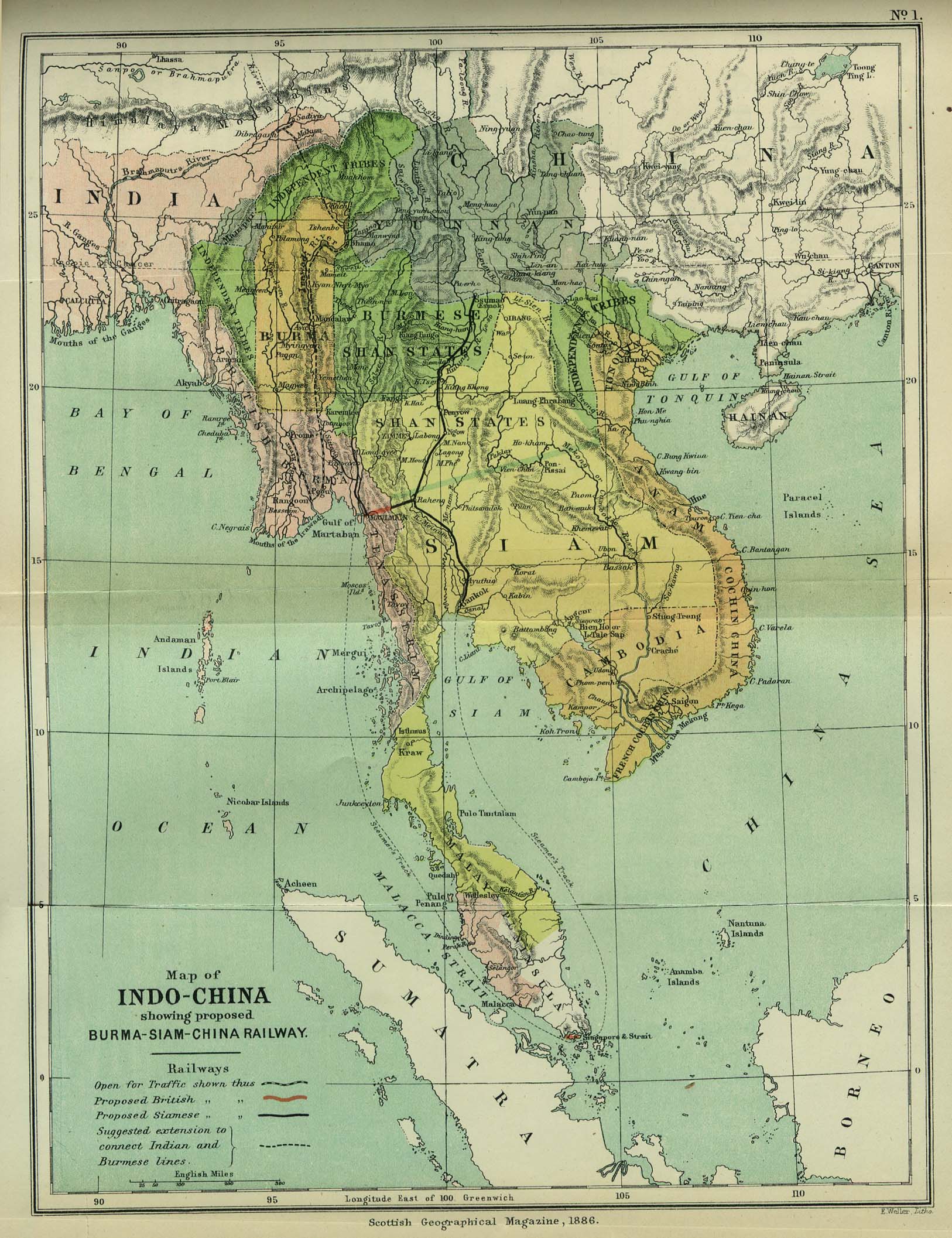
| 描述 | Map of Indochina | ||||
| 日期 | |||||
| 來源 | http://www.lib.utexas.edu/maps/cambodia.html (http://www.lib.utexas.edu/maps/historical/indo_china_1886.jpg); Scottish Geographical Magazine (Volume II) | ||||
| 作者 | Scottish Geographical Magazine and edited by Hugh A. Webster and Arthur Silva White | ||||
| 授權許可 (重用此檔案) |
|
||||
| 其他版本 | File:IndoChina1886.jpg | ||||
檔案歷史
點選日期/時間以檢視該時間的檔案版本。
| 日期/時間 | 縮圖 | 尺寸 | 使用者 | 備註 | |
|---|---|---|---|---|---|
| 目前 | 2008年5月2日 (五) 02:56 | | 1,626 × 2,114(533 KB) | Calliopejen1(留言 | 貢獻) | {{Information |Description=Map of French Indochina |Source=http://www.lib.utexas.edu/maps/cambodia.html (http://www.lib.utexas.edu/maps/historical/indo_china_1886.jpg) |Date=1886 |Author=Scottish Geographical Magazine |Permission={{PD-old}} |other_version |
無法覆蓋此檔案。
檔案用途
沒有使用此檔案的頁面。
全域檔案使用狀況
以下其他 wiki 使用了這個檔案:
- bcl.wikipedia.org 的使用狀況
- el.wikipedia.org 的使用狀況
- en.wikipedia.org 的使用狀況
- en.wikiversity.org 的使用狀況
- fi.wikipedia.org 的使用狀況
- got.wikipedia.org 的使用狀況
- kn.wikipedia.org 的使用狀況
- ms.wikipedia.org 的使用狀況
- pa.wikipedia.org 的使用狀況
- sl.wikipedia.org 的使用狀況
- uz.wikipedia.org 的使用狀況