File:Kerguelen-Location.JPG

പൂർണ്ണ വലിപ്പം (872 × 872 പിക്സൽ, പ്രമാണത്തിന്റെ വലിപ്പം: 119 കെ.ബി., മൈം തരം: image/jpeg)
തലവാചകം
തലവാചകങ്ങൾ
ചുരുക്കം[തിരുത്തുക]
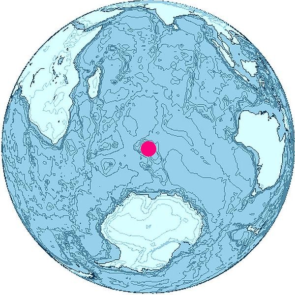
Location of Kerguelen Islands, Indian Ocean.
The map was created with this online map creation tool archive copy at the Wayback Machine.

|
ഈ map ചിത്രം വെക്റ്റർ ഗ്രാഫിക്സ് ഉപയോഗിച്ച് എസ്.വി.ജി. പ്രമാണമായി പുനർനിർമ്മിക്കേണ്ടതാണ്. അങ്ങനെ ചെയ്യുന്നതുകൊണ്ട് പല ഗുണങ്ങളുമുണ്ട്; കൂടുതൽ വിവരങ്ങൾക്ക് മെച്ചപ്പെടുത്തുവാനുള്ള മീഡിയകൾ കാണുക. ഈ ചിത്രത്തിന്റെ എസ്.വി.ജി. പതിപ്പ് കൈവശമുണ്ടെങ്കിൽ ദയവായി അപ്ലോഡ് ചെയ്യുക. അപ്ലോഡ് ചെയ്ത ശേഷം ഈ ഫലകം {{vector version available|പുതിയ ചിത്രത്തിന്റെ പേര്.svg}} എന്ന് മാറ്റിച്ചേർക്കുക.
|


അനുമതി[തിരുത്തുക]

|
ഈ സൃഷ്ടി സ്വതന്ത്ര സോഫ്റ്റ്വേറാണ്; സ്വതന്ത്ര സോഫ്റ്റ്വേർ സമിതി പ്രസിദ്ധീകരിച്ചിട്ടുള്ള ഗ്നു സാർവ്വജനിക അനുവാദപത്രം പതിപ്പ് 2 അല്ലെങ്കിൽ പുതിയ പതിപ്പുകൾ പ്രകാരം താങ്കൾക്കിത് പുനർവിതരണം ചെയ്യാൻ ഒപ്പം/അല്ലെങ്കിൽ മാറ്റം വരുത്താൻ കഴിയുന്നതാണ്. ഈ സൃഷ്ടി ഉപകാരപ്രദമാകുമെന്ന വിശ്വാസത്തിലാണ് വിതരണം ചെയ്യുന്നത്, പക്ഷേ യാതൊരു ഗുണമേന്മ ഉത്തരവാദിത്വവും വഹിക്കുന്നില്ല; വ്യാപാരയോഗ്യം എന്നോ പ്രത്യേക ഉപയോഗത്തിനനുയോജ്യം എന്നോ ഉള്ള യാതൊരു ഗുണമേന്മ ഉത്തരവാദിത്വവും ഉൾപ്പെടുന്നില്ല. കൂടുതൽ വിവരങ്ങൾക്ക് ഗ്നു സാർവ്വജനിക അനുവാദപത്രത്തിന്റെ പതിപ്പ് 2, പതിപ്പ് 3 എന്നിവ കാണുക. |
പ്രമാണ നാൾവഴി
ഏതെങ്കിലും തീയതി/സമയ കണ്ണിയിൽ ഞെക്കിയാൽ പ്രസ്തുതസമയത്ത് ഈ പ്രമാണം എങ്ങനെയായിരുന്നു എന്നു കാണാം.
| തീയതി/സമയം | ലഘുചിത്രം | അളവുകൾ | ഉപയോക്താവ് | അഭിപ്രായം | |
|---|---|---|---|---|---|
| നിലവിലുള്ളത് | 16:26, 26 ജൂൺ 2006 | | 872 × 872 (119 കെ.ബി.) | Apcbg (സംവാദം | സംഭാവനകൾ) | Location of Kerguelen Islands, Indian Ocean. The map was created with this [http://www.aquarius.geomar.de/omc/ online map creation tool]. |
ഈ പ്രമാണത്തിനു മുകളിൽ മറ്റൊരു പ്രമാണം ചേർക്കാൻ താങ്കൾക്ക് കഴിയില്ല.
പ്രമാണത്തിന്റെ ഉപയോഗം
ഈ പ്രമാണം വിക്കിയിലെ താളുകളിലൊന്നിലും ഉപയോഗിക്കുന്നില്ല.
പ്രമാണത്തിന്റെ ആഗോള ഉപയോഗം
താഴെ കൊടുത്തിരിക്കുന്ന മറ്റ് വിക്കികൾ ഈ പ്രമാണം ഉപയോഗിക്കുന്നു:
- ckb.wikipedia.org സംരംഭത്തിലെ ഉപയോഗം
- cs.wikipedia.org സംരംഭത്തിലെ ഉപയോഗം
- en.wikipedia.org സംരംഭത്തിലെ ഉപയോഗം
- eo.wikipedia.org സംരംഭത്തിലെ ഉപയോഗം
- fi.wikipedia.org സംരംഭത്തിലെ ഉപയോഗം
- fr.wikipedia.org സംരംഭത്തിലെ ഉപയോഗം
- Discussion:Faune des îles Kerguelen
- Wikipédia:Le saviez-vous ?/Archives/2014
- Utilisateur:GhosterBot/BacASable/testStat bis/Visibilité des anecdotes (2014)
- Utilisateur:GhosterBot/BacASable/testStat b/Visibilité des anecdotes (2014)
- Utilisateur:GhosterBot/BacASable/testStat/Visibilité des anecdotes (2014)
- Utilisateur:GhosterBot/BacASable/testStat/Visibilité des anecdotes (2014)/2014 09
- Utilisateur:GhosterBot/BacASable/testStat/Visibilité des anecdotes (2014)/2014 10
- Utilisateur:GhosterBot/BacASable/testStat/Visibilité des anecdotes (2014)/2014 11
- Wikipédia:Statistiques des anecdotes de la page d'accueil/Visibilité des anecdotes (2014)
- Wikipédia:Statistiques des anecdotes de la page d'accueil/Visibilité des anecdotes (2014)/2014 06
- fy.wikipedia.org സംരംഭത്തിലെ ഉപയോഗം
- gv.wikipedia.org സംരംഭത്തിലെ ഉപയോഗം
- lt.wikipedia.org സംരംഭത്തിലെ ഉപയോഗം
- mr.wikipedia.org സംരംഭത്തിലെ ഉപയോഗം
- nn.wikipedia.org സംരംഭത്തിലെ ഉപയോഗം
- Heard- og McDonaldøyane
- Atlas Cove
- Cave Bay
- Corinthian Bay
- Mechanics Bay på Heardøya
- South West Bay
- Spit Bay
- Wakefield Reef
- Cape Arkona på Heardøya
- Cape Bidlingmaier
- Cape Labuan
- Corinth Head
- Erratic Point
- Cape Laurens
- Cape Lockyer
- Rogers Head
- Spit Point
- Mount Aubert de la Rue
- Round Hill på Heardøya
- Scarlet Hill
- Abbotsmithbreen
- Drury Rock
- Meyer Rock
- Needle Island
- Norwegian Rock
- Sail Rock ved Heardøya
- South Island i McDonaldøyane
- Sunken Rock
- Lambeth Bluff
- Lavett Bluff
- Melbourne Bluff
ഈ പ്രമാണത്തിന്റെ കൂടുതൽ ആഗോള ഉപയോഗം കാണുക.