File:Long Valley caldera NE rim.jpg
둘러보기로 이동
검색으로 이동
최대 해상도입니다.
Long_Valley_caldera_NE_rim.jpg (800 × 500 픽셀, 파일 크기: 207 KB, MIME 종류: image/jpeg)
캡션
설명
이 파일이 나타내는 바에 대한 한 줄 설명을 추가합니다
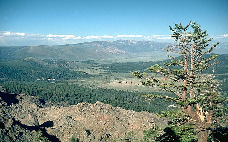
Northern part of Long Valley Caldera, California, United States.
파일 설명[편집]
| 설명 |
English: View is toward the east across the northern part of Long Valley Caldera, California, United States. The caldera rim extends east from the Glass Creek flow (lower left) to Bald Mountain and Glass Mountain in the far distance. Lookout Mountain is behind the tree. |
| 날짜 | 촬영 날짜: 1998년 7월 29일 |
| 출처 | Archived source link |
| 저자 | S.R. Brantley |
| 카메라 위치 | | 이 지역의 다른 사진을 보기: OpenStreetMap |
|---|
라이선스[편집]
|
|
파일 역사
날짜/시간 링크를 클릭하면 해당 시간의 파일을 볼 수 있습니다.
| 날짜/시간 | 섬네일 | 크기 | 사용자 | 설명 | |
|---|---|---|---|---|---|
| 현재 | 2009년 2월 7일 (토) 07:43 | | 800 × 500 (207 KB) | Hike395 (토론 | 기여) | {{Information |Description={{en|1=View is toward the east across the northern part of Long Valley Caldera, California, United States. The caldera rim extends east from the Glass Creek flow (lower left) to Bald Mountain |
이 파일을 덮어쓸 수 없습니다.
이 파일을 사용하는 문서
다음 문서 2개가 이 파일을 사용하고 있습니다:
이 파일을 사용하고 있는 모든 위키의 문서 목록
다음 위키에서 이 파일을 사용하고 있습니다:
- ar.wikipedia.org에서 이 파일을 사용하고 있는 문서 목록
- de.wikipedia.org에서 이 파일을 사용하고 있는 문서 목록
- el.wikipedia.org에서 이 파일을 사용하고 있는 문서 목록
- en.wikipedia.org에서 이 파일을 사용하고 있는 문서 목록
- es.wikipedia.org에서 이 파일을 사용하고 있는 문서 목록
- fr.wikipedia.org에서 이 파일을 사용하고 있는 문서 목록
- he.wikipedia.org에서 이 파일을 사용하고 있는 문서 목록
- id.wikipedia.org에서 이 파일을 사용하고 있는 문서 목록
- ko.wikipedia.org에서 이 파일을 사용하고 있는 문서 목록
- ms.wikipedia.org에서 이 파일을 사용하고 있는 문서 목록
- no.wikipedia.org에서 이 파일을 사용하고 있는 문서 목록
- pl.wikipedia.org에서 이 파일을 사용하고 있는 문서 목록
- ru.wikipedia.org에서 이 파일을 사용하고 있는 문서 목록
- simple.wikipedia.org에서 이 파일을 사용하고 있는 문서 목록
- uk.wikipedia.org에서 이 파일을 사용하고 있는 문서 목록