File:Map of Central Asia with trade routes and movements, von Richthofen.png
둘러보기로 이동
검색으로 이동
미리 보기 크기: 800 × 483 픽셀 다른 해상도: 320 × 193 픽셀 | 640 × 386 픽셀 | 1,024 × 618 픽셀 | 1,280 × 772 픽셀 | 2,034 × 1,227 픽셀
원본 파일 (2,034 × 1,227 픽셀, 파일 크기: 4.8 MB, MIME 종류: image/png)
캡션
설명
이 파일이 나타내는 바에 대한 한 줄 설명을 추가합니다
파일 설명[편집]
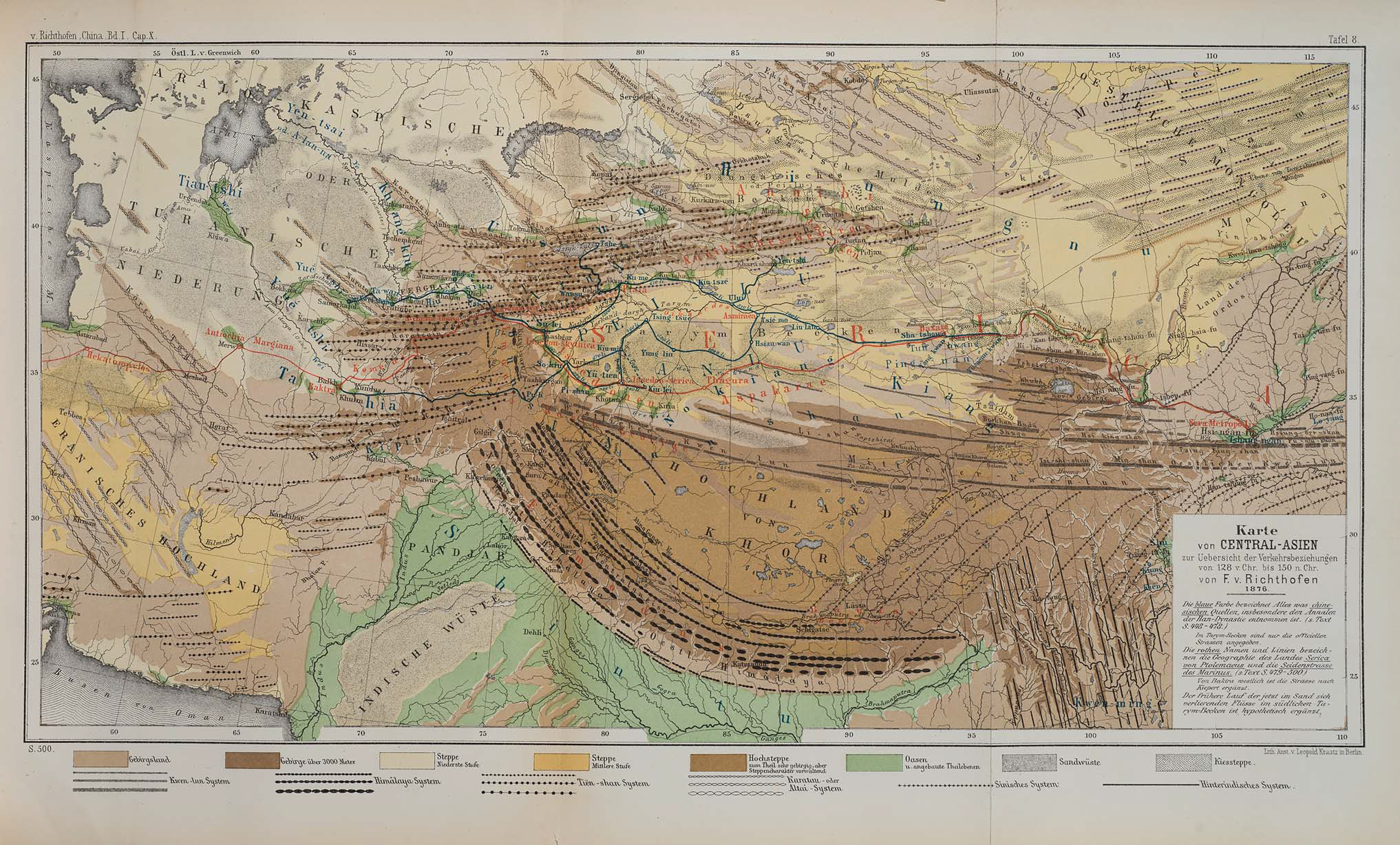
| 설명 | Map of Central Asia for overview of trade routes and movements from 128 BC to 150 AD |
| 날짜 |
Dated 1876 Published 1877 |
| 출처 |
F. von Richthofen (1877). China: Ergebnisse eigener Reisen und darauf gegründeter Studien. Band 1, Einleitender Theil [China: Expedition results and studies based thereupon. Volume 1, Introductory Part]. Berlin: Verlag von Dietrich Reimer. As reproduced in James D. Sidaway & Chih Yuan Woon (2017). Chinese Narratives on “One Belt, One Road” (一带一路) in Geopolitical and Imperial Contexts. The Professional Geographer 69(4), 591-603. doi: 10.1080/00330124.2017.1288576 |
| 저자 | F. von Richthofen (1833–1905) |
| 다른 버전 |
.png)
라이선스[편집]
|
이 작품은 미국, 그리고 저작권 보호 기간이 저작자 사후 100년, 또는 그 이하인 모든 국가에서 퍼블릭 도메인입니다. | |
| 이 저작물은 모든 저작인접권을 포함한 저작권법하의 규제로부터 자유로운 것으로 확인되었습니다. | |
| 주석 | 이 이미지에는 주석이 있습니다: 공용에서 주석을 보기 |
파일 역사
날짜/시간 링크를 클릭하면 해당 시간의 파일을 볼 수 있습니다.
| 날짜/시간 | 섬네일 | 크기 | 사용자 | 설명 | |
|---|---|---|---|---|---|
| 현재 | 2018년 11월 24일 (토) 08:14 | | 2,034 × 1,227 (4.8 MB) | Cold Season (토론 | 기여) | {{Information |Description= Map of Central Asia for overview of trade routes and movements. |Source= Von Richthofen, F. (1877). ''China: Ergebnisse eigener Reisen und darauf gegründeter Studien''. Band 1, Einleitender Theil [China: Expedition results and studies based thereupon. Volume 1, Introductory Part]. Berlin: Verlag von Dietrich Reimer. As reproduced in James D. Sidaway & Chih Yuan Woon (2017) Chinese Narratives on “One Belt, One Road” (一带一路) in Geopolitical and Imperial Contexts, ''T... |
이 파일을 덮어쓸 수 없습니다.
이 파일을 사용하는 문서
다음 문서 2개가 이 파일을 사용하고 있습니다:
이 파일을 사용하고 있는 모든 위키의 문서 목록
다음 위키에서 이 파일을 사용하고 있습니다:
- en.wikipedia.org에서 이 파일을 사용하고 있는 문서 목록
- et.wikipedia.org에서 이 파일을 사용하고 있는 문서 목록
- fa.wikipedia.org에서 이 파일을 사용하고 있는 문서 목록
- he.wikipedia.org에서 이 파일을 사용하고 있는 문서 목록
- ko.wikipedia.org에서 이 파일을 사용하고 있는 문서 목록
- pt.wikipedia.org에서 이 파일을 사용하고 있는 문서 목록
- sl.wikipedia.org에서 이 파일을 사용하고 있는 문서 목록
- th.wikipedia.org에서 이 파일을 사용하고 있는 문서 목록