File:Map of New Netherland (Novi Belgii Novaeque Angliae) by Justus Danckerts c1673.jpg
קפיצה לניווט
קפיצה לחיפוש

גודל התצוגה המקדימה הזאת: 714 × 600 פיקסלים. רזולוציות אחרות: 286 × 240 פיקסלים | 572 × 480 פיקסלים | 915 × 768 פיקסלים | 1,219 × 1,024 פיקסלים | 2,439 × 2,048 פיקסלים | 8,908 × 7,481 פיקסלים.
לקובץ המקורי (8,908 × 7,481 פיקסלים, גודל הקובץ: 9.59 מ"ב, סוג MIME: image/jpeg)
כיתובים
כיתובים
נא להוסיף משפט שמסביר מה הקובץ מייצג
תקציר
[עריכה]_by_Justus_Danckerts_c1673.jpg&action=edit§ion=1)
| תיאור |
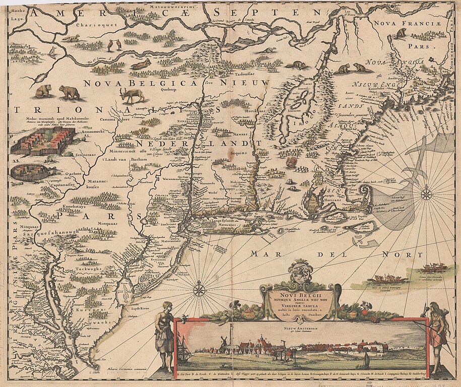
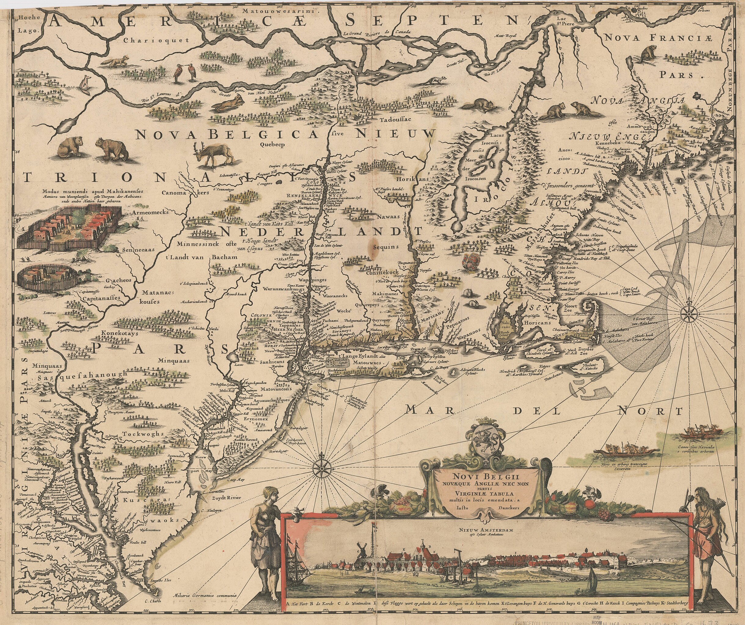
English: Title: Novi Belgii, Novæque Angliæ nec non partis Virginiæ tabula. Map of New Netherland (Nova Belgica - Nieuw Nederlandt). Made by Justus Danckerts in c1673. The first issue of the "Jansson-Visscher series," lacking Philadelphia. Cf. Campbell, T. New light on the Jansson-Visscher maps of New England (In: Map collectors' circle, no. 24), Relief shown pictorially. Place names in Latin and Dutch. Names of Indian tribes. Inset view: Nieuw Amsterdam op't Eylant Manhattans. Publication date from Burden. |
| תאריך יצירה | בסביבות 1673 |
| מקור | Stanford Libraries - https://kurma-monitor-prod.stanford.edu/catalog/princeton-df65vb21k |
| יוצר | Danckerts, Justus, 1635-1701 |
רישיון
[עריכה]_by_Justus_Danckerts_c1673.jpg&action=edit§ion=2)
|
יצירה זו נמצאת בנחלת הכלל במדינת המקור ובמדינות אחרות בהם תקופת זכויות היוצרים היא משך חיי היוצר ו-100 שנה (או פחות) מפטירתו.
| |
| הקובץ הזה זוהה כקובץ חופשי מכל מגבלה ידועה תחת חוק זכויות היוצרים, כולל כל הזכויות הקשורות והסמוכות. | |
היסטוריית הקובץ
ניתן ללחוץ על תאריך/שעה כדי לראות את הקובץ כפי שנראה באותו זמן.
| תאריך/שעה | תמונה ממוזערת | ממדים | משתמש | הערה | |
|---|---|---|---|---|---|
| נוכחית | 09:07, 1 במרץ 2024 | | 7,481 × 8,908 (9.59 מ"ב) | Artanisen (שיחה | תרומות) | Uploaded a work by Danckerts, Justus, 1635-1701 from Stanford Libraries - https://kurma-monitor-prod.stanford.edu/catalog/princeton-df65vb21k with UploadWizard |
אין באפשרותך לדרוס את הקובץ הזה.
שימוש בקובץ
הדפים הבאים משתמשים בקובץ הזה:
.jpg)
_by_Justus_Danckerts_c1673.jpg&oldid=857249424)