File:Operation Albion Map.jpg
קפיצה לניווט
קפיצה לחיפוש
גודל התצוגה המקדימה הזאת: 775 × 600 פיקסלים. רזולוציות אחרות: 310 × 240 פיקסלים | 620 × 480 פיקסלים | 993 × 768 פיקסלים | 1,242 × 961 פיקסלים.
לקובץ המקורי (1,242 × 961 פיקסלים, גודל הקובץ: 311 ק"ב, סוג MIME: image/jpeg)
כיתובים
כיתובים
נא להוסיף משפט שמסביר מה הקובץ מייצג
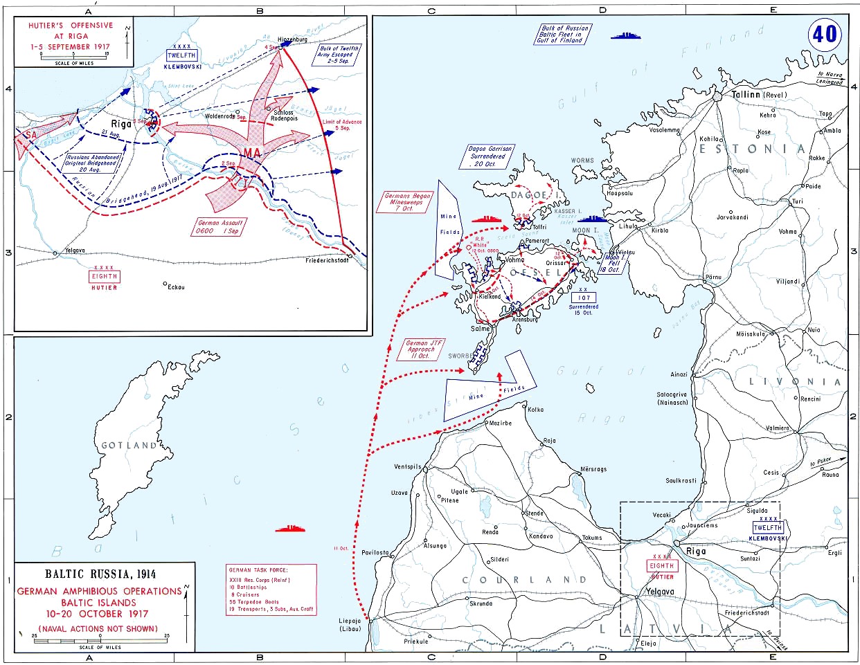
| תיאור | Map showing amphibious operations of Operation Albion, Baltic Islands, 10 - 20 October 1917, and Hutier's Offensive at Riga 1 - 5 September 1917 (inset) | |||
| תאריך יצירה | בסביבות 1938 | |||
| מקור | United States Military Academy Campaign Atlas to the Great War. http://www.dean.usma.edu/history/web03/atlases/WorldWarOne/WWOneJPG/WWOne40.jpg | |||
| יוצר | United States Military Academy | |||
| אישורים והיתרים (שימוש חוזר בקובץ זה) |
|

היסטוריית הקובץ
ניתן ללחוץ על תאריך/שעה כדי לראות את הקובץ כפי שנראה באותו זמן.
| תאריך/שעה | תמונה ממוזערת | ממדים | משתמש | הערה | |
|---|---|---|---|---|---|
| נוכחית | 16:56, 22 בינואר 2012 | | 961 × 1,242 (311 ק"ב) | Hohum (שיחה | תרומות) | Cleanup, made sea blue. |
| 17:49, 4 בפברואר 2009 |  | 961 × 1,242 (198 ק"ב) | Rcbutcher (שיחה | תרומות) | {{Information |Description=Map showing amphibious operations of Operation Albion, Baltic Islands, 10 - 20 October 1917, and Hutiers Offensive at Riga 1 - 5 Septemver 1917 (inset) |Source=United States Military Academy Campaign Atlas to the Great War. http |
אין באפשרותך לדרוס את הקובץ הזה.
שימוש בקובץ
הדף הבא משתמש בקובץ הזה:
שימוש גלובלי בקובץ
אתרי הוויקי השונים הבאים משתמשים בקובץ זה:
- שימוש באתר cs.wikipedia.org
- שימוש באתר da.wikipedia.org
- שימוש באתר en.wikipedia.org
- Operation Albion
- SMS Königsberg (1915)
- SMS Karlsruhe (1916)
- SMS Nürnberg (1916)
- List of wars involving Estonia
- SMS Nautilus (1906)
- SMS Kolberg
- SMS Markgraf
- High Seas Fleet
- Wikipedia:WikiProject Military history/News/June 2013/Book reviews
- Wikipedia:WikiProject Military history/News/October 2017/World War I timeline
- שימוש באתר es.wikipedia.org
- שימוש באתר et.wikipedia.org
- שימוש באתר fr.wikipedia.org
- שימוש באתר he.wikipedia.org
- שימוש באתר hu.wikipedia.org
- שימוש באתר it.wikipedia.org
- שימוש באתר ja.wikipedia.org
- שימוש באתר lv.wikipedia.org
- שימוש באתר nl.wikipedia.org
- שימוש באתר no.wikipedia.org
- שימוש באתר pt.wikipedia.org
- שימוש באתר sv.wikipedia.org
- שימוש באתר tr.wikipedia.org
- שימוש באתר uk.wikipedia.org
- שימוש באתר vi.wikipedia.org
- שימוש באתר www.wikidata.org
- שימוש באתר zh.wikipedia.org