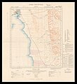
File:Ordnance Survey, Suez (FL35468138 2367587).jpg

לקובץ המקורי (14,288 × 15,558 פיקסלים, גודל הקובץ: 283.79 מ"ב, סוג MIME: image/jpeg)
כיתובים
כיתובים
תקציר
[עריכה]| Warning | The original file is very high-resolution. It might not load properly or could cause your browser to freeze when opened at full size. | Open in ZoomViewer |
|---|
| Suez
( |
||||||||||||||||||||||||
|---|---|---|---|---|---|---|---|---|---|---|---|---|---|---|---|---|---|---|---|---|---|---|---|---|
| אומן |
artist QS:P170,Q548721 |
|||||||||||||||||||||||
| כותרת |
Suez |
|||||||||||||||||||||||
| מפרסם |
Ordnance Survey Office |
|||||||||||||||||||||||
| תיאור |
Suez. |
|||||||||||||||||||||||
| שפה | אנגלית | |||||||||||||||||||||||
| תאריך הוצאה לאור |
1913 date QS:P,+1913-00-00T00:00:00Z/9 |
|||||||||||||||||||||||
| אוסף |
institution QS:P195,Q111677119 |
|||||||||||||||||||||||
| מיקום נוכחי |
institution QS:P195,Q188915 |
|||||||||||||||||||||||
| מיקום הוצאה | סאות'המפטון | |||||||||||||||||||||||
| חיפוש בקטלוג מרחב InfoField | סאות'המפטון | |||||||||||||||||||||||
| הערות |
Surveyed in 1908-9 under arrangements between the War Office and the Survey Department, Egypt. Engraved by W. & A.K. Johnston, Edinburgh and printed at the the War Office 1913. English: Africa. 1:125,000, sheet North H-36 ; O-II | |||||||||||||||||||||||
| קנה מידה InfoField | 1:125,000 cm | |||||||||||||||||||||||
| IE PID InfoField | IE35468136 | |||||||||||||||||||||||
| רוזטה שם קובץ InfoField | FL35468138 | |||||||||||||||||||||||
| מזהה רשומה בספרייה הלאומית (P3959) InfoField | 990023675870205171 | |||||||||||||||||||||||
| מוצג InfoField | סיני – חצי אי אסיאתי בים האדום, על גבול אסיה-אפריקה | |||||||||||||||||||||||
| חיפוש בקטלוג מרחב InfoField | סיני, אנגלית, שרות הסקר והמיפוי הממשלתי של בריטניה | |||||||||||||||||||||||
| חיפוש בקטלוג מרחב InfoField | Sinai peninsulaOrdnance Survey Office | |||||||||||||||||||||||
| מקור/צלם |
|
|||||||||||||||||||||||
| גרסאות אחרות | ||||||||||||||||||||||||
| Jpg / Tif version InfoField |
|
|||||||||||||||||||||||

רישיון
[עריכה]| Public domainPublic domainfalsefalse |
This work created by the United Kingdom Government is in the public domain.
This is because it is one of the following:
HMSO has declared that the expiry of Crown Copyrights applies worldwide (ref: HMSO Email Reply) Deutsch ∙ English ∙ Español ∙ français ∙ italiano ∙ Nederlands ∙ polski ∙ português ∙ sicilianu ∙ slovenščina ∙ suomi ∙ Türkçe ∙ македонски ∙ русский ∙ українська ∙ മലയാളം ∙ 한국어 ∙ 日本語 ∙ 简体中文 ∙ 繁體中文 ∙ العربية ∙ +/− |
 |
היסטוריית הקובץ
ניתן ללחוץ על תאריך/שעה כדי לראות את הקובץ כפי שנראה באותו זמן.
| תאריך/שעה | תמונה ממוזערת | ממדים | משתמש | הערה | |
|---|---|---|---|---|---|
| נוכחית | 21:06, 30 ביולי 2023 |  | 15,558 × 14,288 (283.79 מ"ב) | Geagea (שיחה | תרומות) | pattypan 22.03 |
אין באפשרותך לדרוס את הקובץ הזה.
שימוש בקובץ
הדף הבא משתמש בקובץ הזה:
מטא־נתונים
קובץ זה מכיל מידע נוסף, שכנראה הגיע ממצלמה דיגיטלית או מסורק שבהם הקובץ נוצר או עבר דיגיטציה.
אם הקובץ שונה ממצבו הראשוני, כמה מהנתונים להלן עלולים שלא לשקף באופן מלא את הקובץ הנוכחי.
| התאריך והשעה של הפיכת הקובץ לדיגיטלי | 18:04, 10 באפריל 2016 |
|---|---|
| התאריך והשעה של שינוי הקובץ | 15:44, 19 במאי 2016 |
| תאריך השינוי האחרון של המטא־נתונים | 15:44, 19 במאי 2016 |
| מזהה ייחודי של המסמך המקורי | xmp.did:6C76033CA21DE611816AAB4B47518BDC |
- Files with broken file links
- Large images
- Information field template with formatting
- Files from the National Library of Israel
- Artworks without Wikidata item
- UK Government artistic works
- Eran Laor Cartographic Collection maps/2023 batch
- Eran Laor Cartographic Collection maps/2023 batch/English-language maps
- Uploaded with pattypan


