File:Palestine location map Topographic.png
둘러보기로 이동
검색으로 이동

미리 보기 크기: 521 × 600 픽셀 다른 해상도: 208 × 240 픽셀 | 417 × 480 픽셀 | 667 × 768 픽셀 | 889 × 1,024 픽셀 | 1,393 × 1,604 픽셀
원본 파일 (1,393 × 1,604 픽셀, 파일 크기: 2.97 MB, MIME 종류: image/png)
캡션
설명
이 파일이 나타내는 바에 대한 한 줄 설명을 추가합니다
파일 설명[편집]
| 설명 |
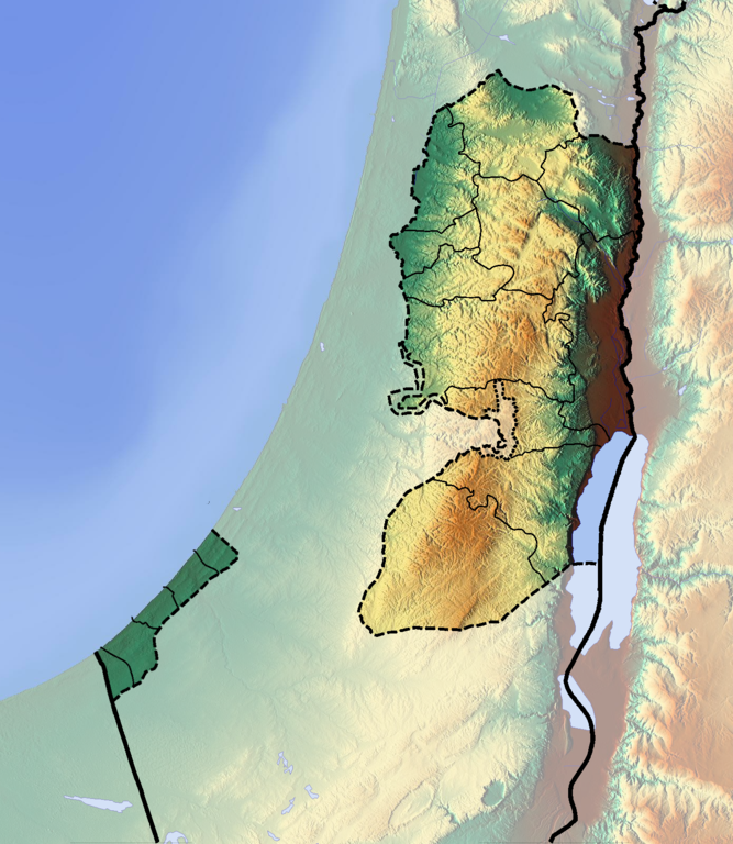
Deutsch: Positionskarte der Palästinensischen Autonomiegebiete bzw. von Westjordanland und Gazastreifen
Quadratische Plattkarte, N-S-Streckung 115 %. Geographische Begrenzung der Karte:
English: Location map of the Palestinian territories (West Bank and Gaza Strip)
Equirectangular projection, N/S stretching 115 %. Geographic limits of the map:
|
| 날짜 | |
| 출처 | 자작 (backgroung : http://www.maps-for-free.com) |
| 저자 | Dr Brains |
라이선스[편집]
나는 아래 작품의 저작권자로서, 이 저작물을 다음과 같은 라이선스로 배포합니다:

|
자유 소프트웨어 재단에서 발행한 GNU 자유 문서 사용 허가서 1.2판의 규정에 따라 본 문서를 복제하거나 개작 및 배포할 수 있습니다. 본 문서에는 변경 불가 부분이 없으며, 앞 표지 구절과 뒷 표지 구절도 없습니다. 본 사용 허가서의 전체 내용은 GNU 자유 문서 사용 허가서 부분에 포함되어 있습니다. | 1.2로만 |
|
|
GNU 자유 문서 사용 허가서 1.3판 또는 자유 소프트웨어 재단에서 발행한 이후 판의 규정에 따라 본 문서를 복제하거나 개작 및 배포할 수 있습니다. 본 문서에는 변경 불가 부분이 없으며, 앞 표지 구절과 뒷 표지 구절도 없습니다. 본 사용 허가서의 전체 내용은 GNU 자유 문서 사용 허가서 부분에 포함되어 있습니다.
|
이 파일의 라이선스 갱신은 숙련된 사용자가 확인해야 합니다. 확인하려면 이 글을 클릭해주십시오.
|
이 라이선스 중에서 목적에 맞는 것을 선택하여 사용할 수 있습니다.
파일 역사
날짜/시간 링크를 클릭하면 해당 시간의 파일을 볼 수 있습니다.
| 날짜/시간 | 섬네일 | 크기 | 사용자 | 설명 | |
|---|---|---|---|---|---|
| 현재 | 2012년 6월 16일 (토) 10:05 | | 1,393 × 1,604 (2.97 MB) | Dr Brains (토론 | 기여) |
이 파일을 덮어쓸 수 없습니다.
이 파일을 사용하는 문서
다음 문서 18개가 이 파일을 사용하고 있습니다:
- User:Dr Brains/Gallery
- User:Dr Brains/Gallery/Maps
- Category:1995 in the State of Palestine
- Category:1997 in the State of Palestine
- Category:1998 in the State of Palestine
- Category:Alumni by university or college in the State of Palestine
- Category:Bridges in the State of Palestine
- Category:Caves in the State of Palestine
- Category:Churches in the State of Palestine
- Category:Museums in the State of Palestine
- Category:Nature of the State of Palestine
- Category:Palestine by decade
- Category:Palestine in the 1990s
- Category:Palestine in the 20th century
- Category:Springs of Palestine
- Category:Streets in the State of Palestine
- Category:Tunnels in Palestine
- Category:Water in the State of Palestine
이 파일을 사용하고 있는 모든 위키의 문서 목록
다음 위키에서 이 파일을 사용하고 있습니다:
- als.wikipedia.org에서 이 파일을 사용하고 있는 문서 목록
- ar.wikipedia.org에서 이 파일을 사용하고 있는 문서 목록
- cs.wikipedia.org에서 이 파일을 사용하고 있는 문서 목록
- da.wikipedia.org에서 이 파일을 사용하고 있는 문서 목록
- de.wikivoyage.org에서 이 파일을 사용하고 있는 문서 목록
- dsb.wikipedia.org에서 이 파일을 사용하고 있는 문서 목록
- eo.wikipedia.org에서 이 파일을 사용하고 있는 문서 목록
- Cisjordanio
- Gazaa Sektoro
- Palestina aŭtonomio
- Organizaĵo por Liberigo de Palestino
- Jenin
- Moskeo Al-Aksa
- Ŝablono:Situo sur mapo Palestino
- Ortodoksa Eklezio de Jerusalemo
- Universitato de Nablus
- Qabatiya
- Palestiniaj teritorioj
- Ŝtato Palestino
- Universitato Bir Zeit
- Universitato Al-Kuds
- Beit Ĥanina
- Universitato de Betleĥem
- Universitato Al-Azhar en Gazao
- Islama Universitato en Gazao
- Hospitalo Al-Ŝifa
- Tombo de Jozefo
- Palestina Leĝdona Konsilio
- Aj (Biblio)
- es.wikipedia.org에서 이 파일을 사용하고 있는 문서 목록
- frr.wikipedia.org에서 이 파일을 사용하고 있는 문서 목록
- fr.wikipedia.org에서 이 파일을 사용하고 있는 문서 목록
- fy.wikipedia.org에서 이 파일을 사용하고 있는 문서 목록
- hsb.wikipedia.org에서 이 파일을 사용하고 있는 문서 목록
이 파일의 더 많은 사용 내역을 봅니다.