File:Rand McNally & Co. (Chicago), Lands of the sojourn and wandering of the Israelites Period of about 1700 to 1270 B.C (FL36587309 3917023).jpg
קפיצה לניווט
קפיצה לחיפוש

גודל התצוגה המקדימה הזאת: 460 × 600 פיקסלים. רזולוציות אחרות: 184 × 240 פיקסלים | 368 × 480 פיקסלים | 589 × 768 פיקסלים | 785 × 1,024 פיקסלים | 2,558 × 3,335 פיקסלים.
לקובץ המקורי (2,558 × 3,335 פיקסלים, גודל הקובץ: 4.53 מ"ב, סוג MIME: image/jpeg)
כיתובים
כיתובים
נא להוסיף משפט שמסביר מה הקובץ מייצג
תקציר
[עריכה]| ראנד מקנלי: Lands of the sojourn and wandering of the Israelites Period of about 1700 to 1270 B.C
( |
||||||||||||||||||||||||
|---|---|---|---|---|---|---|---|---|---|---|---|---|---|---|---|---|---|---|---|---|---|---|---|---|
| אומן |
|
|||||||||||||||||||||||
| כותרת |
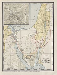
Lands of the sojourn and wandering of the Israelites Period of about 1700 to 1270 B.C |
|||||||||||||||||||||||
| מפרסם |
Rand McNally & Company |
|||||||||||||||||||||||
| תיאור |
Lands of the sojourn and wandering of the Israelites Period of about 1700 to 1270 B.C. Rand McNally & Co. Engr's, Chicago. |
|||||||||||||||||||||||
| שפה | אנגלית | |||||||||||||||||||||||
| תאריך הוצאה לאור | 1938 | |||||||||||||||||||||||
| טכניקה | 1 online resource (1 map). | |||||||||||||||||||||||
| אוסף |
|
|||||||||||||||||||||||
| מיקום נוכחי |
|
|||||||||||||||||||||||
| מיקום הוצאה | New York Chicago San Francisco | |||||||||||||||||||||||
| חיפוש בקטלוג מרחב | New York Chicago San Francisco | |||||||||||||||||||||||
| הערות | Digital image of the original in Amir Cahanovitc Collection, Israel. ACC 610-4.; Digital image received from donor.; From: Rand McNally historical atlas of the Holy Land.; Inset: Vicinity of mount Sinai. | |||||||||||||||||||||||
| IE PID | IE36587307 | |||||||||||||||||||||||
| רוזטה שם קובץ | FL36587309 | |||||||||||||||||||||||
| מזהה רשומה בספרייה הלאומית (P3959) | 990039170230205171 | |||||||||||||||||||||||
| חיפוש בקטלוג מרחב | אנגלית, ראנד מקנלי | |||||||||||||||||||||||
| חיפוש בקטלוג מרחב | Exodus, TheMapsRand McNally & Company | |||||||||||||||||||||||
| מקור/צלם |
|
|||||||||||||||||||||||
| גרסאות אחרות | ||||||||||||||||||||||||
| Jpg / Tif version |
|
|||||||||||||||||||||||


,_Lands_of_the_sojourn_and_wandering_of_the_Israelites_Period_of_about_1700_to_1270_B.C_(FL36587309_3917023).jpg)

,_Lands_of_the_sojourn_and_wandering_of_the_Israelites_Period_of_about_1700_to_1270_B.C_(FL36587309_3917023).jpg&action=edit§ion=1)
רישיון
[עריכה],_Lands_of_the_sojourn_and_wandering_of_the_Israelites_Period_of_about_1700_to_1270_B.C_(FL36587309_3917023).jpg&action=edit§ion=2)
This work is in the public domain because it was published in the United States between 1929 and 1963, and although there may or may not have been a copyright notice, the copyright was not renewed. For further explanation, see Commons:Hirtle chart and the copyright renewal logs. Note that it may still be copyrighted in jurisdictions that do not apply the rule of the shorter term for US works (depending on the date of the author's death), such as Canada (70 years p.m.a.), Mainland China (50 years p.m.a., not Hong Kong or Macao), Germany (70 years p.m.a.), Mexico (100 years p.m.a.), Switzerland (70 years p.m.a.), and other countries with individual treaties.
|
 |
היסטוריית הקובץ
ניתן ללחוץ על תאריך/שעה כדי לראות את הקובץ כפי שנראה באותו זמן.
| תאריך/שעה | תמונה ממוזערת | ממדים | משתמש | הערה | |
|---|---|---|---|---|---|
| נוכחית | 21:35, 3 בספטמבר 2023 | | 3,335 × 2,558 (4.53 מ"ב) | Geagea (שיחה | תרומות) | pattypan 22.03 |
אין באפשרותך לדרוס את הקובץ הזה.
שימוש בקובץ
הדף הבא משתמש בקובץ הזה:
,_Lands_of_the_sojourn_and_wandering_of_the_Israelites_Period_of_about_1700_to_1270_B.C_(FL36587309_3917023).jpg&oldid=798244722)