File:Tirah Campaign map.jpg
קפיצה לניווט
קפיצה לחיפוש

גודל התצוגה המקדימה הזאת: 800 × 509 פיקסלים. רזולוציות אחרות: 320 × 204 פיקסלים | 640 × 407 פיקסלים | 1,024 × 652 פיקסלים | 1,280 × 815 פיקסלים | 1,656 × 1,054 פיקסלים.
לקובץ המקורי (1,656 × 1,054 פיקסלים, גודל הקובץ: 362 ק"ב, סוג MIME: image/jpeg)
כיתובים
כיתובים
נא להוסיף משפט שמסביר מה הקובץ מייצג
תקציר
[עריכה]| תיאור |
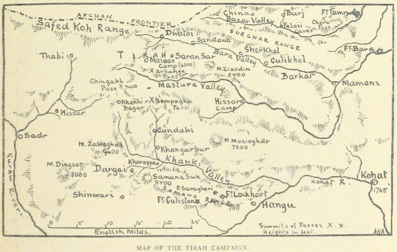
English: A map of places and battles in the 1897-1898 Tirah Campaign. |
||
| תאריך יצירה | |||
| מקור |
From page 525 of the 1899 book 'The Wars of the 'Nineties. A history of the warfare of the last ten years of the nineteenth century ... With ... illustrations ... and plans by the author'. Uploaded by the British Library to Flickr here. Cropped.
|
||
| יוצר | Andrew Hilliard Atteridge |

רישיון
[עריכה]
|
יצירה זו נמצאת בנחלת הכלל במדינת המקור ובמדינות אחרות בהם תקופת זכויות היוצרים היא משך חיי היוצר ו-70 שנה (או פחות) מפטירתו.
This work is in the public domain in the United States because it was published (or registered with the U.S. Copyright Office) before January 1, 1929. | |
| הקובץ הזה זוהה כקובץ חופשי מכל מגבלה ידועה תחת חוק זכויות היוצרים, כולל כל הזכויות הקשורות והסמוכות. | |
היסטוריית הקובץ
ניתן ללחוץ על תאריך/שעה כדי לראות את הקובץ כפי שנראה באותו זמן.
| תאריך/שעה | תמונה ממוזערת | ממדים | משתמש | הערה | |
|---|---|---|---|---|---|
| נוכחית | 20:58, 14 במרץ 2016 | | 1,054 × 1,656 (362 ק"ב) | Howicus (שיחה | תרומות) | User created page with UploadWizard |
אין באפשרותך לדרוס את הקובץ הזה.
שימוש בקובץ
אין דפים המשתמשים בקובץ זה.
שימוש גלובלי בקובץ
אתרי הוויקי השונים הבאים משתמשים בקובץ זה:
- שימוש באתר de.wikipedia.org
- שימוש באתר en.wikipedia.org
- שימוש באתר he.wikipedia.org