File:Txu-oclc-6614368-nk50-7.jpg
קפיצה לניווט
קפיצה לחיפוש
גודל התצוגה המקדימה הזאת: 790 × 600 פיקסלים. רזולוציות אחרות: 316 × 240 פיקסלים | 632 × 480 פיקסלים | 1,011 × 768 פיקסלים | 1,280 × 972 פיקסלים | 2,560 × 1,944 פיקסלים | 5,000 × 3,797 פיקסלים.
לקובץ המקורי (5,000 × 3,797 פיקסלים, גודל הקובץ: 4.75 מ"ב, סוג MIME: image/jpeg)
כיתובים
כיתובים
נא להוסיף משפט שמסביר מה הקובץ מייצג
תקציר
[עריכה]
| תיאור |
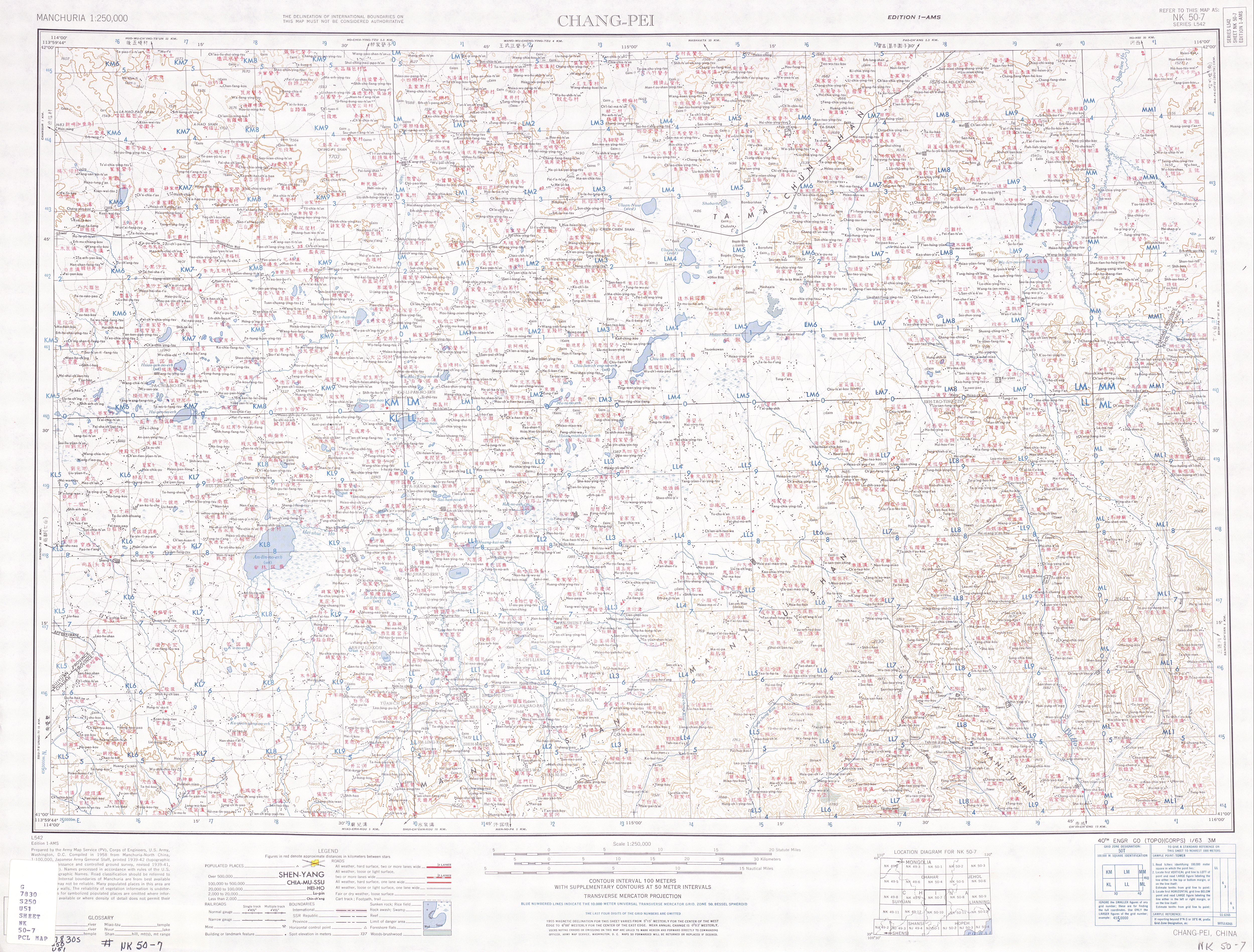
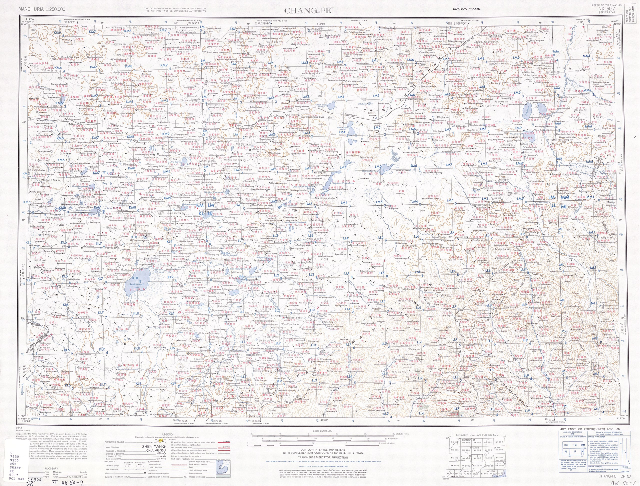
English: Manchuria AMS Topographic Maps |
| תאריך יצירה | |
| מקור | http://legacy.lib.utexas.edu/maps/ams/manchuria/ |
| יוצר | Army Map Service, Corps of Engineers |
רישיון
[עריכה]
This image or file is a work of a U.S. Army Corps of Engineers soldier or employee, taken or made as part of that person's official duties. As a work of the U.S. federal government, the image is in the public domain.
|
היסטוריית הקובץ
ניתן ללחוץ על תאריך/שעה כדי לראות את הקובץ כפי שנראה באותו זמן.
| תאריך/שעה | תמונה ממוזערת | ממדים | משתמש | הערה | |
|---|---|---|---|---|---|
| נוכחית | 10:47, 12 בספטמבר 2019 | | 3,797 × 5,000 (4.75 מ"ב) | Geographyinitiative (שיחה | תרומות) | User created page with UploadWizard |
אין באפשרותך לדרוס את הקובץ הזה.
שימוש בקובץ
אין דפים המשתמשים בקובץ זה.
שימוש גלובלי בקובץ
אתרי הוויקי השונים הבאים משתמשים בקובץ זה:
- שימוש באתר en.wikipedia.org
- שימוש באתר he.wikipedia.org