Manchester
Mine navigeerimisribale
Mine otsikasti

major city in Greater Manchester, England, UK         | |||||
| Laadi fail üles | |||||
| Hääldus | |||||
|---|---|---|---|---|---|
| Üksikjuht nähtusest | |||||
| Asukoht |
| ||||
| Asukoht veekogus või selle kaldal | |||||
| Ametlik keel | |||||
| Asutamise või loomise aeg |
| ||||
| Rahvaarv |
| ||||
| Pindala |
| ||||
| Kõrgus merepinnast |
| ||||
| Mitte segamini ajada | |||||
| koduleht | |||||
 | |||||
Maps
[vajehta]Main categories:
- Maps of Greater Manchester (the metropolitan county)
- Maps of the City of Manchester (the borough within Greater Manchester)
- Maps of Manchester (the city centre area within the borough)
-
 The metropolitan county of Greater Manchester
 -
 The City of Manchester within Greater Manchester
 -
 The City of Manchester council wards
 -
 Manchester Central (UK parliament constituency)
 -
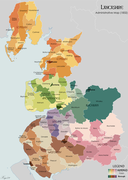
 The City of Manchester boundary
 -
 Map of central Manchester


.png)
_2018.png)


Symbols
[vajehta]kategooriat: Symbols of Manchester
-
 Coat of arms of Manchester City Council
 -
 Manchester coat of arms on the Dawson Street Bridge, Castlefield
 -
 Manchester coat of arms on the Town Hall entrance
 -
 Manchester coat of arms inside the Town Hall
 -
 Manchester bees emblem
 -
 Manchester bee emblem on the Town Hall mosaic floor
 -
 Manchester bee emblem on a street bollard
 -
 Flag of Manchester


.png)


History
[vajehta]kategooriat: History of the City of Manchester
-
 Map of Roman Manchester
 -
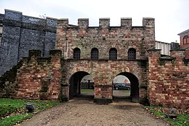 The Roman fort of Mamucium
 -
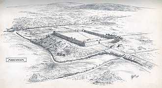 Illustration of the Roman fort of Mamucium
 -
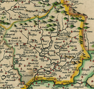 John Speed map of the Salford Hundred (1610)
 -
 Opening of the Bridgewater Canal (1761)
 -
 1832 map of the county of Lancashire
 -
 The Peterloo Massacre (1819)
 -
 Liverpool and Manchester Railway (1831)
 -
 McConnel & Company cotton mills (c.1820)
 -
 1880 view of Manchester from Kersal Moor
 -
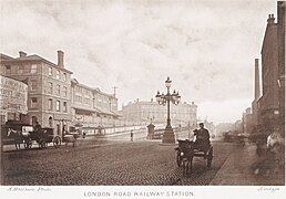 London Road Railway Station (c. 1868)
 -
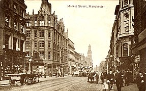 Market Street, 1890s
 -
 Old Town Hall
 -
 New Town Hall, Albert Square (1891)
 -
 Royal Infirmary and Piccadilly (1905)
 -
 Assize Courts
 -
 The Manchester Blitz (1941)
 -
 The Manchester Baby electronic computer


.jpg)


%27_(11213199943).jpg)

.jpg)


Views of Manchester
[vajehta]-
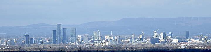
 Manchester Skyline
 -
 View of Manchester from Pendlebury
 -
 Manchester & Salford skyline
 -
 view of Manchester from Alderley Edge
 -
 Great Jackson Street
 -
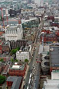
 Aerial photograph of Manchester
 -
 central


.jpg)
Architecture and landmarks
[vajehta]kategooriat: Buildings in the City of Manchester
-
 Manchester Town Hall
 -
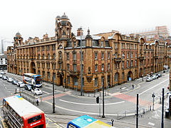
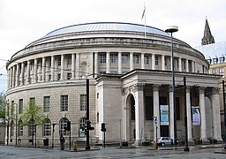 Manchester Central Library
 -
 Manchester Central Library
 -
 Terrac3ed houses in Ancoats
 -
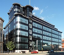
 ISIS Wharf Tower
 -
 Manchester skyline by night
 -
 Beetham Tower
 -
 Piccadilly Gardens
 -
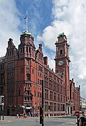
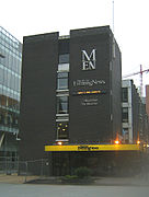 Manchester Evening News
 -
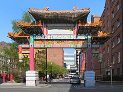 Chinatown
 -
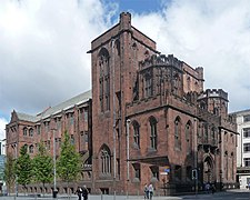
 Manchester Cathedral
 -
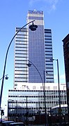 CIS Tower
 -
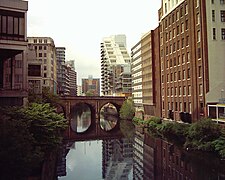 River Irwell
 -
 Deansgate
 -
 London Road Fire Station
 -
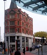
 Sinclair's Oyster Bar
 -
 The Palace Hotel
 -
 Watts Warehouse
 -
 John Rylands Library
 -
 Daily Express Building
 -
 Universtity Of Manchester Whitworth Hall
 -
 Gorton Monastery
 -
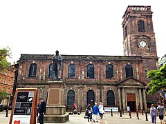 St Anne's Church
 -
 Church of the Holy Name
 -
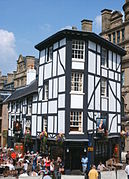
 The Hidden Gem
 -
 CornerHouse
 -
 Royal Exchange
 -
 Corn Exchange


.jpeg)


.jpg)


Art and culture
[vajehta]kategooriat: Culture of the City of Manchester
Theatre and music
[vajehta]-
 Royal Exchange Theatre
 -
 The Hallé Orchestra
 -
 The Bridgewater Hall
 -
 The Ardwick Apollo
 -
 The Manchester Academy
 -
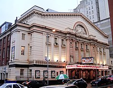 The Manchester Opera House


Madchester
[vajehta]-
 The Stone Roses
 -
 The Happy Mondays
 -
 The Charlatans
 -
 James
James -
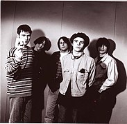
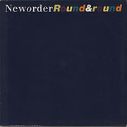 New Order
.jpg)

.jpg)
.jpg)

Sport
[vajehta]-
 Inside the Etihad Stadium

Transport
[vajehta]kategooriat: Transport in Manchester
Bus
[vajehta]-
 SELNEC bus
 -
 Greater Manchester Transport bus (1970s)
 -
 GM Buses bus
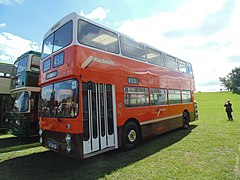
 -
 GM Buses South bus
 -

-
 Stagecoach Manchester bus
 -
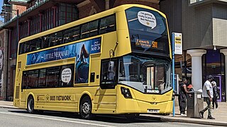 Bee Network bus
,_SELNEC_40_event.jpg)
_1971_Daimler_Fleetline_Park_Royal,_10_April_2010_(1).jpg)

.jpg)
,_13_April_2009.jpg)
,_25_July_2008.jpg)
.jpg)
Rail
[vajehta]-
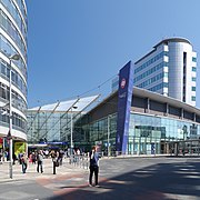 Manchester Picadilly Station
 -
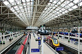 Manchester Picadilly Station
 -
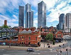
 Manchester Victoria station
 -
 Manchester Victoria station
 -
 Manchester Oxford Road station
 -
 Deansgate station
 -
 Manchester Central station (closed 1969)


Tram
[vajehta]Põhigalerii: Manchester Metrolink.
-
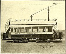 Manchester Corporation Tramways (1901-1949)
 -
 Metrolink map
 -
 Metrolink tram system
 -
 Metrolink trams at Victoria
 -
 St Peter's Square tram stop
_(14780912523).jpg)

.JPG)

.jpg)