Category:North Africa
(Weitergeleitet von North Africa)
Region in Afrika  | |||||
| Medium hochladen | |||||
| Ist ein(e) | |||||
|---|---|---|---|---|---|
| Ist Teil von | |||||
| Ort | Afrika, Südhalbkugel | ||||
| Besteht aus | |||||
 | |||||
English: North Africa — the geographic and political region of Africa.
- For the natural history region in North Africa, see main Category: Northern Africa and its subcategories.
Français : Afrique du Nord.
日本語: 北アフリカ.
Magyar: Észak-Afrika.
العربية: تصنيف:شمال أفريقيا.
Unterkategorien
Es werden 19 von insgesamt 19 Unterkategorien in dieser Kategorie angezeigt:
In Klammern die Anzahl der enthaltenen Kategorien (K), Seiten (S), Dateien (D)
Medien in der Kategorie „North Africa“
Folgende 67 Dateien sind in dieser Kategorie, von 67 insgesamt.
-
 Atlas-Mountains-Labeled-2.jpg 3.755 × 1.884; 1,25 MB
-
 Atlasgebergte.jpg 953 × 517; 129 KB
-
 2009-12-2 Scabbard Decorative Element, Barbary Coast (5039283134).jpg 3.264 × 2.448; 1,43 MB
-
 2009-12-2 Sword, Hilt, Barbary Coast (5039283130).jpg 3.264 × 2.448; 1,72 MB
-
 2009-12-2 Sword, Scabbard, Barbary Coast (5039283126).jpg 3.264 × 1.524; 457 KB
-
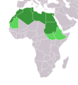
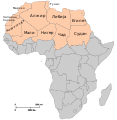
 Flags map of Maghreb.svg 512 × 326; 60 KB
-
 Almohad Dynasty.jpg 985 × 691; 145 KB
-
 Ancient Roman settlements.jpg 2.736 × 2.736; 1,23 MB
-
 Berber States 1058.png 1.200 × 729; 248 KB
-
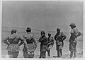
 Bersaglieri entering Mersa Matruh.jpg 1.646 × 1.363; 240 KB
-
-
 Empty Cicada shell.jpg 1.920 × 1.080; 640 KB
-
 ENSA Maroc.png 1.430 × 802; 652 KB
-
 Europe outline map.png 1.817 × 1.120; 299 KB
-
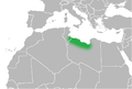
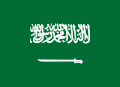
 Flag used by Egypt and Tlemcen.png 2.160 × 1.620; 173 KB
-
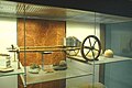 Garamanate Chariot reconstruction Tripoli Museum.jpg 2.025 × 1.349; 203 KB
-
 U.S. POLICY CHALLENGES IN NORTH AFRICA (IA gov.gpo.fdsys.CHRG-110hhrg35873).pdf 1.275 × 1.650, 34 Seiten; 611 KB
-
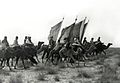 Hilalians Bedouins.jpg 372 × 256; 20 KB
-

-
 Images-Maroc-vert.jpg 377 × 97; 22 KB
-
 Italian officers surveying the terrain at Al Alamein.jpg 2.128 × 1.511; 311 KB
-
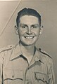 JBH in 1942 - North Africa.jpg 908 × 1.348; 134 KB
-
 Karte der Länder Nordafrikas.png 360 × 392; 10 KB
-
 Libyan Desert-Flash floods 3.jpg 3.872 × 2.592; 4,27 MB
-
 Logo noir SHNA.png 1.080 × 1.080; 142 KB
-
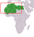
 Insurgency Maghreb.png 476 × 281; 10 KB
-
 Main migrations and population movements in North Africa.jpg 1.000 × 592; 80 KB
-
 Malte guisolphe.jpg 945 × 1.394; 810 KB
-
 Mamluk Sultanate.JPG 1.357 × 628; 40 KB
-
 Map of Levantine Sea (location).png 2.655 × 2.244; 282 KB
-
 Map of Marmarica.png 918 × 623; 55 KB
-
 Map of Phasania.png 918 × 623; 55 KB
-
 Map of Syrtica.png 918 × 623; 60 KB
-
 Marché de gros aux poissons MAROC.jpg 450 × 338; 79 KB
-
 Melilla 1909.jpg 2.249 × 1.390; 978 KB
-
 MENA.png 700 × 400; 86 KB
-
 Middle Atlas Tribes.png 530 × 447; 285 KB
-
 Middle East Satellite Television Dishes.jpg 4.320 × 3.240; 5,05 MB
-
 Milwaukee Public Museum February 2023 22 (Africa--Northern Africa).jpg 6.000 × 4.000; 6,13 MB
-

-

-
 Milwaukee Public Museum February 2023 25 (Africa--Northern Africa).jpg 6.000 × 4.000; 6,28 MB
-
 Milwaukee Public Museum February 2023 26 (Africa--Northern Africa).jpg 6.000 × 4.000; 5,94 MB
-
 Morocco Y-DNA.png 299 × 324; 14 KB
-
 Nicholas Andriani in Morocco.jpg 4.898 × 3.265; 282 KB
-
 Nordafrica.png 360 × 392; 14 KB
-
 North Africa (definitions).png 6.460 × 3.403; 1,3 MB
-
 North Africa (MODIS 2019-07-21).jpg 7.970 × 6.416; 2,26 MB
-
 North Africa, from the "Physical And Political Map Of Africa ... 1822".png 1.905 × 791; 2,88 MB
-
 North-africa-map.jpg 805 × 468; 152 KB
-
 NorthAfricanAdmixtureIberianPeninsula.jpg 968 × 597; 136 KB
-
 Nude North African Girl.png 237 × 278; 169 KB
-
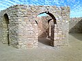 Old city, Sebha, Libya.jpg 2.048 × 1.536; 579 KB
-
 Political map of North Africa according UN mk.svg 1.200 × 1.230; 58 KB
-
 Political map of North Africa mk.svg 1.200 × 1.230; 59 KB
-
 Progetto Ægea - AEgea Project - FIAT EMEA CAR.jpg 1.534 × 1.132; 513 KB
-

-
 Saadiantombs.jpg 2.197 × 1.533; 1,46 MB
-
 Sheikh Abdus Salam al-Asmar al-Faituri plaque.jpg 3.872 × 2.592; 3,81 MB
-
 Shrine of 70 Sahaba before destruction.jpg 3.872 × 2.592; 4,28 MB
-
 Tamazgha 01.png 334 × 164; 18 KB
-
 The Todgha Gorges.jpg 5.184 × 3.456; 4,69 MB
-
 Tunis, North Africa ESA0.jpg 3.840 × 2.880; 11,65 MB
-
 UNAF-Map.svg 550 × 550; 194 KB
-
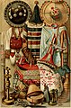 Völkerkunde (1885) (14595343869).jpg 2.122 × 3.218; 1,22 MB
-
 Área de Difusión MBC 4.gif 800 × 582; 130 KB
-
 ⴰⴽⵓⵏⴰⴹ ⵎⵓⵃⴰⵎⴰⴷ ⴳ ⵉⵙⵏⵉ ⵏ ⵓⵔⵖ.jpg 576 × 710; 117 KB


.jpg)
.jpg)
.jpg)


.png)


.jpg)
.jpg)
.jpg)
.jpg)
.jpg)


.png)
.jpg)


_(14595343869).jpg)

