Servian Wall
跳至導覽
跳至搜尋

Map of Rome with the Servian Wall (in red) and it's gates
The Servian Wall (in Latin: Murus Servii Tullii) was a defensive barrier constructed around the city of Rome in the early 4th century BC. The wall was 3.6 m thick, 11 km long, and had more than a dozen gates.
da Nord a Sud
[編輯]nord est
[編輯]-

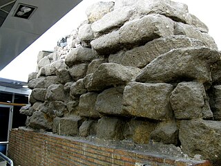
Large part of the Servian Wall near Termini station (Esquilino)
-

near Termini station
-
 In Termini station, external side
 -
 In Termini station, side against the agger
 -

between Quirinale and Trajan's Forum
-
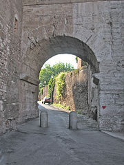
 Porta Esquilina, as rebuild by August. Remodelled in 262 as Arch of Gallienus
 -
Porta Caelimontana, near Colosseum


sud est
[編輯]-
 wall on the Aventine hill
 -
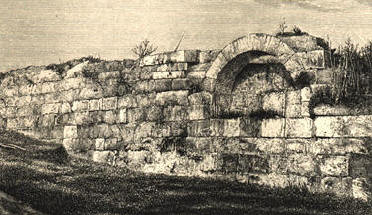
drawing of remains on the Aventine hill
-

the same, today
-

bastione, under modern buildings


nord ovest
[編輯]-

a via Salandra (left)
-

mura serviane tagliate a via Salandra per aprire via Carducci
-

a via Salandra (right)


