Category:Aldermaston Wharf
Aller à la navigation
Aller à la recherche
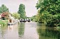
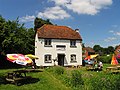
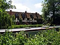
English: Aldermaston Wharf is a small settlement situated north-northwest of Aldermaston in the West Berkshire district, part of the English county of Berkshire. The Kennet and Avon Canal and Great Western Railway pass through it and Aldermaston railway station and Aldermaston Lock are located here. The A4 road runs just to the north of the village. Aldermaston Wharf Visitor Centre owned by British Waterways has a cafe and a canal cottage furnished to the period of the canal's construction.
village britannique  | |||||
| Téléverser des médias | |||||
| Nature de l’élément | |||||
|---|---|---|---|---|---|
| Lieu | West Berkshire, Berkshire, Angleterre du Sud-Est, Angleterre | ||||
 | |||||
Sous-catégories
Cette catégorie comprend 5 sous-catégories, dont les 5 ci-dessous.
A
- Aldermaston Lift Bridge (6 F)
- Aldermaston Lock (6 F)
P
- Padworth crossing, Berkshire (1 F)
R
- Aldermaston railway station (10 F)
T
- Towney Lock (5 F)
Média dans la catégorie « Aldermaston Wharf »
Cette catégorie comprend 36 fichiers, dont les 36 ci-dessous.
-
 ABC Boat Hire fleet at Aldermaston wharf - geograph.org.uk - 5849199.jpg 3 744 × 1 961 ; 1,99 Mio
-
 Admoor Bridge - geograph.org.uk - 794111.jpg 640 × 480 ; 136 kio
-
 Alder Bridge school - geograph.org.uk - 1189204.jpg 640 × 426 ; 193 kio
-
 Aldermastom Wharf - geograph.org.uk - 4126540.jpg 3 416 × 2 270 ; 1,39 Mio
-
 Aldermaston Gravel pits - geograph.org.uk - 71868.jpg 560 × 420 ; 33 kio
-
 Aldermaston Wharf - geograph.org.uk - 1189190.jpg 640 × 427 ; 162 kio
-
 Aldermaston Wharf - geograph.org.uk - 127660.jpg 640 × 418 ; 142 kio
-
 Aldermaston Wharf - geograph.org.uk - 127661.jpg 640 × 418 ; 126 kio
-
 Aldermaston Wharf - geograph.org.uk - 127924.jpg 640 × 418 ; 61 kio
-
 Aldermaston Wharf - geograph.org.uk - 19835.jpg 640 × 480 ; 445 kio
-
 Aldermaston Wharf - geograph.org.uk - 2375554.jpg 1 024 × 683 ; 124 kio
-
 Aldermaston Wharf - geograph.org.uk - 4126536.jpg 3 456 × 2 592 ; 3,88 Mio
-
 Aldermaston Wharf - geograph.org.uk - 4894706.jpg 640 × 388 ; 52 kio
-
 Aldermaston Wharf Village Name sign - geograph.org.uk - 4387125.jpg 2 253 × 2 995 ; 3,01 Mio
-
 Aldermaston Wharf, Residences - geograph.org.uk - 19843.jpg 640 × 480 ; 525 kio
-
 AldermastonWharfTouristInformation.JPG 1 224 × 1 632 ; 565 kio
-
 Butt Inn, Aldermaston Wharf - geograph.org.uk - 859134.jpg 600 × 469 ; 70 kio
-
 Byway to Beenham Grange - geograph.org.uk - 1573496.jpg 640 × 480 ; 130 kio
-
 Canal towpath, Aldermaston Wharf - geograph.org.uk - 3997323.jpg 1 280 × 851 ; 365 kio
-
 CanalCottageRecreationAldermastonWharf.JPG 1 632 × 1 224 ; 420 kio
-
 George V postbox - geograph.org.uk - 1189171.jpg 425 × 640 ; 189 kio
-
 Kennet and Avon Canal - geograph.org.uk - 599147.jpg 640 × 444 ; 131 kio
-
 Kennet and Avon Canal west of Aldermaston - geograph.org.uk - 332969.jpg 640 × 477 ; 122 kio
-
 New houses, Aldermaston Wharf - geograph.org.uk - 1776056.jpg 640 × 427 ; 89 kio
-
 Outbuilding (4727730977).jpg 1 524 × 1 350 ; 1,48 Mio
-

-
 Padworth Lock at Aldermaston Wharf - geograph.org.uk - 19838.jpg 640 × 480 ; 431 kio
-
 Padworth Lock, Kennet and Avon Navigation - geograph.org.uk - 392615.jpg 640 × 483 ; 132 kio
-
 The Kennet and Avon Canal, Aldermaston - geograph.org.uk - 1776026.jpg 640 × 480 ; 159 kio
-
 Towney Bridge - geograph.org.uk - 332795.jpg 640 × 477 ; 109 kio
-

-
 Wharf Cottages - geograph.org.uk - 1189178.jpg 640 × 426 ; 181 kio
-
 WharfCottageAldermaston.JPG 1 632 × 1 224 ; 396 kio
-
 Aldermaston trout farm - geograph.org.uk - 1189230.jpg 640 × 427 ; 187 kio
-
 Aldermaston Wharf Farmland - geograph.org.uk - 5016.jpg 640 × 480 ; 489 kio
-
 Farmland near Aldermaston and Woolhampton - geograph.org.uk - 19846.jpg 640 × 480 ; 493 kio


.jpg)
_Swing_Bridge,_Kennet_and_Avon_Canal_-_geograph.org.uk_-_392587.jpg)


