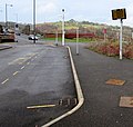
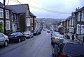
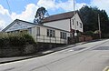
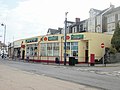
Category:Bargoed
Aller à la navigation
Aller à la recherche
Български: 300px|мини|Главната улица на Баргойд
Cymraeg: Mae Bargod (defnyddir yr enw Bargoed gan siaradwyr Cymraeg hefyd) yn dref ar lan afon Rhymni i'r gogledd o Gaerffili ym Morgannwg, Cymru. Fe'i gweinyddir fel rhan o fwrdeistref sirol Caerffili. Mae marchnad wythnosol yn y dre.
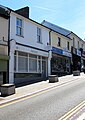
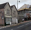
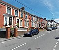
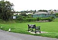
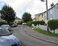
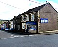
English: Bargoed is a town in the Rhymney Valley, Wales, one of the South Wales Valleys. It lies on the Rhymney River in the county borough of Caerphilly and straddles ancient boundary of Glamorgan and Monmouthshire. 'Greater Bargoed', as defined by the local authority Caerphilly County Borough Council, consists of the towns of Bargoed, Aberbargoed and the village of Gilfach. The combined population of these settlements is approximately 13,000.
Norsk bokmål: Bargoed er en by i Rhymni Valley i det sørlige Wales. Den ligger ved elven Rhymni, på grensen mellom de tradisjonelle grevskapene Glamorgan og Monmouthshire. Dette har gitt opphav til det walisiske navnet, som betyr «grense».
ville et communauté dans le borough de comté de Caerphilly, au pays de Galles   | |||||
| Téléverser des médias | |||||
| Prononciation (fichier son) | |||||
|---|---|---|---|---|---|
| Nature de l’élément | |||||
| Lieu | Caerphilly, pays de Galles | ||||
| Population |
| ||||
| Superficie |
| ||||
 | |||||
Sous-catégories
Cette catégorie comprend 4 sous-catégories, dont les 4 ci-dessous.
B
- Bargoed railway station (35 F)
- Bargoed Viaduct (7 F)
H
- Heolddu Comprehensive School (2 F)
S
- St Sannan's Church, Bedwellty (17 F)
Média dans la catégorie « Bargoed »
Cette catégorie comprend 1 020 fichiers, dont les 200 ci-dessous.
(page précédente) (page suivante)-
 'Arrow-slit' window filled in - geograph.org.uk - 486326.jpg 480 × 640 ; 140 kio
-
 (my)dentist, High Street, Bargoed - geograph.org.uk - 5815087.jpg 567 × 800 ; 111 kio
-
 17-24 Vere Place, Gilfach - geograph.org.uk - 6242192.jpg 1 600 × 1 448 ; 479 kio
-

-
 1902 Welsh inscription on Ainon, Gilfach - geograph.org.uk - 6243874.jpg 579 × 640 ; 70 kio
-
 20 Zone signs, Mount Pleasant Street, Aberbargoed - geograph.org.uk - 6173541.jpg 1 600 × 1 200 ; 341 kio
-
 2010 Wales Caerphilly Community Bargoed map.svg 512 × 725 ; 375 kio
-
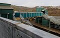
 Rail-Head Treatment Train at Bargoed (geograph 5966668).jpg 4 426 × 3 319 ; 6,69 Mio
-
 2024 Wales Caerphilly Community Bargoed map.svg 512 × 725 ; 345 kio
-
 328 Aberbargoed - geograph.org.uk - 3541302.jpg 800 × 773 ; 161 kio
-
 328 takeaway at 4 Commercial Street, Aberbargoed - geograph.org.uk - 6173533.jpg 1 600 × 1 200 ; 350 kio
-
 37405 approaches Gilfach Fargoed - geograph.org.uk - 343170.jpg 640 × 445 ; 186 kio
-
 37421 at Bargoed, Rhymney Valley, south Wales.png 5 866 × 3 911 ; 34,96 Mio
-

-
 A glimpse of Angel Lane railway bridge, Gilfach - geograph.org.uk - 3463756.jpg 800 × 599 ; 220 kio
-
 A glimpse of Bargoed Viaduct - geograph.org.uk - 3493008.jpg 800 × 613 ; 150 kio
-
 A straight Crescent in Bargoed - geograph.org.uk - 5751678.jpg 800 × 611 ; 100 kio
-
 A view NNW from Bargoed railway station - geograph.org.uk - 3418041.jpg 800 × 637 ; 181 kio
-

-

-
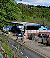
 A469 Bridge over the Rhymney River - geograph.org.uk - 5387778.jpg 5 184 × 3 456 ; 6,5 Mio
-
 A469 east of Gilfach - geograph.org.uk - 5651231.jpg 640 × 480 ; 55 kio
-
 A469 Factory Road near Bristol Terrace - geograph.org.uk - 5761116.jpg 640 × 481 ; 81 kio
-
 A469 Station Road, Bargoed - geograph.org.uk - 5651275.jpg 640 × 481 ; 60 kio
-
 A469 Station Road, Bargoed - geograph.org.uk - 6175220.jpg 1 600 × 1 089 ; 424 kio
-
 A469, Bargoed - geograph.org.uk - 6130999.jpg 4 000 × 3 000 ; 4,59 Mio
-
 Aberbargoed - Please drive carefully - geograph.org.uk - 6175149.jpg 1 600 × 1 200 ; 594 kio
-
 Aberbargoed Buds AFC - geograph.org.uk - 3498036.jpg 800 × 600 ; 138 kio
-
 Aberbargoed Clinic - geograph.org.uk - 3496442.jpg 800 × 566 ; 130 kio
-

-
 Aberbargoed Indian Takeaway - geograph.org.uk - 6173682.jpg 1 526 × 1 600 ; 507 kio
-
 Aberbargoed Post Office - geograph.org.uk - 3496378.jpg 799 × 800 ; 170 kio
-

-
 Aberbargoed Village Hall - geograph.org.uk - 3541317.jpg 800 × 658 ; 111 kio
-
 Aberbargoed, Commercial Street.jpg 640 × 480 ; 112 kio
-
 Access ramp, Gilfach Fargoed railway station - geograph.org.uk - 1850175.jpg 640 × 552 ; 120 kio
-
 Across Angel Lane bridge, Gilfach - geograph.org.uk - 3463777.jpg 800 × 600 ; 191 kio
-
 Across Angel Lane bridge, Gilfach - geograph.org.uk - 6138331.jpg 4 000 × 3 000 ; 2,92 Mio
-
 Across Bargoed Newydd Viaduct - geograph.org.uk - 3464396.jpg 800 × 494 ; 92 kio
-
 Across Bargoed railway station footbridge - geograph.org.uk - 5028089.jpg 800 × 600 ; 97 kio
-
 Across the Rhymney valley, Bargoed - geograph.org.uk - 3492912.jpg 800 × 528 ; 151 kio
-
 Advanced Heat van, Lewis Crescent, Gilfach - geograph.org.uk - 6241003.jpg 1 409 × 1 483 ; 514 kio
-
 Advert on a Gwerthonor Place side wall, Gilfach - geograph.org.uk - 6240053.jpg 1 550 × 1 600 ; 450 kio
-
 Aeron Place houses, Gilfach - geograph.org.uk - 3463236.jpg 800 × 500 ; 101 kio
-
 Aeron Place, Gilfach - geograph.org.uk - 3463216.jpg 800 × 550 ; 111 kio
-
 Ainon Baptist Church, Maes-y-graig Street, Gilfach - geograph.org.uk - 6243872.jpg 1 600 × 1 163 ; 449 kio
-
 Ajantha in Bargoed - geograph.org.uk - 5751229.jpg 800 × 790 ; 120 kio
-
 Ajantha Indian Takeaway, 50 Cardiff Road, Bargoed - geograph.org.uk - 6138591.jpg 826 × 1 024 ; 193 kio
-
 Alcohol Control Area notice, Bargoed bus station - geograph.org.uk - 5999286.jpg 1 600 × 1 307 ; 449 kio
-
 All routes-Pob llwybr direction sign, Angel Way, Bargoed - geograph.org.uk - 6138662.jpg 1 024 × 667 ; 154 kio
-
 Allotment entrance gates, Gilfach - geograph.org.uk - 6243971.jpg 1 600 × 1 200 ; 713 kio
-
 Altered Image in Aberbargoed - geograph.org.uk - 6173650.jpg 1 559 × 1 600 ; 465 kio
-
 An entrance gate to Parc Coetir Bargod - geograph.org.uk - 1050507.jpg 640 × 480 ; 161 kio
-
 An entrance gate to Parc Coetir Bargod - geograph.org.uk - 1637513.jpg 640 × 480 ; 119 kio
-
 An exit from Parc Coetir Bargod, Gilfach - geograph.org.uk - 3462068.jpg 800 × 668 ; 266 kio
-
 Angel Lane entrance to park, Gilfach - geograph.org.uk - 1850216.jpg 640 × 480 ; 77 kio
-
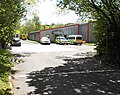
 Angel Lane Industrial Estate, Aberbargoed - geograph.org.uk - 3540348.jpg 800 × 571 ; 106 kio
-
 Angel Lane railway bridge identifier, Gilfach - geograph.org.uk - 6143890.jpg 609 × 640 ; 138 kio
-
 Angel Lane railway bridge, Gilfach - geograph.org.uk - 1850186.jpg 640 × 480 ; 95 kio
-
 Angel Lane towards Bargoed Woodland Park - geograph.org.uk - 6151983.jpg 1 024 × 919 ; 254 kio
-
 Angel Lane, Aberbargoed - geograph.org.uk - 4354682.jpg 4 000 × 2 172 ; 1,62 Mio
-

-
 Appliance UK store in Bargoed - geograph.org.uk - 5775817.jpg 800 × 673 ; 124 kio
-
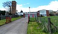
 Army Cadet Force (ACF) buildings, Aberbargoed - geograph.org.uk - 3496328.jpg 800 × 520 ; 112 kio
-
 Arriving at Bargoed Railway Station. - geograph.org.uk - 806467.jpg 640 × 421 ; 102 kio
-
 Art Deco Burton building, Bargoed.jpg 2 576 × 1 932 ; 1,97 Mio
-

-
 August 17th 2019 Texaco fuel prices, Gwerthonor Place, Gilfach - geograph.org.uk - 6240060.jpg 1 600 × 1 220 ; 415 kio
-
 B.Thomas Pet and Garden Supplies, Bargoed - geograph.org.uk - 3464777.jpg 800 × 719 ; 179 kio
-

-
 Back lane on the northeast side of Gwerthonor Lane, Gilfach - geograph.org.uk - 6240262.jpg 1 360 × 1 600 ; 455 kio
-

-
 Back lane towards Gwerthonor Lane, Gilfach - geograph.org.uk - 6240944.jpg 1 600 × 1 452 ; 647 kio
-
 Back lane towards Lewis Crescent, Gilfach - geograph.org.uk - 6240399.jpg 1 600 × 1 200 ; 437 kio
-
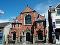 Baptist chapel, Bargoed - geograph.org.uk-3464808.jpg 800 × 603 ; 147 kio
-
 Barber shop at 13 Gwerthonor Place, Gilfach - geograph.org.uk - 6243564.jpg 1 600 × 1 565 ; 420 kio
-
 Barclays Bank, Bargoed - geograph.org.uk - 3464928.jpg 800 × 787 ; 170 kio
-
 Barclays, 1 Hanbury Road, Bargoed - geograph.org.uk - 5815170.jpg 800 × 552 ; 99 kio
-
 Bargoed Ambulance Station - geograph.org.uk - 3493181.jpg 800 × 633 ; 189 kio
-
 Bargoed bus station (geograph 4805015).jpg 800 × 536 ; 89 kio
-
 Bargoed Bus Station (geograph 5997739).jpg 1 024 × 801 ; 171 kio
-
 Bargoed Bus Station and Trafalgar Buildings - geograph.org.uk - 868033.jpg 640 × 480 ; 250 kio
-
 Bargoed bus station toilets (geograph 3491669).jpg 800 × 641 ; 158 kio
-
 Bargoed bus station toilets - geograph.org.uk - 5027569.jpg 800 × 598 ; 122 kio
-
 Bargoed Chiropractic Clinic - geograph.org.uk - 5988494.jpg 1 024 × 912 ; 233 kio
-
 Bargoed Chiropractic Clinic, Bargoed - geograph.org.uk - 5752438.jpg 575 × 800 ; 96 kio
-
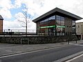
 Bargoed Citizens Advice Bureau - geograph.org.uk - 5839090.jpg 673 × 800 ; 123 kio
-
 Bargoed Colliery, 1973 - geograph.org.uk - 3401027.jpg 640 × 352 ; 84 kio
-
 Bargoed Fire Station - geograph.org.uk - 467177.jpg 640 × 426 ; 179 kio
-
 Bargoed Fire Station, Gilfach - geograph.org.uk - 3463055.jpg 800 × 476 ; 125 kio
-
 Bargoed Fish Bar, Bargoed - geograph.org.uk - 5751122.jpg 800 × 600 ; 104 kio
-
 Bargoed Golf Club - geograph.org.uk - 4998639.jpg 3 033 × 2 273 ; 693 kio
-
 Bargoed Golf Course - geograph.org.uk - 4998586.jpg 3 264 × 2 448 ; 2,63 Mio
-
 Bargoed Hall Family Health Centre - geograph.org.uk - 1849402.jpg 640 × 365 ; 53 kio
-
 Bargoed Hand Car Wash, Bargoed - geograph.org.uk - 5851764.jpg 947 × 874 ; 211 kio
-
 Bargoed Hand Car Wash, Station Road, Bargoed - geograph.org.uk - 6140857.jpg 875 × 1 024 ; 418 kio
-
 Bargoed Interchange electronic display board (geograph 5027682).jpg 800 × 762 ; 142 kio
-
 Bargoed Labour Club - geograph.org.uk - 5764150.jpg 800 × 626 ; 106 kio
-
 Bargoed Labour Club ^ Institute - geograph.org.uk - 1848281.jpg 640 × 480 ; 56 kio
-
 Bargoed Local Store, High Street, Bargoed - geograph.org.uk - 5815103.jpg 765 × 800 ; 137 kio
-
 Bargoed Masonic Hall - geograph.org.uk - 1848285.jpg 640 × 417 ; 59 kio
-
 Bargoed McDonnel Road.jpg 640 × 437 ; 72 kio
-
 Bargoed Methodist Church, Bargoed - geograph.org.uk - 5751573.jpg 800 × 641 ; 134 kio
-
 Bargoed Methodist Church, Bargoed - geograph.org.uk - 5769437.jpg 800 × 522 ; 89 kio
-
 Bargoed North DNO distribution-supply cubicle - geograph.org.uk - 4804802.jpg 800 × 740 ; 153 kio
-
 Bargoed Police Station - geograph.org.uk - 3464610.jpg 800 × 696 ; 153 kio
-
 Bargoed Post Office - geograph.org.uk - 1848265.jpg 640 × 480 ; 66 kio
-
 Bargoed Post Office - geograph.org.uk - 5751217.jpg 800 × 701 ; 134 kio
-
 Bargoed railway station - geograph.org.uk - 3418155.jpg 640 × 558 ; 89 kio
-
 Bargoed Railway Station adoption plaque - geograph.org.uk - 5851731.jpg 640 × 387 ; 71 kio
-
 Bargoed railway station canopy - geograph.org.uk - 5855988.jpg 1 024 × 806 ; 209 kio
-
 Bargoed railway station car park - geograph.org.uk - 6175242.jpg 1 600 × 866 ; 300 kio
-
 Bargoed railway station car park notice - geograph.org.uk - 6133607.jpg 1 024 × 925 ; 274 kio
-
 Bargoed railway station footbridge - geograph.org.uk - 5028084.jpg 800 × 509 ; 96 kio
-
 Bargoed railway station footbridge - geograph.org.uk - 6175281.jpg 1 600 × 1 127 ; 502 kio
-
 Bargoed railway station lift - geograph.org.uk - 6133604.jpg 991 × 1 024 ; 282 kio
-
 Bargoed railway station, Gwent - geograph.org.uk - 3306687.jpg 1 024 × 768 ; 183 kio
-
 Bargoed RFC premises - geograph.org.uk - 1850053.jpg 526 × 640 ; 75 kio
-
 Bargoed Roundabout - geograph.org.uk - 6175185.jpg 1 600 × 1 074 ; 412 kio
-
-
 Bargoed Skate Park - geograph.org.uk - 5791604.jpg 800 × 591 ; 147 kio
-
 Bargoed Taxis office, 59 Cardiff Road, Bargoed - geograph.org.uk - 6138627.jpg 1 024 × 981 ; 249 kio
-
 Bargoed Town Hall - geograph.org.uk - 5839226.jpg 800 × 796 ; 163 kio
-
 Bargoed Tyres, Brakes ^ Exhausts, Bargoed - geograph.org.uk - 6137741.jpg 1 024 × 942 ; 150 kio
-
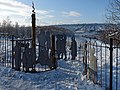
 Bargoed War Memorial - geograph.org.uk - 3418321.jpg 640 × 623 ; 162 kio
-
 Bargoed Woodland Park - geograph.org.uk - 6175275.jpg 3 361 × 2 271 ; 2,35 Mio
-
 Bargoed ^ District Social Club - geograph.org.uk - 3418230.jpg 640 × 501 ; 83 kio
-
 Bargoed's new bus station - geograph.org.uk - 3418575.jpg 640 × 551 ; 94 kio
-
 Bargoed, High Street.jpg 640 × 480 ; 79 kio
-

-
 Bedwellty Road Aberbargoed - geograph.org.uk - 3497954.jpg 800 × 645 ; 132 kio
-
 Bedwellty Road approaches Aberbargoed - geograph.org.uk - 3499570.jpg 800 × 678 ; 159 kio
-

-
 Bedwellty Road crosses the Rhymney, Bargoed - geograph.org.uk - 3495131.jpg 800 × 569 ; 156 kio
-
 Bedwellty Road east of Pant Street Aberbargoed - geograph.org.uk - 3496502.jpg 800 × 688 ; 150 kio
-

-
 Bedwellty Road west of crossroads, Aberbargoed - geograph.org.uk - 3541360.jpg 800 × 748 ; 157 kio
-
 Bedwellty Road, Aberbargoed - geograph.org.uk - 1050494.jpg 640 × 480 ; 121 kio
-
 Bedwellty Road, Aberbargoed - geograph.org.uk - 3370792.jpg 640 × 480 ; 112 kio
-
 Bench above a grassy depression in Gilfach - geograph.org.uk - 6242980.jpg 1 600 × 1 094 ; 418 kio
-
 Bench and litter bin on a green, Gilfach - geograph.org.uk - 6243907.jpg 1 600 × 1 218 ; 474 kio
-
 Bench on a grassy corner, Bargoed - geograph.org.uk - 5752479.jpg 800 × 686 ; 150 kio
-

-
 Bend at the western end of Maes-y-graig Street, Gilfach - geograph.org.uk - 6243967.jpg 1 600 × 1 322 ; 672 kio
-
 Bend in a path through Bargoed Woodland Park - geograph.org.uk - 6181777.jpg 1 600 × 1 200 ; 984 kio
-
 Bend in Park Drive, Bargoed - geograph.org.uk - 5791666.jpg 800 × 741 ; 139 kio
-
 Bends in Lewis Crescent, Gilfach - geograph.org.uk - 6240973.jpg 1 600 × 1 270 ; 450 kio
-
 Best-One shop on a Bargoed corner - geograph.org.uk - 5751457.jpg 800 × 652 ; 140 kio
-
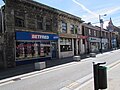 Betfred in Bargoed - geograph.org.uk - 5815461.jpg 800 × 600 ; 117 kio
-
-
 Bilingual direction signs on platform 2, Bargoed railway station - geograph.org.uk - 6240155.jpg 1 351 × 1 600 ; 776 kio
-
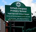 Bilingual school name sign, Gilfach - geograph.org.uk - 6242667.jpg 1 024 × 932 ; 170 kio
-

-
 Bilingual sign, Gilfach Street, Bargoed - geograph.org.uk - 6137915.jpg 854 × 1 024 ; 192 kio
-
 Bilingual signpost on a Bargoed corner - geograph.org.uk - 6117462.jpg 987 × 1 024 ; 295 kio
-
 Bilingual Taxi-Tacsi sign, Bargoed - geograph.org.uk - 5027796.jpg 800 × 623 ; 101 kio
-
 Blackwood Automotive Ltd, Markham - geograph.org.uk - 3490630.jpg 800 × 482 ; 102 kio
-
 Blocks alongside Hanbury Road, Bargoed - geograph.org.uk - 5838855.jpg 643 × 800 ; 126 kio
-

-
 Bluebells - geograph.org.uk - 5772422.jpg 1 600 × 1 329 ; 274 kio
-
 Bluebells and Buttercups, Aberbargoed Grasslands - geograph.org.uk - 3985113.jpg 640 × 480 ; 140 kio
-
 Body Canvas in Aberbargoed - geograph.org.uk - 6173631.jpg 1 406 × 1 600 ; 519 kio
-
 Bourton’s Music School in Bargoed - geograph.org.uk - 5775785.jpg 800 × 589 ; 105 kio
-
 Bowen Industrial Estate direct sign, Bargoed - geograph.org.uk - 6175195.jpg 1 600 × 1 324 ; 505 kio
-
 Bowling green, Gilfach - geograph.org.uk - 3461469.jpg 800 × 678 ; 131 kio
-
 Bridge Street houses and viaduct in Bargoed - geograph.org.uk - 6076063.jpg 5 184 × 3 888 ; 4,76 Mio
-
 Bridge Street houses Bargoed - geograph.org.uk - 3493099.jpg 800 × 594 ; 153 kio
-
 Bridge Street, Bargoed - geograph.org.uk - 3370748.jpg 640 × 369 ; 110 kio
-
 Bridleway across the common - geograph.org.uk - 625575.jpg 640 × 477 ; 87 kio
-
 Brindavan Care Home, Aberbargoed - geograph.org.uk - 3541242.jpg 800 × 544 ; 98 kio
-
 Bristol Terrace car park regulations, Bargoed - geograph.org.uk - 5822571.jpg 640 × 556 ; 121 kio
-
 Bristol Terrace car park, Bargoed - geograph.org.uk - 5822569.jpg 800 × 746 ; 155 kio
-
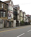
 Bristol Terrace houses, Bargoed - geograph.org.uk - 3491730.jpg 800 × 626 ; 148 kio
-
 Bristol Terrace houses, Bargoed - geograph.org.uk - 5824799.jpg 800 × 529 ; 126 kio
-
 Bristol Terrace, Bargoed - geograph.org.uk - 3491739.jpg 800 × 600 ; 156 kio
-
 Bristol Terrace, Bargoed - geograph.org.uk - 5752420.jpg 800 × 731 ; 105 kio
-

-
 Bryntirion Surgery car park entrance, Bargoed - geograph.org.uk - 5764816.jpg 800 × 688 ; 128 kio
-
 BT phonebox, Park Place, Gilfach - geograph.org.uk - 6137849.jpg 1 024 × 821 ; 176 kio
-
 Building on New Road, Aberbargoed - geograph.org.uk - 3996569.jpg 1 600 × 1 058 ; 342 kio
-
 Business as usual, Hanbury Square, Bargoed - geograph.org.uk - 3464560.jpg 800 × 547 ; 120 kio
-
 Caerphilly UK community map (Bargoed).svg 894 × 1 266 ; 474 kio
-
 Caersalem Baptist Chapel, Aberbargoed - geograph.org.uk - 3370810.jpg 640 × 480 ; 155 kio
-
 Calfaria chapel, Greenfield Street, Bargoed - geograph.org.uk - 5751415.jpg 800 × 765 ; 138 kio
-
 Cambrian One Stop Motor Cycles shop in Aberbargoed - geograph.org.uk - 6174309.jpg 1 024 × 811 ; 189 kio
-
 Cantonese in Bargoed - geograph.org.uk - 5751204.jpg 756 × 800 ; 118 kio
-
 Capel, Gilfach - geograph.org.uk - 1849435.jpg 640 × 615 ; 88 kio
-
-
 Car dismantlers near Bargoed railway station - geograph.org.uk - 4804785.jpg 800 × 516 ; 106 kio
-
 Cardiff Central train in Bargoed railway station - geograph.org.uk - 5988566.jpg 1 024 × 910 ; 269 kio
-
 Cardiff Road bus stop, shelter and bench, Gilfach - geograph.org.uk - 6240102.jpg 1 593 × 1 600 ; 623 kio
-
 Cardiff Road houses, Bargoed - geograph.org.uk - 6138645.jpg 1 024 × 913 ; 223 kio
-
 Cardiff Road railway bridge, Gilfach - geograph.org.uk - 3450334.jpg 800 × 570 ; 143 kio
-
 Cardiff Road regeneration work, Bargoed - geograph.org.uk - 3464469.jpg 800 × 528 ; 129 kio
-
 Cardiff Road, Bargoed - geograph.org.uk - 3463988.jpg 800 × 764 ; 151 kio
-
 Carol's Bridal Wear in Bargoed - geograph.org.uk - 5751278.jpg 668 × 800 ; 125 kio
-
 Cars and houses, Lewis Crescent, Gilfach - geograph.org.uk - 6240933.jpg 1 600 × 962 ; 321 kio
-

-

-
 Cattle grid on road north off the common - geograph.org.uk - 625502.jpg 640 × 468 ; 70 kio

dentist,_High_Street,_Bargoed_-_geograph.org.uk_-_5815087.jpg)


.jpg)


_buildings,_Aberbargoed_-_geograph.org.uk_-_3496328.jpg)


.jpg)
.jpg)

.jpg)


.jpg)


_signpost_near_Bargoed_bus_station_-_geograph.org.uk_-_5027588.jpg)


.svg)


