Category:Little Cornard
Aller à la navigation
Aller à la recherche
English: Little Cornard is a village and civil parish in Suffolk, England. Located around half a mile from its larger sibling, Great Cornard, on the B1057 road between Sudbury and Colchester, it is part of the Babergh district. The parish also includes the hamlet of Workhouse Green.
village britannique  | |||||
| Téléverser des médias | |||||
| Nature de l’élément | |||||
|---|---|---|---|---|---|
| Lieu | Babergh, Suffolk, Angleterre de l'Est, Angleterre | ||||
| Population |
| ||||
 | |||||
Sous-catégories
Cette catégorie comprend 4 sous-catégories, dont les 4 ci-dessous.
Média dans la catégorie « Little Cornard »
Cette catégorie comprend 53 fichiers, dont les 53 ci-dessous.
-
 Advantage Point - geograph.org.uk - 2844209.jpg 768 × 1 024 ; 342 kio
-
 Arable land near Wyatts Lane, Little Cornard - geograph.org.uk - 4953259.jpg 3 648 × 2 432 ; 2,91 Mio
-
 At the top of the church tower - geograph.org.uk - 5434385.jpg 428 × 640 ; 65 kio
-
 Blackhouse Lane - geograph.org.uk - 2844369.jpg 1 024 × 768 ; 241 kio
-
 Cornard Mere - geograph.org.uk - 1464345.jpg 640 × 480 ; 93 kio
-
 Cornard Mere - geograph.org.uk - 5431635.jpg 640 × 428 ; 121 kio
-
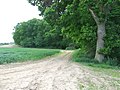
 Country Track - geograph.org.uk - 2844184.jpg 1 024 × 768 ; 269 kio
-
 Cut And Shut - geograph.org.uk - 2844175.jpg 1 024 × 768 ; 299 kio
-
 Farm Building - geograph.org.uk - 2844217.jpg 1 024 × 768 ; 271 kio
-
 Find The Pillbox - geograph.org.uk - 2844203.jpg 1 024 × 768 ; 339 kio
-
 Fitches Wood - geograph.org.uk - 4499914.jpg 1 024 × 768 ; 281 kio
-
 Footbridge - geograph.org.uk - 2844188.jpg 768 × 1 024 ; 369 kio
-
 Footpath - geograph.org.uk - 2844255.jpg 1 024 × 768 ; 338 kio
-
 Footpath - geograph.org.uk - 2844427.jpg 1 024 × 768 ; 320 kio
-
 Footpath Across Shalford Meadow - geograph.org.uk - 2844364.jpg 1 024 × 768 ; 186 kio
-
 Footpath on arable field margin, Little Cornard - geograph.org.uk - 4953258.jpg 3 648 × 2 432 ; 3,9 Mio
-

-
 Footpath on field boundary, Little Cornard - geograph.org.uk - 4953257.jpg 3 648 × 2 736 ; 5,47 Mio
-
 Kedington Hill - geograph.org.uk - 1464341.jpg 640 × 480 ; 80 kio
-
 Lane north from Pond Farm - geograph.org.uk - 5431533.jpg 640 × 480 ; 180 kio
-
 Lane with pipeline marker - geograph.org.uk - 5431540.jpg 640 × 480 ; 179 kio
-
 Little Cornard church - geograph.org.uk - 5431561.jpg 640 × 428 ; 132 kio
-
 Little Cornard war memorial - geograph.org.uk - 5434396.jpg 640 × 480 ; 214 kio
-
 Looking to Cornard Mere Nature Reserve - geograph.org.uk - 4953256.jpg 3 648 × 2 432 ; 2,79 Mio
-
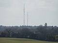 Masts at Little Cornard from Calais Street - geograph.org.uk - 3860499.jpg 800 × 600 ; 38 kio
-

-

-
 Masts at Little Cornard from near Tye Went - geograph.org.uk - 3870252.jpg 800 × 600 ; 61 kio
-
 Masts at Little Cornard from Round Maple - geograph.org.uk - 3851962.jpg 800 × 600 ; 44 kio
-
 Muddy Track - geograph.org.uk - 2844185.jpg 768 × 1 024 ; 349 kio
-
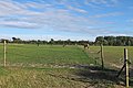 Paddock near Peacock Hall, Little Cornard - geograph.org.uk - 4607375.jpg 3 648 × 2 432 ; 2,79 Mio
-
 Pet Grave - geograph.org.uk - 2844583.jpg 1 024 × 768 ; 386 kio
-
 Pet Grave - geograph.org.uk - 2844587.jpg 768 × 1 024 ; 331 kio
-
 Public footpath through nursery playground, Little Cornard - geograph.org.uk - 4607406.jpg 3 648 × 2 736 ; 3,65 Mio
-
 Railway Line And Stile - geograph.org.uk - 2844257.jpg 1 024 × 768 ; 358 kio
-
 Road Closed - geograph.org.uk - 2844368.jpg 1 024 × 768 ; 205 kio
-
 Road Junction - geograph.org.uk - 2844225.jpg 1 024 × 768 ; 189 kio
-
 Road Sign - geograph.org.uk - 2844223.jpg 768 × 1 024 ; 234 kio
-
 Stile on footpath to Kedington Hill - geograph.org.uk - 1464340.jpg 640 × 480 ; 136 kio
-
 Stour Valley from Daws Hall Nature Reserve - geograph.org.uk - 4269007.jpg 2 816 × 2 112 ; 2,63 Mio
-
 Television transmitter, Little Cornard - geograph.org.uk - 4607400.jpg 2 421 × 2 421 ; 1,01 Mio
-
 They Shoot Horse Don't They - geograph.org.uk - 2054389.jpg 1 200 × 1 600 ; 321 kio
-
 Under The Power Lines - geograph.org.uk - 2844231.jpg 768 × 1 024 ; 330 kio
-
 Upper Road, Workhouse Green - geograph.org.uk - 5431525.jpg 640 × 480 ; 179 kio
-

-

-
 View toward Kedington Hill - geograph.org.uk - 1464344.jpg 640 × 480 ; 65 kio
-
 Warning Horses - geograph.org.uk - 2046735.jpg 1 600 × 1 200 ; 442 kio
-
 Weir on River Stour at Daws Hall Nature Reserve - geograph.org.uk - 2815560.jpg 2 816 × 2 112 ; 2,3 Mio
-
 Wheatfield south of Chapel Lane - geograph.org.uk - 5431550.jpg 640 × 428 ; 86 kio
-
 Willowmere Caravan Park, Sudbury - geograph.org.uk - 3277663.jpg 2 074 × 1 408 ; 921 kio
-
 Yorley Farm yard, Little Cornard - geograph.org.uk - 4607389.jpg 1 024 × 683 ; 281 kio
-
 Cottage on Chapel Lane - geograph.org.uk - 373322.jpg 640 × 429 ; 86 kio


