Category:Llandaff
Aller à la navigation
Aller à la recherche
For the neighbouring suburb, see Category:Llandaff North

district of Cardiff, Wales, UK   | |||||
| Téléverser des médias | |||||
| Nature de l’élément | |||||
|---|---|---|---|---|---|
| Lieu | Cardiff, pays de Galles | ||||
| Cathédrale | |||||
| À ne pas confondre avec | |||||
 | |||||
Sous-catégories
Cette catégorie comprend 13 sous-catégories, dont les 13 ci-dessous.
1
- Llandaff in the 1900s (12 F)
C
- The Cathedral School, Llandaff (10 F)
D
H
L
- Llandaff Fields (17 F)
R
- Llandaff Rowing Club (5 F)
T
Média dans la catégorie « Llandaff »
Cette catégorie comprend 259 fichiers, dont les 200 ci-dessous.
(page précédente) (page suivante)-
 2010 Wales Cardiff Community Llandaff map.svg 512 × 546 ; 341 kio
-
 2024 Wales Cardiff Community Llandaff map.svg 512 × 546 ; 319 kio
-
 3 The Cathedral Green, Llandaff, October 2018.jpg 1 536 × 2 048 ; 653 kio
-
 36 Cardiff Road, Llandaff, October 2018 03.jpg 1 536 × 2 048 ; 540 kio
-
 4 Llandaff Place, Cardiff Road, Llandaff, March 2019.jpg 4 032 × 3 024 ; 3,68 Mio
-
 A48 through Caewal Road, Cardiff - geograph.org.uk - 5534451.jpg 800 × 644 ; 100 kio
-
 Across the weir (geograph 7708883).jpg 4 032 × 3 024 ; 3,86 Mio
-

-
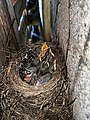 Babybirdsinthenest.jpg 3 024 × 4 032 ; 5,03 Mio
-
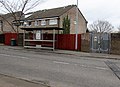
 Barclays Bank, Llandaff, Cardiff - geograph.org.uk - 5534356.jpg 800 × 600 ; 120 kio
-

-
 Beale Close houses, Danescourt, Cardiff - geograph.org.uk - 4389133.jpg 800 × 582 ; 93 kio
-
 Beale Close, Danescourt, Cardiff - geograph.org.uk - 4371935.jpg 800 × 475 ; 76 kio
-

-
 Bishop's Palace Garden.jpg 5 184 × 3 456 ; 10,89 Mio
-
 Bishop's Walk, near junction with Western Avenue, Cardiff - geograph.org.uk - 4139460.jpg 2 560 × 1 920 ; 2,17 Mio
-
 Black Lion name sign, Llandaff, Cardiff - geograph.org.uk - 5534398.jpg 730 × 800 ; 114 kio
-
 Blethin Close, Danescourt, Cardiff - geograph.org.uk - 4372075.jpg 800 × 530 ; 103 kio
-
 Blush in High Street, Llandaff, Cardiff - geograph.org.uk - 5661379.jpg 755 × 800 ; 166 kio
-
 Boundary Wall to the west of The Cathedral School, Llandaff, May 2020.jpg 4 032 × 3 024 ; 7,14 Mio
-
 Burne Jones Close, Danescourt, Cardiff - geograph.org.uk - 4371946.jpg 800 × 540 ; 105 kio
-

-
 Butchers Arms, 16 High Street, Llandaff, Cardiff - geograph.org.uk - 5535269.jpg 800 × 678 ; 111 kio
-
 Butchers Arms, Llandaff - geograph.org.uk - 3435797.jpg 3 872 × 2 592 ; 4,25 Mio
-
 Caewal Road, Llandaff, Cardiff - geograph.org.uk - 5534437.jpg 800 × 630 ; 118 kio
-
 Campaign notice - geograph.org.uk - 938291.jpg 640 × 480 ; 104 kio
-
 Cantonian High School.jpg 640 × 480 ; 286 kio
-
 Cardiff Rd, Llandaff - geograph.org.uk - 1889117.jpg 3 296 × 2 472 ; 1,85 Mio
-
 Cardiff Road, Llandaff - geograph.org.uk - 2007386.jpg 533 × 640 ; 92 kio
-
 Cardiff ward location - Llandaff.png 800 × 571 ; 179 kio
-
 Cathedral Court (Nos. 1-5 consec), Llandaff, July 2020.jpg 1 536 × 2 048 ; 865 kio
-
 Cathedral Green, Llandaff - geograph.org.uk - 2006527.jpg 640 × 480 ; 71 kio
-
 Cathedral Green, Llandaff - geograph.org.uk - 2324455.jpg 640 × 480 ; 102 kio
-
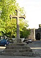 Celtic Cross at Llandaff - 2010 - geograph.org.uk - 2101359.jpg 858 × 1 218 ; 180 kio
-
 Chapel Street, Llandaff, Cardiff - geograph.org.uk - 5661351.jpg 691 × 800 ; 122 kio
-
 Christ in Majesty, Llandaff Cathedral - geograph.org.uk - 6123096.jpg 2 962 × 3 895 ; 907 kio
-
 Church Hall at Llandaff Cathedral - geograph.org.uk - 2105022.jpg 2 048 × 1 536 ; 2,03 Mio
-

-
 City of Llandaff on Cardiff Road (A4119 road).JPG 2 816 × 2 112 ; 3,01 Mio
-
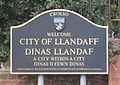 City of Llandaff sign, Llandaff, Cardiff.JPG 2 092 × 1 475 ; 584 kio
-
 Cored Llandaf - Llandaff Weir - geograph.org.uk - 4541546.jpg 640 × 441 ; 91 kio
-
-
 Cranmer Court, Llandaff, Cardiff - geograph.org.uk - 5534483.jpg 756 × 800 ; 123 kio
-
 Cricket near Llandaff - geograph.org.uk - 1923766.jpg 640 × 480 ; 60 kio
-
 Danescourt - geograph.org.uk - 2792105.jpg 480 × 640 ; 76 kio
-
 Danescourt - geograph.org.uk - 2948275.jpg 480 × 640 ; 139 kio
-
 Danescourt railway station footbridge, Cardiff - geograph.org.uk - 4389204.jpg 800 × 528 ; 130 kio
-
 Danescourt railway station name sign, Cardiff - geograph.org.uk - 4389120.jpg 800 × 594 ; 137 kio
-

-
 Danescourt railway station, Cardiff - geograph.org.uk - 3306948.jpg 1 024 × 768 ; 246 kio
-
-

-
 Demolition of the former BBC studios in Llandaff (geograph 7025460).jpg 4 606 × 2 591 ; 3,08 Mio
-
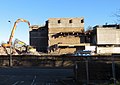 Demolition of the former BBC studios in Llandaff North (geograph 7025460).jpg 3 378 × 2 386 ; 2,21 Mio
-
 East along Radyr Court Road, Danescourt, Cardiff - geograph.org.uk - 4372067.jpg 800 × 600 ; 195 kio
-

-
 East side of the Maltsters, Llandaff, Cardiff - geograph.org.uk - 5534422.jpg 800 × 662 ; 127 kio
-

-
 Edward Clarke Close, Danescourt, Cardiff - geograph.org.uk - 4371922.jpg 800 × 538 ; 97 kio
-

-
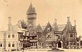 Ely Court (Insole Court) 1898-1905.jpg 1 200 × 763 ; 124 kio
-
 Ely Road, Llandaff, Cardiff - geograph.org.uk - 4139507.jpg 2 560 × 1 920 ; 2,24 Mio
-

-
 Entrance to Llandaff Rowing Club - geograph.org.uk - 1887495.jpg 640 × 480 ; 134 kio
-
 Epstein Close, Danescourt, Cardiff - geograph.org.uk - 4374904.jpg 800 × 548 ; 88 kio
-
-
 Fairfield House, Ely Road, Cardiff - geograph.org.uk - 2284490.jpg 1 024 × 683 ; 131 kio
-
 Fairwater Conservative Club - geograph.org.uk - 5198317.jpg 3 264 × 2 448 ; 1,97 Mio
-
 Fairwater Grove West, Cardiff - geograph.org.uk - 1985540.jpg 640 × 506 ; 81 kio
-
 Fairwater railway station access ramp, Cardiff - geograph.org.uk - 4040677.jpg 800 × 600 ; 214 kio
-
 Fairwater Road housing, Cardiff - geograph.org.uk - 3815531.jpg 640 × 496 ; 90 kio
-

-
 Ffordd y Tyllgoed, Highfields, Llandaf, Caerdydd.jpg 4 000 × 3 000 ; 3,02 Mio
-

-
 Footbridge over the busy A48, Western Avenue, Cardiff - geograph.org.uk - 1889176.jpg 3 296 × 2 472 ; 1,87 Mio
-
 Footpath to Llandaff Cathedral - geograph.org.uk - 1888121.jpg 640 × 480 ; 128 kio
-
 Former North Lodge to Rookwood House, Llandaff, August 2019 02.jpg 1 536 × 2 048 ; 1,11 Mio
-

-
-
 Garden Wall and Gatepiers of Cathedral Court, Llandaff, May 2020.jpg 4 032 × 3 024 ; 4,45 Mio
-
 Garden wall of 1&2 St. Mary’s, Llandaff, October 2018.jpg 4 032 × 3 024 ; 5,23 Mio
-
 Garden wall of Pendinas, Llandaff, February 2019.jpg 4 032 × 3 024 ; 5,18 Mio
-
 Garden walls of 1 and 2 White House, Llandaff, October 2018 (2).jpg 1 536 × 2 048 ; 1,13 Mio
-
 Garden Walls to White House Cottage, Llandaff.jpg 3 264 × 2 448 ; 3,61 Mio
-
 Gargoyle, Llandaff Cathedral - geograph.org.uk - 2007363.jpg 480 × 640 ; 70 kio
-
 Garlands, 9 High Street, Llandaff, Cardiff - geograph.org.uk - 5661393.jpg 800 × 679 ; 109 kio
-
 Gatehouse of ruined Bishop's Castle, Llandaff - geograph.org.uk - 1889173.jpg 3 296 × 2 472 ; 1,9 Mio
-
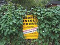
 Glimpse of Insole Court - geograph.org.uk - 5976856.jpg 3 264 × 2 448 ; 3,4 Mio
-
 Glyn Simon Close, Danescourt, Cardiff - geograph.org.uk - 4372007.jpg 800 × 568 ; 121 kio
-

-
 Heol Aradur, Cardiff - geograph.org.uk - 4374043.jpg 800 × 462 ; 91 kio
-
 Heol Seddon, Danescourt, Cardiff - geograph.org.uk - 4374843.jpg 800 × 462 ; 84 kio
-
 Heol-y-Pavin, Llandaff - geograph.org.uk - 1889134.jpg 3 296 × 2 472 ; 1,85 Mio
-
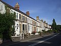
 High Street houses, Llandaff, Cardiff - geograph.org.uk - 5661387.jpg 677 × 800 ; 133 kio
-
 High Street, Llandaff - geograph.org.uk - 3435804.jpg 3 872 × 2 592 ; 3,37 Mio
-
 High Street, Llandaff, Cardiff - geograph.org.uk - 5660942.jpg 768 × 800 ; 131 kio
-
 Highfields Llandaf.jpg 4 000 × 3 000 ; 1,67 Mio
-
 Holgate Close - geograph.org.uk - 2792095.jpg 640 × 480 ; 81 kio
-

-
 Houses on Western Avenue, Cardiff - geograph.org.uk - 4139483.jpg 2 560 × 1 920 ; 2,14 Mio
-
 Inconvenient in Llandaff, Cardiff - geograph.org.uk - 5534557.jpg 800 × 549 ; 121 kio
-

-
 Insole Court - geograph.org.uk - 5976848.jpg 3 203 × 2 403 ; 2,15 Mio
-
 Insole Court - geograph.org.uk - 5976852.jpg 3 264 × 2 448 ; 2,05 Mio
-
 Insole Court in autumn - geograph.org.uk - 5976858.jpg 2 448 × 3 264 ; 2,5 Mio
-
 Insole Court Tree Shadows.jpg 2 666 × 4 000 ; 9,36 Mio
-
 Insole Grove, Llandaff - geograph.org.uk - 1257583.jpg 640 × 427 ; 96 kio
-
 Interior, Llandaff Cathedral, Cardiff - geograph.org.uk - 4139428.jpg 1 920 × 2 560 ; 2,22 Mio
-
 Into Danescourt Primary School, Cardiff - geograph.org.uk - 4372041.jpg 800 × 533 ; 123 kio
-
 James Rice Buckley - geograph.org.uk - 2006914.jpg 640 × 480 ; 82 kio
-
 John Speed - Map of Landaffe.png 1 091 × 833 ; 1,96 Mio
-
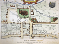 John Speed's map of Landaffe.png 1 091 × 814 ; 1,79 Mio
-

-

-
 Large houses, Waun-gron Road, Cardiff - geograph.org.uk - 1985563.jpg 640 × 480 ; 103 kio
-
 Llandaf, Cardiff (26391253780).jpg 5 184 × 3 456 ; 12,42 Mio
-
 Subway beneath the A48, Cardiff - geograph.org.uk - 708278.jpg 640 × 480 ; 97 kio
-
 Llandaff bell tower ruin, Cathedral Green, Llandaff.jpg 4 288 × 3 216 ; 2,65 Mio
-
 Llandaff Castle gatehouse - geograph.org.uk - 2006536.jpg 640 × 480 ; 80 kio
-
 Llandaff Cathedral - geograph.org.uk - 3435824.jpg 3 872 × 2 592 ; 4,25 Mio
-
 Llandaff Cathedral - geograph.org.uk - 6123088.jpg 3 167 × 4 349 ; 1,35 Mio
-
 Llandaff Cathedral south door – 1963 - geograph.org.uk - 6465047.jpg 854 × 1 280 ; 418 kio
-
 Llandaff Cathedral, Llandaff, Cardiff - geograph.org.uk - 4139423.jpg 2 560 × 1 920 ; 2,23 Mio
-
 Llandaff Institute - geograph.org.uk - 3435808.jpg 3 872 × 2 592 ; 5,01 Mio
-

-

-
 Llandaff Meadow, June, 2017.jpg 4 943 × 3 296 ; 7,63 Mio
-
 Llandaff Post Office, Cardiff - geograph.org.uk - 5661025.jpg 777 × 800 ; 130 kio
-
 Llandaff rowing club - geograph.org.uk - 1948671.jpg 640 × 480 ; 73 kio
-
 Llandaff Surgery - geograph.org.uk - 2004899.jpg 640 × 480 ; 82 kio
-
 Llandaff Surgery, Cardiff - geograph.org.uk - 5661391.jpg 800 × 800 ; 169 kio
-
 Llandaff Waterfall (4641501).jpg 1 200 × 908 ; 151 kio
-
 Llandaff, Glamorgan (gcf02397).jpg 1 074 × 1 200 ; 174 kio
-
 Llandaff.1610.Speed.map.jpg 1 800 × 1 243 ; 223 kio
-
 Lychgate in Danescourt, Cardiff - geograph.org.uk - 4379777.jpg 800 × 594 ; 142 kio
-
 Map of Cardiff and its Environs OS Map name 043-10, Ordnance Survey, 1875-1882.png 11 346 × 7 536 ; 24,54 Mio
-
 Mathew Walk houses, Danescourt, Cardiff - geograph.org.uk - 4379810.jpg 800 × 639 ; 140 kio
-
 Mathew Walk, Danescourt, Cardiff - geograph.org.uk - 4371974.jpg 800 × 574 ; 122 kio
-
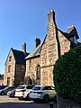
 Melrose Court, Penhill, Cardiff - geograph.org.uk - 1982166.jpg 3 296 × 2 472 ; 1,77 Mio
-
 Mile Stone - Cardiff 2 - geograph.org.uk - 5597931.jpg 417 × 640 ; 68 kio
-
 Narrow Chapel Street, Llandaff, Cardiff - geograph.org.uk - 5692666.jpg 582 × 800 ; 129 kio
-
 NatWest Cymru, Llandaff, Cardiff - geograph.org.uk - 5534351.jpg 800 × 792 ; 105 kio
-
 North along Chapel Street, Llandaff, Cardiff - geograph.org.uk - 5661097.jpg 431 × 800 ; 97 kio
-

-

-

-
 NW corner of the churchyard, Danescourt, Cardiff - geograph.org.uk - 4379766.jpg 711 × 800 ; 183 kio
-

-
 On the new footbridge from Radyr Quarry Junction - geograph.org.uk - 6081208.jpg 1 024 × 683 ; 200 kio
-
 Ordnance Survey Cut Mark - geograph.org.uk - 5571566.jpg 640 × 448 ; 121 kio
-
 Ordnance Survey Cut Mark - geograph.org.uk - 5597906.jpg 640 × 441 ; 118 kio
-
 Ordnance Survey Cut Mark - geograph.org.uk - 5597908.jpg 640 × 337 ; 73 kio
-
 Ordnance Survey Cut Mark - geograph.org.uk - 5597915.jpg 640 × 453 ; 107 kio
-
 Ordnance Survey Cut Mark - geograph.org.uk - 5597920.jpg 640 × 397 ; 96 kio
-
 Ordnance Survey Cut Mark - geograph.org.uk - 5597923.jpg 640 × 429 ; 108 kio
-
 Ordnance Survey Cut Mark - geograph.org.uk - 5597925.jpg 640 × 436 ; 89 kio
-
 Ordnance Survey Cut Mark - geograph.org.uk - 5597927.jpg 640 × 413 ; 93 kio
-
 Ordnance Survey Cut Mark - geograph.org.uk - 5597937.jpg 640 × 345 ; 97 kio
-
 Ordnance Survey Cut Mark - geograph.org.uk - 5597943.jpg 393 × 640 ; 81 kio
-
 Ordnance survey Cut Mark - geograph.org.uk - 5597945.jpg 640 × 438 ; 104 kio
-
 Ordnance Survey Cut Mark - geograph.org.uk - 5597946.jpg 640 × 385 ; 97 kio
-
 Ordnance Survey Cut Mark - geograph.org.uk - 5947648.jpg 673 × 1 024 ; 200 kio
-
 Ordnance Survey Cut Mark - geograph.org.uk - 5947653.jpg 748 × 1 024 ; 347 kio
-
 Ordnance Survey Cut Mark - geograph.org.uk - 5947788.jpg 537 × 1 024 ; 170 kio
-
 Ordnance Survey Flush Bracket (G3711) - geograph.org.uk - 5597918.jpg 498 × 640 ; 99 kio
-
 Palace Road, Cardiff - geograph.org.uk - 1985615.jpg 640 × 470 ; 84 kio
-
 Parade of shops, Waun Gron Road, Cardiff - geograph.org.uk - 1136922.jpg 640 × 427 ; 56 kio
-
 Paradox Hairdressing, Danescourt, Cardiff - geograph.org.uk - 4371876.jpg 800 × 563 ; 122 kio
-
-
-
 Path to Danescourt Primary School, Cardiff - geograph.org.uk - 4379798.jpg 800 × 506 ; 123 kio
-
 Path to Heol Aradur, Cardiff - geograph.org.uk - 5662459.jpg 777 × 800 ; 237 kio
-

-
 Peckham Close - geograph.org.uk - 2792111.jpg 640 × 480 ; 70 kio
-
 Piper Close, Danescourt, Cardiff - geograph.org.uk - 4374965.jpg 800 × 446 ; 93 kio
-
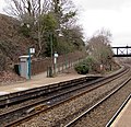
 Platform 1, Danescourt railway station, Cardiff - geograph.org.uk - 4539012.jpg 800 × 616 ; 173 kio
-
 Playing fields at the Cathedral School, Llandaff - geograph.org.uk - 1888186.jpg 640 × 480 ; 116 kio
-
 Preaching Cross on Cathedral Green, Llandaff - geograph.org.uk - 2006887.jpg 480 × 640 ; 76 kio
-
 Prebendal House Close-up.jpg 5 184 × 3 456 ; 8,77 Mio
-
 Public Conveniences, Llandaff - geograph.org.uk - 1887554.jpg 640 × 480 ; 111 kio
-
-

-

-
 Radyr Chain bus stop shelter adverts, Cardiff - geograph.org.uk - 5662469.jpg 800 × 550 ; 162 kio
-
 Radyr Comprehensive School - geograph.org.uk - 2792120.jpg 640 × 480 ; 66 kio
-

-
 Radyr Filling Station, Llantrisant Road, Cardiff - geograph.org.uk - 5662435.jpg 800 × 613 ; 124 kio
-
 Radyr Loop Line bridge - geograph.org.uk - 3664460.jpg 2 276 × 1 708 ; 1,48 Mio
-
-
 Railway Bridge - geograph.org.uk - 5198308.jpg 3 264 × 2 448 ; 2,12 Mio
-
 Railway bridge in Ely Road, Cardiff - geograph.org.uk - 2284484.jpg 1 024 × 683 ; 144 kio
-
 Railway bridge near Danescourt - geograph.org.uk - 2084963.jpg 2 816 × 2 112 ; 2,33 Mio
-

-
 Restway Court, Danescourt Way, Cardiff - geograph.org.uk - 4372108.jpg 800 × 551 ; 96 kio
-
 River Taff at Llandaff North - geograph.org.uk - 5454030.jpg 3 264 × 2 448 ; 2,65 Mio
-
 Road junction at Waun-gron Road - geograph.org.uk - 4139444.jpg 2 560 × 1 920 ; 2,04 Mio
-
 Road junction, Llandaff High Street - geograph.org.uk - 4139498.jpg 2 560 × 1 920 ; 2,11 Mio
-

-
 Roper Close, Danescourt, Cardiff - geograph.org.uk - 4374877.jpg 800 × 538 ; 99 kio
-
 Roundabout on the A4119 - geograph.org.uk - 1887677.jpg 640 × 480 ; 96 kio


.jpg)


,_Llandaff,_July_2020.jpg)


.JPG)


.jpg)
.jpg)


_1898-1905.jpg)


.jpg)


.jpg)


.jpg)
.jpg)


_-_geograph.org.uk_-_5597918.jpg)


