Category:Rhymney
Aller à la navigation
Aller à la recherche
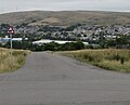
Български: 300px|мини|Панорамен изглед от Римни
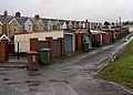
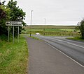
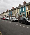
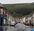
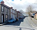
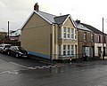
English: Rhymney is a town and a Community located in the county borough of Caerphilly, in south-east Wales, within the historic boundaries of Monmouthshire. Along with the villages of Pontlottyn, Fochriw, Abertysswg, Deri and New Tredegar, Rhymney is designated as the 'Upper Rhymney Valley' by the local Unitary Authority, Caerphilly County Borough Council. As a community, Rhymney includes the town of Rhymney, Pontlottyn, Abertysswg, Butetown and Twyncarno.
ville et communauté dans le borough de comté de Caerphilly, au pays de Galles   | |||||
| Téléverser des médias | |||||
| Nature de l’élément | |||||
|---|---|---|---|---|---|
| Lieu | Caerphilly, pays de Galles | ||||
| Population |
| ||||
| Superficie |
| ||||
| À ne pas confondre avec | |||||
 | |||||
Sous-catégories
Cette catégorie comprend 13 sous-catégories, dont les 13 ci-dessous.
2
A
B
- Bute Town (6 F)
I
- Idris Davies School (3 F)
P
R
- Rhymney Cemetery (10 F)
- Rhymney College (2 F)
- Rhymney Hill (4 F)
- Rhymney railway station (28 F)
S
- Soar-y-graig chapel, Rhymney (2 F)
Média dans la catégorie « Rhymney »
Cette catégorie comprend 1 058 fichiers, dont les 200 ci-dessous.
(page précédente) (page suivante)-
 2010 Wales Caerphilly Community Rhymney map.svg 512 × 725 ; 375 kio
-
 2024 Wales Caerphilly Community Rhymney map.svg 512 × 725 ; 345 kio
-
 21st century houses in Abertysswg - geograph.org.uk - 6144627.jpg 1 024 × 673 ; 167 kio
-
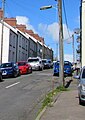
 53-56 High Street, Rhymney - geograph.org.uk - 5998923.jpg 1 024 × 768 ; 176 kio
-
 A back alley in Rhymney - geograph.org.uk - 3939925.jpg 800 × 576 ; 131 kio
-
 A back lane in Abertysswg - geograph.org.uk - 6133395.jpg 1 024 × 722 ; 232 kio
-
 A back lane in Abertysswg - geograph.org.uk - 6141467.jpg 1 024 × 782 ; 230 kio
-
 A bench with a view of a fence, Pontlottyn - geograph.org.uk - 3420310.jpg 640 × 560 ; 130 kio
-
 A dominant blackbird - geograph.org.uk - 3371780.jpg 640 × 293 ; 131 kio
-
 A reminder of the former Rhymney Brewery - geograph.org.uk - 2967507.jpg 640 × 480 ; 91 kio
-
 A signal sign, Pontlottyn - geograph.org.uk - 3425276.jpg 800 × 628 ; 173 kio
-
 A view down Edmund Street, Pontlottyn - geograph.org.uk - 3424050.jpg 640 × 434 ; 64 kio
-
 A view south from Pontlottyn railway station - geograph.org.uk - 3419148.jpg 640 × 480 ; 117 kio
-
 A1 Autocare, Rhymney - geograph.org.uk - 3819836.jpg 800 × 538 ; 125 kio
-
 A465 near Princetown - geograph.org.uk - 2951703.jpg 640 × 482 ; 43 kio
-
 A465 passing woodland east of Rhymney - geograph.org.uk - 2498681.jpg 800 × 600 ; 287 kio
-
 A465 towards Princetown and Tafarnaubach - geograph.org.uk - 6125780.jpg 1 024 × 821 ; 175 kio
-
 A465 westbound near Bute Town - geograph.org.uk - 3790748.jpg 640 × 481 ; 42 kio
-
 A469 at Old Police Court, Pontllotyn - geograph.org.uk - 5761140.jpg 640 × 480 ; 57 kio
-
 A469 direction sign near Bute Town - geograph.org.uk - 6224384.jpg 1 367 × 1 271 ; 346 kio
-
 A469 heads NW away from Rhymney - geograph.org.uk - 3940139.jpg 800 × 565 ; 97 kio
-
 A469, Bute Town, Rhymney - geograph.org.uk - 3020536.jpg 640 × 480 ; 148 kio
-
 Abandoned car park - geograph.org.uk - 5423940.jpg 4 414 × 2 753 ; 1,78 Mio
-
 Abertysswg - Please Drive Carefully - geograph.org.uk - 6141189.jpg 1 024 × 942 ; 316 kio
-

-
 Abertysswg Community Centre - geograph.org.uk - 6140797.jpg 1 024 × 979 ; 282 kio
-
 Abertysswg Community Centre name sign - geograph.org.uk - 6140820.jpg 1 024 × 475 ; 168 kio
-
 Abertysswg Falcons name, Maes McLaren, Abertysswg - geograph.org.uk - 6134238.jpg 1 024 × 768 ; 279 kio
-
 Abertysswg Pensioners Hall - geograph.org.uk - 6140800.jpg 1 024 × 1 016 ; 241 kio
-
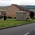
 Abertysswg prime electricity substation - geograph.org.uk - 6144647.jpg 3 960 × 2 574 ; 2,49 Mio
-
 Abertysswg War Memorial - geograph.org.uk - 6140753.jpg 1 024 × 887 ; 265 kio
-
 Abertysswg Working Men's Club - geograph.org.uk - 951895.jpg 640 × 481 ; 101 kio
-
 Abertysswg Working Men's Club ^ Institute - geograph.org.uk - 6141423.jpg 1 024 × 862 ; 187 kio
-
 Accept guide dogs, Rhymney - geograph.org.uk - 3940336.jpg 800 × 669 ; 184 kio
-
 Access road to Blaencarno - geograph.org.uk - 3681866.jpg 800 × 451 ; 173 kio
-
 Access road to Maerdy View, Rhymney - geograph.org.uk - 6142018.jpg 1 024 × 697 ; 214 kio
-
 Action for Children, Waterloo Terrace, Pontlottyn - geograph.org.uk - 5855910.jpg 1 024 × 646 ; 130 kio
-
 Advance warning for junction to Bargoed - geograph.org.uk - 2498668.jpg 800 × 600 ; 329 kio
-
 AED on Rhymney railway station - geograph.org.uk - 6215427.jpg 1 359 × 1 600 ; 335 kio
-
 Ael y Bryn direction sign, Upper High Street, Rhymney - geograph.org.uk - 6112047.jpg 1 024 × 967 ; 191 kio
-
 Ael-y-bryn Community Centre near Rhymney - geograph.org.uk - 6110973.jpg 1 024 × 578 ; 127 kio
-
 Ael-y-Bryn Community Centre, Rhymney - geograph.org.uk - 3135406.jpg 640 × 480 ; 74 kio
-
 Alexander Place, Rhymney - geograph.org.uk - 3816939.jpg 800 × 518 ; 105 kio
-
 Alexander Street, Abertysswg - geograph.org.uk - 6140789.jpg 727 × 1 024 ; 142 kio
-
 Alfred Street, Abertysswg - geograph.org.uk - 6133369.jpg 1 024 × 777 ; 136 kio
-
 Amazing Angels, 100 Ty Coch, Rhymney - geograph.org.uk - 6116924.jpg 1 024 × 844 ; 208 kio
-
 Andrew Buchan clock, Rhymney - geograph.org.uk - 2967466.jpg 640 × 480 ; 67 kio
-
 Aneurin Terrace bus stop and shelter, Rhymney - geograph.org.uk - 6112110.jpg 1 024 × 956 ; 233 kio
-
 Aneurin Terrace houses, Rhymney - geograph.org.uk - 6112039.jpg 1 024 × 812 ; 162 kio
-
 Aneurin Terrace houses, Rhymney - geograph.org.uk - 6112137.jpg 1 024 × 879 ; 143 kio
-
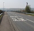 ARAF-SLOW on the approach to Llechryd - geograph.org.uk - 6125766.jpg 1 024 × 930 ; 158 kio
-
 Art Everywhere, No.1, Victoria Road, Rhymney - geograph.org.uk - 3601534.jpg 640 × 480 ; 83 kio
-
 Arthur Street houses, Abertysswg - geograph.org.uk - 6140807.jpg 946 × 1 024 ; 237 kio
-
 Ascent away from Abertysswg - geograph.org.uk - 6144688.jpg 1 024 × 677 ; 170 kio
-
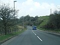
 Ascent towards Llechryd - geograph.org.uk - 6117529.jpg 1 024 × 939 ; 365 kio
-
 Ascent towards Rhymney - geograph.org.uk - 6140683.jpg 1 024 × 774 ; 265 kio
-
 Ashgrove House, Rhymney - geograph.org.uk - 3926637.jpg 800 × 561 ; 144 kio
-
 B4257 at Rhymney boundary - geograph.org.uk - 5761146.jpg 640 × 480 ; 62 kio
-
 B4257 north of Rhymney - geograph.org.uk - 5761165.jpg 640 × 481 ; 63 kio
-
 B4257 north of Rhymney - geograph.org.uk - 6117050.jpg 1 024 × 766 ; 192 kio
-
 B4257 west of Llechryd - geograph.org.uk - 6117599.jpg 1 024 × 883 ; 284 kio
-
 Back of an electricity substation, Fochriw Road, Pontlottyn - geograph.org.uk - 5864793.jpg 1 018 × 1 024 ; 167 kio
-
 Barriers across a footpath and cycleway, Rhymney - geograph.org.uk - 6145811.jpg 952 × 1 024 ; 365 kio
-
 Be part of our Team, Rhymney Fire Station - geograph.org.uk - 5999044.jpg 949 × 1 024 ; 259 kio
-
 Bench on a grassy bank, Abertysswg - geograph.org.uk - 6141406.jpg 1 024 × 927 ; 293 kio
-
 Bench, Carn-y-tyla Terrace, Abertysswg - geograph.org.uk - 6144580.jpg 1 024 × 768 ; 351 kio
-
 Bend in the A469, Pontlottyn - geograph.org.uk - 5880072.jpg 1 024 × 953 ; 206 kio
-
 Bend in the minor road from Rhymney to Abertysswg - geograph.org.uk - 6141979.jpg 1 024 × 863 ; 229 kio
-
 Best One in Pontlottyn - geograph.org.uk - 5856539.jpg 1 024 × 1 011 ; 208 kio
-
 Best-One and post office, Ty Coch, Rhymney - geograph.org.uk - 6116892.jpg 1 024 × 867 ; 228 kio
-
 Beulah Baptist Church - geograph.org.uk - 691830.jpg 640 × 481 ; 83 kio
-
 Beulah Chapel and Beulah Street - geograph.org.uk - 1629829.jpg 640 × 480 ; 145 kio
-
 Beulah chapel, Rhymney - geograph.org.uk - 3135588.jpg 640 × 480 ; 54 kio
-
 Blackbird with mealworms - geograph.org.uk - 3492030.jpg 640 × 480 ; 123 kio
-
 Blast Furnace, Pontlottyn - geograph.org.uk - 6140554.jpg 1 024 × 907 ; 233 kio
-
 Blue tit with a mealworm - geograph.org.uk - 3492018.jpg 640 × 480 ; 107 kio
-
 Board Street flats, Pontlottyn - geograph.org.uk - 3425400.jpg 800 × 584 ; 130 kio
-
 Boulder-lined edge of a sports field, Pontlottyn - geograph.org.uk - 6140613.jpg 3 719 × 2 005 ; 1,66 Mio
-
 Boulders alongside the B4257 in the north of Rhymney - geograph.org.uk - 6112013.jpg 1 024 × 536 ; 109 kio
-
 Boulders alongside the B4257 north of Rhymney - geograph.org.uk - 6117057.jpg 1 024 × 886 ; 293 kio
-
 Boundary fence, Rhymney Common - geograph.org.uk - 3889821.jpg 640 × 480 ; 82 kio
-
 Brewer Street, Pontlottyn - geograph.org.uk - 5855776.jpg 1 024 × 981 ; 191 kio
-
 Brick sides of a road bridge, Abertysswg - geograph.org.uk - 6156152.jpg 1 024 × 878 ; 223 kio
-

-
 Bridleway signpost, Princetown - geograph.org.uk - 6121330.jpg 1 024 × 767 ; 176 kio
-
 Bryn Amlwg Close, Princetown - geograph.org.uk - 6121169.jpg 1 024 × 696 ; 134 kio
-
 Bryn Carno semis, Rhymney - geograph.org.uk - 6117028.jpg 1 024 × 870 ; 174 kio
-
 Bryn Seion Street, Rhymney - geograph.org.uk - 3939932.jpg 800 × 523 ; 114 kio
-
 Brynglas houses, Pontlottyn - geograph.org.uk - 5864772.jpg 1 024 × 704 ; 128 kio
-
 Brynhyfryd - geograph.org.uk - 5299232.jpg 4 928 × 3 264 ; 6,13 Mio
-

-
 Brynhyfryd Site, Pontlottyn - geograph.org.uk - 2927940.jpg 3 008 × 2 000 ; 1,91 Mio
-
 Brynteg Crescent - geograph.org.uk - 940217.jpg 640 × 480 ; 99 kio
-
 Brynteg Crescent, Rhymney - geograph.org.uk - 3842781.jpg 640 × 480 ; 92 kio
-
 BT phonebox on a Rhymney corner - geograph.org.uk - 6110945.jpg 395 × 640 ; 58 kio
-
 Building dated 1906, Bute Town near Rhymney - geograph.org.uk - 6208625.jpg 1 051 × 1 600 ; 335 kio
-
 Bungalows below Warne's Terrace, Abertysswg - geograph.org.uk - 6141417.jpg 1 024 × 602 ; 181 kio
-
 Bus shelter on a small triangle, Rhymney - geograph.org.uk - 6140689.jpg 1 024 × 858 ; 171 kio
-

-
 Bus stop, shelter and bench, Llechryd - geograph.org.uk - 6117616.jpg 1 024 × 843 ; 342 kio
-
 Bute Town Playground - geograph.org.uk - 6208605.jpg 1 600 × 988 ; 501 kio
-
 Bute Town Reservoir, Rhymney - geograph.org.uk - 3020517.jpg 640 × 480 ; 134 kio
-
 Bute Town, Rhymney - geograph.org.uk - 3020525.jpg 640 × 480 ; 114 kio
-
 Butetown - Y Drenewydd, Rhymney - geograph.org.uk - 3135866.jpg 640 × 480 ; 62 kio
-
 Butetown direction sign south of Llechryd - geograph.org.uk - 6208581.jpg 1 600 × 1 431 ; 505 kio
-
 Byelaws notice, Maes McLaren, Abertysswg - geograph.org.uk - 6134230.jpg 1 024 × 584 ; 163 kio
-
 Caerphilly UK community map (Rhymney).svg 894 × 1 266 ; 474 kio
-
 Calvary Chapel (Evangelical) in Rhymney - geograph.org.uk - 3820329.jpg 800 × 496 ; 111 kio
-
 Calvary Chapel information board, Rhymney - geograph.org.uk - 5999067.jpg 1 024 × 912 ; 192 kio
-
 Calvary chapel, Rhymney - geograph.org.uk - 3135583.jpg 640 × 480 ; 77 kio
-
 Calvin White's Shop - geograph.org.uk - 2927894.jpg 3 008 × 2 000 ; 2,33 Mio
-
 Cambrian Street Rhymney - geograph.org.uk - 3871474.jpg 800 × 468 ; 106 kio
-
 Canolfan Cymunedol Abertyswg - geograph.org.uk - 6140817.jpg 1 024 × 609 ; 239 kio
-
 Capital Valley Business Park direction sign, Pontlottyn - geograph.org.uk - 5880057.jpg 1 024 × 816 ; 145 kio
-
 Car-lined Colenso Terrace, Rhymney - geograph.org.uk - 5999314.jpg 1 024 × 984 ; 252 kio
-

-
 Cardiff Central train in Rhymney station - geograph.org.uk - 6215408.jpg 1 600 × 1 347 ; 471 kio
-
 Carn Y Tyla Terrace (1) - geograph.org.uk - 987915.jpg 640 × 480 ; 105 kio
-
 Carn Y Tyla Terrace (2) - geograph.org.uk - 987918.jpg 640 × 480 ; 73 kio
-
 Carn-y-tyla Terrace houses, Abertysswg - geograph.org.uk - 6144552.jpg 1 024 × 739 ; 155 kio
-
 Carn-y-tyla Terrace, Abertysswg - geograph.org.uk - 6144527.jpg 1 024 × 741 ; 184 kio
-
 Carno Bridge, Rhymney - geograph.org.uk - 3193329.jpg 640 × 480 ; 96 kio
-
 Carno Court electricity substation, Rhymney - geograph.org.uk - 6208906.jpg 1 600 × 1 164 ; 427 kio
-
 Carno Street and Upper High St junction - geograph.org.uk - 5423972.jpg 5 202 × 3 465 ; 2,69 Mio
-
 Carno Street bridge over Rhymney River - geograph.org.uk - 5423955.jpg 5 202 × 3 465 ; 4,13 Mio
-
 Carno Street trees in Rhymney - geograph.org.uk - 3816933.jpg 492 × 800 ; 141 kio
-
 Carno Street, Rhymney - geograph.org.uk - 3250086.jpg 640 × 480 ; 114 kio
-
 Cars and houses, Carn-y-tyla Terrace, Abertysswg - geograph.org.uk - 6144576.jpg 1 024 × 701 ; 142 kio
-
 Cars and houses, High Street, Rhymney - geograph.org.uk - 5999317.jpg 898 × 1 024 ; 159 kio
-
 Carters Private Hire booking office, Rhymney - geograph.org.uk - 3824128.jpg 800 × 615 ; 136 kio
-
 Castle Hotel, Rhymney - geograph.org.uk - 1119738.jpg 640 × 480 ; 83 kio
-
 Cattle grid on a minor road north-east of Dowlais Top - geograph.org.uk - 5961253.jpg 2 560 × 1 920 ; 2,46 Mio
-
 Cattle grid on a minor road north-west of Bute Town - geograph.org.uk - 5961233.jpg 2 560 × 1 920 ; 2,36 Mio
-
 Cattle Grid onto Rhymney and Bedwellty Common - geograph.org.uk - 499784.jpg 640 × 480 ; 236 kio
-
 Cattle grid warning sign west of Llechryd - geograph.org.uk - 6224279.jpg 1 515 × 1 600 ; 513 kio
-
-
 CCTV camera near Bute Town - geograph.org.uk - 6224559.jpg 1 500 × 1 600 ; 378 kio
-
 CCTV cameras notice on Rhymney railway station - geograph.org.uk - 6208537.jpg 1 014 × 1 024 ; 302 kio
-
 CCTV in operation notice, Charles Street, Abertysswg - geograph.org.uk - 6141167.jpg 1 024 × 925 ; 278 kio
-
 Central Fish Bar in Pontlottyn - geograph.org.uk - 5856089.jpg 1 207 × 1 367 ; 307 kio
-
 Changing ends at Rhymney railway station - geograph.org.uk - 3819681.jpg 800 × 561 ; 144 kio
-
 Charles Street - geograph.org.uk - 952398.jpg 640 × 480 ; 107 kio
-
 Charles Street speed bumps, Abertysswg - geograph.org.uk - 6133372.jpg 1 024 × 941 ; 207 kio
-
 Charles Street, Abertysswg - geograph.org.uk - 6133331.jpg 640 × 582 ; 94 kio
-
 Children's playground in Abertysswg - geograph.org.uk - 6140768.jpg 1 024 × 849 ; 284 kio
-
 Children's slide in Bute Town Playground near Rhymney - geograph.org.uk - 6208610.jpg 1 397 × 1 600 ; 616 kio
-
 Church and a former school in Abertysswg - geograph.org.uk - 6146744.jpg 1 024 × 726 ; 169 kio
-
 Church Street houses, Rhymney - geograph.org.uk - 3871409.jpg 800 × 465 ; 103 kio
-
 Church Street, Pontlottyn - geograph.org.uk - 3419340.jpg 640 × 523 ; 98 kio
-
 Church Street, Pontlottyn - geograph.org.uk - 5855737.jpg 1 024 × 768 ; 159 kio
-
 Church Street, Rhymney (1) - geograph.org.uk - 1658891.jpg 640 × 480 ; 96 kio
-
 Class 142 dmu at Rhymney station - geograph.org.uk - 5999357.jpg 1 024 × 665 ; 174 kio
-
 Class 37 at Pontlottyn - geograph.org.uk - 6170519.jpg 4 297 × 3 222 ; 3,82 Mio
-
 Class 37 at Pontlottyn - geograph.org.uk - 6271409.jpg 5 112 × 2 875 ; 3,9 Mio
-
 Class 37 at Pontlottyn - geograph.org.uk - 6271413.jpg 3 945 × 2 958 ; 3,17 Mio
-
 Class 37 at Pontlottyn - geograph.org.uk - 6271414.jpg 4 961 × 3 720 ; 5,31 Mio
-
 Class 37 at Rhymney - geograph.org.uk - 6170522.jpg 5 184 × 3 888 ; 5,19 Mio
-
 Class 37 at Rhymney - geograph.org.uk - 6191063.jpg 5 080 × 3 810 ; 7,47 Mio
-
 Class 37 at Rhymney - geograph.org.uk - 6271411.jpg 5 184 × 3 888 ; 6,61 Mio
-
 Class 37 at Rhymney - geograph.org.uk - 6271412.jpg 5 184 × 3 888 ; 5,93 Mio
-
 Class 37 diesel-electric locomotive in sidings, Rhymney - geograph.org.uk - 6208531.jpg 1 600 × 1 516 ; 571 kio
-
 Class 37 near Pontlottyn - geograph.org.uk - 6164925.jpg 5 184 × 3 888 ; 5,8 Mio
-
 Class 37 near Pontlottyn - geograph.org.uk - 6191065.jpg 5 182 × 3 887 ; 7,74 Mio
-
 Class 37 near Pontlottyn - geograph.org.uk - 6247247.jpg 3 587 × 2 689 ; 3,33 Mio
-
 Class 37 near Pontlottyn - geograph.org.uk - 6247248.jpg 4 661 × 3 495 ; 4,95 Mio
-
 Class 37 near Pontlottyn - geograph.org.uk - 6248919.jpg 4 351 × 3 264 ; 5,15 Mio
-

-
 Clock on Fit4Living centre, Rhymney - geograph.org.uk - 5425340.jpg 5 202 × 3 465 ; 3,18 Mio
-
 Clock on the side of Fit4Living premises, Rhymney - geograph.org.uk - 6208390.jpg 1 600 × 1 316 ; 344 kio
-
 Clos Bryn Brith houses, Princetown - geograph.org.uk - 6121194.jpg 824 × 1 024 ; 139 kio
-
 Clos Bryn Brith, Princetown - geograph.org.uk - 6121172.jpg 1 024 × 682 ; 101 kio
-
 Co-operative Pharmacy in Rhymney - geograph.org.uk - 3816946.jpg 800 × 539 ; 110 kio
-
 Colas Rail Freight Class 37 diesel locomotive in Rhymney - geograph.org.uk - 6231588.jpg 1 600 × 1 200 ; 699 kio
-
 Coleg y Cymoedd Rhymney Campus - geograph.org.uk - 3819811.jpg 800 × 549 ; 90 kio
-
 Colliery memorial, Rhymney - geograph.org.uk - 3135621.jpg 640 × 480 ; 66 kio
-
 Colliery Wheels, Rhymney - geograph.org.uk - 537580.jpg 640 × 480 ; 108 kio
-
 Collins Row, Bute Town, Rhymney - geograph.org.uk - 3135319.jpg 640 × 480 ; 87 kio
-

-
 Community Allotment, Rhymney - geograph.org.uk - 707196.jpg 640 × 480 ; 123 kio
-
 Community allotments, Rhymney - geograph.org.uk - 3135429.jpg 640 × 480 ; 55 kio
-
 Complete Care Pharmacy, High Street, Rhymney - geograph.org.uk - 6208271.jpg 2 747 × 2 428 ; 1,8 Mio
-
 Confluence of a stream and the Rhymney River - geograph.org.uk - 4776638.jpg 4 000 × 3 000 ; 3,38 Mio
-
 Confluence of Nant Carno and the Rhymney River - geograph.org.uk - 3193237.jpg 640 × 480 ; 150 kio
-
 Connect Tyre Bar in Llechryd - geograph.org.uk - 6125716.jpg 1 024 × 813 ; 150 kio
-
 Construction of a medical centre, Rhymney (1) - geograph.org.uk - 3098662.jpg 640 × 480 ; 113 kio
-
 Construction of a medical centre, Rhymney (2) - geograph.org.uk - 3098667.jpg 640 × 480 ; 128 kio
-
-

-
 Corner of Pidwelt Rise and Fochriw Road, Pontlottyn - geograph.org.uk - 5864816.jpg 1 024 × 873 ; 224 kio
-
 Coronation Terrace houses and a postbox, Rhymney - geograph.org.uk - 3939948.jpg 800 × 529 ; 112 kio
-
 Crocodile teeth on Fochriw Road, Pontlottyn - geograph.org.uk - 5902270.jpg 607 × 640 ; 99 kio
-
 Cross Street, Rhymney - geograph.org.uk - 3021649.jpg 640 × 480 ; 87 kio
-
 Cycle route 468 marker near Rhymney - geograph.org.uk - 6141975.jpg 880 × 1 024 ; 247 kio
-
 Cycle route 486 direction sign, Station Road, Abertysswg - geograph.org.uk - 6133346.jpg 770 × 1 024 ; 166 kio
-
 Cycle route NE from Rhymney Walk, Rhymney - geograph.org.uk - 3819859.jpg 800 × 677 ; 190 kio
-

-
 Dan-y-graig houses, Pontlottyn - geograph.org.uk - 3423720.jpg 800 × 576 ; 112 kio
-
 Dan-y-Graig, Pontlottyn - geograph.org.uk - 5855919.jpg 1 024 × 576 ; 123 kio
-
 Dark green cabinet at the edge of Rhymney railway station - geograph.org.uk - 6208432.jpg 1 600 × 1 183 ; 441 kio
-
 Dark green cabinets on a Rhymney corner - geograph.org.uk - 6110954.jpg 1 024 × 866 ; 161 kio


.svg)
_in_Rhymney_-_geograph.org.uk_-_3820329.jpg)


_-_geograph.org.uk_-_987915.jpg)
_-_geograph.org.uk_-_987918.jpg)


_-_geograph.org.uk_-_1658891.jpg)


_-_geograph.org.uk_-_3098662.jpg)
_-_geograph.org.uk_-_3098667.jpg)


