Category:Rudry
Aller à la navigation
Aller à la recherche
village et communauté dans le borough de comté de Caerphilly, au pays de Galles   | |||||
| Téléverser des médias | |||||
| Nature de l’élément | |||||
|---|---|---|---|---|---|
| Lieu | Caerphilly, pays de Galles | ||||
| Population |
| ||||
| Superficie |
| ||||
 | |||||
Sous-catégories
Cette catégorie comprend 7 sous-catégories, dont les 7 ci-dessous.
C
- Caerphilly Tunnel (5 F)
- Cefn Onn quarry (7 F)
D
L
- Llwyn Celyn Forestry Walk (4 F)
- Llwyn Hir Forestry Walk (7 F)
R
- Ruperra Castle (14 F)
S
Média dans la catégorie « Rudry »
Cette catégorie comprend 455 fichiers, dont les 200 ci-dessous.
(page précédente) (page suivante)-
 2010 Wales Caerphilly Community Rudry map.svg 512 × 725 ; 375 kio
-
 2024 Wales Caerphilly Community Rudry map.svg 512 × 725 ; 345 kio
-

-
 A view from crossroads, Draethen - geograph.org.uk - 3062029.jpg 640 × 443 ; 75 kio
-
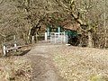
 About to descend to the Ty Mawr pub - geograph.org.uk - 3162133.jpg 1 920 × 1 080 ; 683 kio
-
 Access lane to Cwm Farm near Rudry - geograph.org.uk - 3062573.jpg 640 × 554 ; 99 kio
-
 Approaching Rudry - geograph.org.uk - 1043293.jpg 640 × 480 ; 80 kio
-
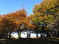
 Autumn colours beside Van Road - geograph.org.uk - 3198799.jpg 2 758 × 3 641 ; 5,04 Mio
-
 Autumn colours in Coed Cefn Onn - geograph.org.uk - 3198748.jpg 4 000 × 3 000 ; 4,21 Mio
-
 Autumn colours in Coed Cefn Onn - geograph.org.uk - 3198753.jpg 4 000 × 3 000 ; 5,06 Mio
-
 Autumn leaves - geograph.org.uk - 5967808.jpg 2 448 × 3 264 ; 3,42 Mio
-
 Barley field in the Rhymney Valley - geograph.org.uk - 2415767.jpg 1 024 × 680 ; 160 kio
-
 Barns at Bridge Farm - geograph.org.uk - 3120289.jpg 2 082 × 1 562 ; 1,11 Mio
-
 Barrier at a track into Coed Parc-y-Van - geograph.org.uk - 4196743.jpg 800 × 600 ; 185 kio
-
 Bend in the road opposite Ty-yr-efail - geograph.org.uk - 3063270.jpg 640 × 493 ; 99 kio
-
 Bend in the road, south-west of Draethen - geograph.org.uk - 2055663.jpg 1 600 × 1 200 ; 693 kio
-
 Berllan Gollen - geograph.org.uk - 5323769.jpg 3 264 × 2 448 ; 3,05 Mio
-
 Bluebells in Cefn Coed Pwll Ddu - geograph.org.uk - 3171474.jpg 3 456 × 2 304 ; 3,12 Mio
-
 Bridge across Nant y Cwm near Rudry - geograph.org.uk - 3062516.jpg 640 × 480 ; 97 kio
-
 Bridge over Cwm Du - geograph.org.uk - 2414592.jpg 1 024 × 680 ; 270 kio
-
 Bridge over small stream, beside the entrance to Coed Wern-ddu - geograph.org.uk - 1956224.jpg 3 296 × 2 472 ; 1,8 Mio
-
 Bridge over the M4 - geograph.org.uk - 210144.jpg 640 × 480 ; 57 kio
-
 Bridge over the Rhymney River near Waterloo - geograph.org.uk - 6161225.jpg 1 024 × 788 ; 289 kio
-
 Bridleway junction in Coed Craig Ruperra - geograph.org.uk - 6164617.jpg 5 179 × 3 451 ; 4,97 Mio
-
 Bryngolau and Garth Place, Rudry - geograph.org.uk - 3063199.jpg 640 × 393 ; 60 kio
-
 Brynhyfryd, Rudry - geograph.org.uk - 3062840.jpg 640 × 509 ; 72 kio
-
 Bungalows at a bend in the road, Waterloo - geograph.org.uk - 6161265.jpg 1 024 × 843 ; 185 kio
-
 Caerphilly Tunnel Air Shaft No.3. - geograph.org.uk - 457512.jpg 480 × 640 ; 359 kio
-
 Caerphilly Tunnel Air Shaft No.4. - geograph.org.uk - 457520.jpg 640 × 480 ; 349 kio
-
 Caerphilly UK community map (Rudry).svg 894 × 1 266 ; 474 kio
-
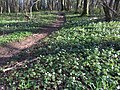 Carpet of Wood Anemones - geograph.org.uk - 5323793.jpg 3 264 × 2 448 ; 4,67 Mio
-
 Cefn Fawr Farm entrance - geograph.org.uk - 1956214.jpg 3 296 × 2 472 ; 1,83 Mio
-
 Cefn Onn farm - geograph.org.uk - 5967943.jpg 3 264 × 2 448 ; 2,75 Mio
-
 Cefn onn Farm, Graig Road - geograph.org.uk - 6162785.jpg 5 179 × 3 451 ; 5,49 Mio
-
 Cefn Onn quarry - geograph.org.uk - 3198695.jpg 4 000 × 3 000 ; 4,3 Mio
-
 Cefn Onn quarry - geograph.org.uk - 3198698.jpg 4 000 × 3 000 ; 4,18 Mio
-
 Cefn Onn quarry - geograph.org.uk - 3198700.jpg 4 000 × 3 000 ; 4,06 Mio
-
 Cefn Onn Quarry - geograph.org.uk - 6196805.jpg 1 600 × 1 200 ; 740 kio
-
 Cefn Onn Ridgeway - geograph.org.uk - 6146129.jpg 1 536 × 2 048 ; 1,31 Mio
-
 Cefn-llwyd Bridge over the Rhymney River - geograph.org.uk - 1956201.jpg 3 296 × 2 472 ; 1,82 Mio
-
 Cefn-onn farm - geograph.org.uk - 3198722.jpg 4 000 × 3 000 ; 3,79 Mio
-
 Cefn-Porth Rd, approaching Rudry Rd, Cardiff - geograph.org.uk - 1534012.jpg 640 × 480 ; 113 kio
-
 Chevron signs at a bend, south-west of Draethen - geograph.org.uk - 2055678.jpg 1 600 × 1 200 ; 789 kio
-
 Coed Cefn-onn - geograph.org.uk - 3198759.jpg 3 000 × 4 000 ; 4,29 Mio
-
 Coed Cefn-onn - geograph.org.uk - 3198767.jpg 4 000 × 3 000 ; 5,41 Mio
-
 Coed Craig Ruperra car park - geograph.org.uk - 2833179.jpg 640 × 480 ; 104 kio
-
 Coed Parc-y-Van car park - geograph.org.uk - 4196720.jpg 800 × 633 ; 156 kio
-
 Coed Parc-y-Van nameboard - geograph.org.uk - 4196681.jpg 800 × 600 ; 200 kio
-
 Coed Rhiwperra - Ruperra Wood - geograph.org.uk - 3729807.jpg 690 × 518 ; 265 kio
-

-
 Craig Llysfaen - geograph.org.uk - 4542504.jpg 640 × 480 ; 99 kio
-
 Crynant Farm, Rudry - geograph.org.uk - 1043274.jpg 640 × 480 ; 74 kio
-
 Crynant Farm, Rudry - geograph.org.uk - 1043278.jpg 640 × 480 ; 60 kio
-
 Crynant Farm, Rudry - geograph.org.uk - 1043279.jpg 640 × 480 ; 66 kio
-
 Cwm Farm near Rudry - geograph.org.uk - 3062496.jpg 640 × 480 ; 76 kio
-
 Cwm-Leyshon Quarry - Disused - geograph.org.uk - 438922.jpg 640 × 480 ; 120 kio
-
 Cwmnofydd Lane, Machen Forge Trail - geograph.org.uk - 1238266.jpg 640 × 480 ; 127 kio
-
 Cyclist on Woodland Track - geograph.org.uk - 5323799.jpg 2 448 × 3 264 ; 3,6 Mio
-

-
 Dark green roadside cabinet near Waterloo - geograph.org.uk - 6161246.jpg 1 024 × 688 ; 232 kio
-

-
 Dead tree stump on Graig Llysfaen - geograph.org.uk - 1934437.jpg 3 296 × 2 472 ; 1,97 Mio
-
 Derelict building, Draethen - geograph.org.uk - 3062131.jpg 640 × 480 ; 120 kio
-
 Derelict tractor, Cefn Onn Farm - geograph.org.uk - 1934360.jpg 3 296 × 2 472 ; 1,87 Mio
-
 Derwen fawr - Great oak - geograph.org.uk - 3729853.jpg 690 × 518 ; 258 kio
-
 Discoloured stream, Rudry - geograph.org.uk - 3063107.jpg 640 × 480 ; 140 kio
-
 Disused Cefn Onn quarry - geograph.org.uk - 2655530.jpg 640 × 480 ; 119 kio
-
 Disused quarry - geograph.org.uk - 5967850.jpg 2 448 × 3 264 ; 2,66 Mio
-
 Downstream along the Rhymney River near Waterloo - geograph.org.uk - 6160526.jpg 2 141 × 2 311 ; 1,22 Mio
-
 Draethen - roadside houses - geograph.org.uk - 6164670.jpg 5 179 × 3 451 ; 4,14 Mio
-

-
 Draethen houses near The Hollybush - geograph.org.uk - 3062152.jpg 640 × 507 ; 79 kio
-
 Drwy gae - Along a field - geograph.org.uk - 4542529.jpg 640 × 480 ; 81 kio
-
 Dumped tyre, Nant y Cwm near Rudry - geograph.org.uk - 3062530.jpg 640 × 480 ; 166 kio
-
 Eastern boundary of Draethen - geograph.org.uk - 2699741.jpg 640 × 448 ; 89 kio
-
 Edge of the forest near Rudry. - geograph.org.uk - 90829.jpg 640 × 480 ; 102 kio
-
 Edward Thomas Close, Rudry - geograph.org.uk - 3063245.jpg 640 × 529 ; 83 kio
-
 Electricity Pylon - Graig Llanishen Footpath - geograph.org.uk - 457337.jpg 640 × 480 ; 320 kio
-
 Electricity pylon, Rudry - geograph.org.uk - 3062882.jpg 640 × 593 ; 88 kio
-
 Electricity pylons - geograph.org.uk - 5967430.jpg 2 448 × 3 264 ; 2,45 Mio
-

-
 End of the 30 zone beyond Waterloo - geograph.org.uk - 6160643.jpg 1 600 × 1 168 ; 421 kio
-
 Entering Llwyncelyn - geograph.org.uk - 3793227.jpg 640 × 480 ; 94 kio
-
 Entrance and driveway near Draethen - geograph.org.uk - 2415772.jpg 1 024 × 680 ; 301 kio
-
 Entrance to Cefn Mably Lakes - geograph.org.uk - 1956207.jpg 3 296 × 2 472 ; 1,91 Mio
-
 Entrance to Coed Wern-ddu - geograph.org.uk - 1956222.jpg 3 296 × 2 472 ; 1,9 Mio
-
 Entrance to Coed Wern-ddu - geograph.org.uk - 2414583.jpg 1 024 × 680 ; 284 kio
-
 Entrance to Coed Wern-ddu - geograph.org.uk - 2847170.jpg 480 × 640 ; 133 kio
-
 Entrance to derelict Cefn Onn Quarry - geograph.org.uk - 6161600.jpg 5 179 × 3 451 ; 4,94 Mio
-
 Entrance to Llwyn Hir car-park, Rudry - geograph.org.uk - 1043298.jpg 640 × 480 ; 111 kio
-
 Entrance to Pentwyn Farm - geograph.org.uk - 1956227.jpg 3 296 × 2 472 ; 1,84 Mio
-
 Entrance to Rudry's Lair Industrial Units, Rudry - geograph.org.uk - 3063033.jpg 640 × 458 ; 124 kio
-
 Farmhouse, Rudry Mill Farm - geograph.org.uk - 3062481.jpg 640 × 480 ; 81 kio
-
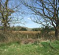
 Farmland by Cefn Mabley Woods - geograph.org.uk - 2409728.jpg 1 024 × 680 ; 220 kio
-
 Farmland in the Rhymney valley - geograph.org.uk - 2409750.jpg 1 024 × 680 ; 164 kio
-
 Farmland near Ruperra Castle - geograph.org.uk - 2414557.jpg 1 024 × 680 ; 163 kio
-

-
 Fenced-off site near Waterloo - geograph.org.uk - 6161250.jpg 1 024 × 552 ; 193 kio
-
 Feral honeybees' nest in a hollow tree on Graig Llysfaen - geograph.org.uk - 1934483.jpg 2 472 × 3 296 ; 2,56 Mio
-
 Field and cottage near Draethen - geograph.org.uk - 3062237.jpg 640 × 498 ; 76 kio
-
 Field and farm buildings, Gwernleyshon Farm - geograph.org.uk - 1043319.jpg 640 × 480 ; 60 kio
-
 Field beside Coed Wern-ddu - geograph.org.uk - 2414587.jpg 1 024 × 680 ; 186 kio
-
 Field by Machen Forge Trail - geograph.org.uk - 2984216.jpg 640 × 480 ; 63 kio
-
 Field east of Waterloo - geograph.org.uk - 2987413.jpg 640 × 480 ; 68 kio
-
 Field footpath - geograph.org.uk - 6241004.jpg 5 184 × 3 456 ; 7,74 Mio
-
 Field in front of Ruperra Castle - geograph.org.uk - 2414567.jpg 4 288 × 2 848 ; 2,25 Mio
-
 Field next to Coed Cefn-onn - geograph.org.uk - 6162979.jpg 5 179 × 3 451 ; 4,86 Mio
-
 Field south of Waterloo near Caerphilly - geograph.org.uk - 2990499.jpg 640 × 480 ; 63 kio
-
 Field with a telegraph pole near Rudry - geograph.org.uk - 2832436.jpg 640 × 480 ; 66 kio
-
 Fields either side of Rhyd-y-Gwern Lane - geograph.org.uk - 6240977.jpg 5 179 × 3 451 ; 4,09 Mio
-
 Fields near Rudry - geograph.org.uk - 3198782.jpg 4 000 × 3 000 ; 2,55 Mio
-
 Fields south of Rudry - geograph.org.uk - 2636152.jpg 640 × 480 ; 84 kio
-
 Footbridge over stream - geograph.org.uk - 6146178.jpg 2 048 × 1 536 ; 1,62 Mio
-
 Footbridge over the Rhymney, Machen - geograph.org.uk - 2763538.jpg 640 × 520 ; 145 kio
-
 Footpath signpost - geograph.org.uk - 2414171.jpg 680 × 1 024 ; 199 kio
-
 Footpath through Coed Craig-Ruperra - geograph.org.uk - 2414573.jpg 1 024 × 680 ; 267 kio
-
 Footpath, part of Rhymney Valley Ridgeway Walk - geograph.org.uk - 6163946.jpg 5 179 × 3 451 ; 4,35 Mio
-
 Fork in the road near Rudry - geograph.org.uk - 3062430.jpg 640 × 422 ; 70 kio
-
 Fork in the road, Rudry - geograph.org.uk - 3062804.jpg 640 × 523 ; 83 kio
-
 Former Ebenezer chapel, Rudry - geograph.org.uk - 3062814.jpg 640 × 399 ; 77 kio
-
 Former post office, Rudry - geograph.org.uk - 3063208.jpg 640 × 508 ; 60 kio
-
 Former red phonebox in Waterloo - geograph.org.uk - 6160902.jpg 1 024 × 944 ; 232 kio
-
 Garth Lane, Rudry - geograph.org.uk - 3063230.jpg 640 × 539 ; 106 kio
-
 Garth Place, Rudry - geograph.org.uk - 3063215.jpg 640 × 495 ; 67 kio
-
 Garth Place, Starbuck St, Rudry - geograph.org.uk - 2251970.jpg 4 000 × 3 000 ; 1,8 Mio
-
 Gate and footpath - geograph.org.uk - 6146143.jpg 3 048 × 2 286 ; 1,96 Mio
-
 Gate and stile, Rhymney Valley Ridgeway Walk - geograph.org.uk - 6163015.jpg 5 179 × 3 451 ; 5,82 Mio
-
 Gated footpath from Rhyd-y-Gwern Farm - geograph.org.uk - 6240931.jpg 5 179 × 3 451 ; 5,07 Mio
-
 Gates to an equine property near Rudry - geograph.org.uk - 2832399.jpg 640 × 480 ; 127 kio
-
 Graig Llanishen Footpath, Thornhill - geograph.org.uk - 441320.jpg 480 × 640 ; 128 kio
-
 Grassy track near Rhyd-y-Gwern Farm - geograph.org.uk - 6240952.jpg 5 179 × 3 451 ; 5,03 Mio
-
 Grassy track to Rhyd-y-Gwern Farm - geograph.org.uk - 6240996.jpg 5 179 × 3 451 ; 4,52 Mio
-
 Green plaque detail, Waterloo - geograph.org.uk - 6160934.jpg 1 234 × 1 205 ; 410 kio
-

-
 Gwernleyshon Farm - geograph.org.uk - 2415768.jpg 1 024 × 680 ; 198 kio
-
 Hedge-lined approach to Draethen - geograph.org.uk - 3062214.jpg 640 × 480 ; 103 kio
-
 Hen Ffawydd - Old Beech Tree - geograph.org.uk - 4542578.jpg 640 × 480 ; 141 kio
-
 Hen geuffordd - Old hollow way - geograph.org.uk - 4542546.jpg 640 × 480 ; 134 kio
-
 High and dry, Rudry - geograph.org.uk - 2252073.jpg 4 000 × 3 000 ; 2,02 Mio
-
 Hill on flank of Craig llanisen - geograph.org.uk - 6161571.jpg 5 179 × 3 451 ; 5,16 Mio
-
 Hole in Field, Machen Forge Trail - geograph.org.uk - 1238287.jpg 640 × 640 ; 110 kio
-
 Horseshoe Cottage, Draethen - geograph.org.uk - 3062096.jpg 640 × 539 ; 89 kio
-
 House at southern edge of Waterloo - geograph.org.uk - 6160884.jpg 1 600 × 1 148 ; 342 kio
-
 Houses opposite the Maenllwyd Inn, Rudry - geograph.org.uk - 3062631.jpg 640 × 397 ; 60 kio
-
 Houses, Berllan-gollen - geograph.org.uk - 6163153.jpg 5 179 × 3 451 ; 5,11 Mio
-
 Inside a former red phonebox, Waterloo - geograph.org.uk - 6160910.jpg 3 000 × 4 000 ; 2,07 Mio
-
 Into Waterloo - geograph.org.uk - 6160875.jpg 1 600 × 1 366 ; 438 kio
-
 Junction in Draethen - geograph.org.uk - 1885287.jpg 640 × 480 ; 107 kio
-
 Junction in lane - geograph.org.uk - 1885292.jpg 640 × 480 ; 68 kio
-

-
 Junction of tracks and paths in woodland - geograph.org.uk - 2832350.jpg 640 × 480 ; 117 kio
-
 Junction of tracks in Coed Craig-Ruperra - geograph.org.uk - 2862936.jpg 640 × 480 ; 146 kio
-
 Kissing gate and view, Rudry - geograph.org.uk - 2252020.jpg 4 000 × 3 000 ; 1,73 Mio
-
-
 Kissing gate at the southern edge of Waterloo - geograph.org.uk - 6160842.jpg 4 000 × 3 000 ; 3,75 Mio
-
 Lane and leaning pole - geograph.org.uk - 1885288.jpg 480 × 640 ; 81 kio
-
 Lane near Machen - geograph.org.uk - 1885278.jpg 640 × 480 ; 103 kio
-
 Lane on the north-western edge of Llwyn Hir wood - geograph.org.uk - 2832376.jpg 640 × 480 ; 106 kio
-
 Lane through Rhyd-y-Gwern farm - geograph.org.uk - 1885274.jpg 640 × 480 ; 76 kio
-
 Lane to Cwm Farm passes Rudry Mill Farm - geograph.org.uk - 3062471.jpg 640 × 480 ; 86 kio
-
 Lane to Hollybush Cottage and The Croft, Rudry - geograph.org.uk - 3063097.jpg 640 × 480 ; 121 kio
-
 Lane to Rudry Mill Farm - geograph.org.uk - 3062560.jpg 640 × 480 ; 129 kio
-
 Lane up from minor road, Rudry - geograph.org.uk - 6163142.jpg 5 243 × 3 545 ; 5 Mio
-
 Late 20th century house on a Waterloo corner - geograph.org.uk - 6161278.jpg 1 600 × 1 297 ; 498 kio
-
 Llanishen Golf Club, Cardiff - geograph.org.uk - 457523.jpg 640 × 480 ; 287 kio
-
 Llwybr Rhiwperra - Ruperra Path - geograph.org.uk - 3729832.jpg 690 × 518 ; 255 kio
-
 Llwyn Celyn Forestry Walk - geograph.org.uk - 437268.jpg 640 × 480 ; 96 kio
-
 Llwyn Celyn, Forestry Commission - geograph.org.uk - 1043265.jpg 640 × 480 ; 138 kio
-
 Llwyn Hir picnic area - geograph.org.uk - 1043299.jpg 640 × 480 ; 108 kio
-
 Llwyn Hir picnic area and car-park - geograph.org.uk - 1043302.jpg 640 × 480 ; 106 kio
-
 Locked gates near Waterloo - geograph.org.uk - 6161241.jpg 1 024 × 738 ; 202 kio
-
 Lone tree on Cefn Onn - geograph.org.uk - 2655498.jpg 640 × 480 ; 95 kio
-
 Looking over the small valley enroute to the Ty Mawr Pub - geograph.org.uk - 3169157.jpg 3 456 × 2 304 ; 1,47 Mio
-
 Looking towards Mynydd Rudry from the car park - geograph.org.uk - 2622741.jpg 640 × 480 ; 105 kio
-

-
 M4 skirting North Cardiff - geograph.org.uk - 130052.jpg 640 × 480 ; 56 kio
-
 Machen Forge Trail - geograph.org.uk - 1238116.jpg 640 × 480 ; 160 kio
-
 Machen Forge Trail - geograph.org.uk - 1238125.jpg 480 × 640 ; 167 kio
-
 Machen Forge Trail - geograph.org.uk - 1238132.jpg 480 × 640 ; 163 kio
-
 Machen Forge Trail - geograph.org.uk - 1238139.jpg 640 × 480 ; 139 kio
-
 Machen Forge Trail - geograph.org.uk - 1238162.jpg 640 × 480 ; 145 kio
-
 Machen Forge Trail - geograph.org.uk - 1238177.jpg 480 × 640 ; 161 kio
-
 Machen Forge Trail - geograph.org.uk - 1238188.jpg 480 × 640 ; 123 kio
-
 Machen Forge Trail - geograph.org.uk - 1238191.jpg 640 × 480 ; 137 kio
-
 Machen Forge Trail - geograph.org.uk - 1238198.jpg 640 × 480 ; 155 kio
-
 Machen Forge Trail - geograph.org.uk - 1238208.jpg 640 × 480 ; 121 kio
-
 Machen Forge Trail - geograph.org.uk - 1239408.jpg 640 × 603 ; 185 kio
-
 Machen Forge Trail Overlooking Waterloo - geograph.org.uk - 1238238.jpg 640 × 480 ; 121 kio
-
 Machen Forge Trail path - geograph.org.uk - 2987409.jpg 640 × 480 ; 175 kio
-
 Machen Forge Trail, Waterloo - geograph.org.uk - 1238223.jpg 640 × 401 ; 101 kio
-
 Machen Viaduct - geograph.org.uk - 2763675.jpg 640 × 480 ; 93 kio
-
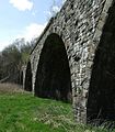 Machen Viaduct, Machen Forge Trail - geograph.org.uk - 1238051.jpg 561 × 640 ; 127 kio
-
 Machen Viaduct, Machen Forge Trail - geograph.org.uk - 1238091.jpg 640 × 480 ; 116 kio
-
 Maenllwyd Inn - geograph.org.uk - 5323760.jpg 3 264 × 2 448 ; 2,45 Mio
-
 Maenllwyd Inn, Rudry - geograph.org.uk - 1951880.jpg 640 × 480 ; 56 kio
-
 Maenllwyd Inn, Rudry - geograph.org.uk - 3062416.jpg 640 × 395 ; 51 kio
-
 Managed woodland - geograph.org.uk - 6146183.jpg 2 448 × 3 264 ; 3,52 Mio
-
 Memorial bench on Craig Ruperra - geograph.org.uk - 2833170.jpg 640 × 480 ; 116 kio
-
 Michaelstone Bridge - geograph.org.uk - 1885297.jpg 640 × 480 ; 117 kio
-
 Michaelstone Bridge - geograph.org.uk - 2415765.jpg 1 024 × 680 ; 239 kio


.svg)


